Download
1 / 32
330 likes | 461 Views
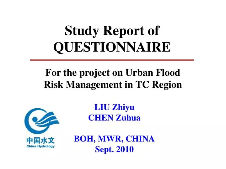
Study Report of QUESTIONNAIRE. For the project on Urban Flood Risk Management in TC Region. LIU Zhiyu CHEN Zuhua BOH, MWR, CHINA Sept. 2010. Good Practices in Urban Flood Management. Outline of pilot cities & Recent flood s in the cities. Background. 1. 2. 3.

E N D
Study Report of QUESTIONNAIRE For the project on Urban Flood Risk Management in TC Region LIU Zhiyu CHEN Zuhua BOH, MWR, CHINA Sept. 2010
Good Practices in Urban Flood Management Outline of pilot cities & Recent floods in the cities Background 1 2 3 Study Report of QUESTIONNAIRE
Background • According to the discussion in the last 42nd TC Annual Session in Singapore, first activities of the UFRM project should be the survey to China, Japan and Republic of Korea for collecting the good practices on UFRM. • According to the discussion at the TC Task Force meeting held in Bangkok on 19-20 July 2010, a draft inventory of good practices in the urban flood risk management collected from the selected pilot cites will be prepared by China as the first activity of next steps of the project. • Before this IWS at Macau, the questionnaires from the three selected cities, i.e., Ansung City (Republic of Korea),Shanghai(China) and Yokohoma City(Japan), were collected.
Outline of cities Ansung City Shanghai Yokohama
Climate:sub-tropical climate, mild and humid with four distinct seasons. flood seasonfrom May to September. Rivers: area of rivers and lakes is 642.7 km2 Main rivers are Huangpu river and its tributaries 2 3 Position, area and population:Yangtze River Delta front, covers an area of 6340.5 km2 ,population of over 16 million Topography:flat and low plain, average altitude is about 4 meters. Districts:18 districts and 1 county, 109 small towns and 3 villages, 101 street offices, 3579 residents committees, etc. Main tasks for flood management: typhoon, rainstorm, high tide and flood Development of city: population, land use 1 4 5 6 7 Shanghai, China
Recent floods in Shanghai “01.8”continuous heavy rain Rainfall is concentrated and has big intensity. 1-h precipitation exceeds 105 mm, exceeds the drainage standard (30-year return) in urban area
Recent floods in Shanghai “Maisha”(No. 0509) Typhoon Features: heavy wind force, ) heavy rainfall (exceeded 200.0mm in many stations), highest tide in Huangpu River exceeded the warning level, the highest water stage in rivers exceeded historical records widely on the Huangpu River .
Position:be located approximately 30 km to the southwest of the Japanese capital city, Tokyo. (with an area of 437km2) Rivers:in the Tsurumi river basin The Tsurumi River is one of the class A rivers in Japan, whose river basin area is 235 km2 . It flows for 42.5 km through Machida City, Yokohama City, and Kawasaki City Social and economy:where 3.68 million people or 1.58 million households live. The GDP of the city is about 13 trillion yen. Its main industries are manufacturing such as electric machinery and transport machinery and service. The Yokohama port is a top-class in Japan terms of trade volume. 1 3 2 Yokohama, Japan
Development of city: population, land use 4 Yokohama, Japan Land use Population
Recent floods in Yokohama city September 1982 Typhoon Judy Inundation above floor level: 910 Inundation below floor level: 1,800 July 1998 Surface water flooding by frontal-type heavy rainfall October 2004 Surface water flooding by Typhoon Ma-on July 2008 Torrential rainfall over 77mm/h, 30 houses were flooded August 2008 Torrential rainfall
Position: The Ansung stream basin, the middle west of Korea, is located in 126°50′∼127°00′ east longitude 36°50′∼ 37°20′ north latitude. 1 Ansung Stream, Korea
Rivers: The Ansung Stream, of which the basin area is 1,655km2 and the stream length is 70.0km. Topography:flat land except upstream. 3 2 Ansung Stream, Korea (i) Channel system (ii) Land cover map (iii) Soil map
Land use and population (i) 1990 (ii) 1995 (iii) 2000 (iv) 2005 Time-series data of land use of urbanizationin GyeongGi-Do , Korea (i) 1990 -1995 (ii) 1995 -2000 (iii) 2000 -2005 (iv) 1990 -2005 Change of population in GyeongGi-Do, Korea.
Recent floods in Ansung city August 1972Concentrated Heavy rainfall 20 ha of landslides occurredconsisting of 632 slides within the 20 750ha of forest land July 1991Heavy rainfall about 250ha of landslides occurred in the Ansung-gun district over an area of 553km2 and 200 ha of landslides occurred in the Yongin-gun district over an area of 592km2 area July 2006Heavy rain of 271mm made some levee breaches 130 houses were inundated and 240 residents evacuated
To highlight the land use planning. To enhance meteor-hydrological monitoring, forecasting and warning to provide timely, accurate and all-sided information support to the urban flood management. To build up various dissemination ways of flood warning information to individual residents To apply flood hazard/risk map widely as an important technique of urban flood preparedness. To emphasize on the function of retarding basins and discharge ponds in the urban flood management To establish the comprehensive urban flood management strategy a b c e d f Good practices in urban flood management
Good practices in urban flood management Urban flood management strategy -Shanghai flood control works system organizing and commanding system “FIVE SYSTEMS” early warning and pre-arranged planning system information security system rescue system
Good practices in urban flood management Urban flood management strategy -Shanghai In working principle, insist safety first, defense as the main work, often prepared not relax, utmost rescue, try to grasp the initiative of prevent flood and typhoon In working concept, insist people oriented, to place ensuring the safety of the lives and properties in the first place, try to achieve no death and less loss. In working mechanism, insist various levels of flood control responsibility system whose core is responsibility system of administrative chiefs, “FIVE INSIST” In working measures, insist considering both construction and management and treating management as the key. Continuous tamp the material foundation and management foundation In emergency rescue, insist the people and the army joint together
To highlight the land use planning. b 2 Good practices in urban flood management • Shanghai--The scheme of planning control line (Blue Line) • For the construction projects • in river managing scope, should be examined and verified by Shanghai river management bureau or river administrative department. • out of the river management scope usually didn’t consider flood hazard. • Constructions of other infrastructuressuch as railways and high ways should be designed according to the national standard Flood Control Standard.
To highlight the land use planning. b 2 Good practices in urban flood management Yokohama city– Acts and ordinances to guiding the land use • “Act on Countermeasures against Flood Damage of Specified Rivers Running Across Cities” • developers must construct rainwater storage and infiltration facilities if the area is over 1,000m3 and • owners of discharge ponds over 100m3 are obliged to maintain their function. • Ordinance to coordinate development by private sectors with city planning • the city directs developers to construct rainwater runoff control facilities and maintain open spaces to grow trees. • To designates “urbanization promotion area” and “urbanization restricted area”
To enhance meteor-hydrological monitoring, forecasting and warning to provide timely, accurate and all-sided information support to the urban flood management. c Good practices in urban flood management • MAPLE (McGill Algorithm for Precipitation nowcasting and Lagrangian Extrapolation) method, by NIMR, Korea • Combine the point rainfall data at the gage stations and that of the climate radar to get more accurate forecast of rainfall.
MAPLE and AWS stations and adjustmentintegration Grids for the rainfall in Ansung data watershed area
Good practices in urban flood management • The integrated typhoon and rainfall Monitoring &Detection System of Shanghai • Constituted by 98 auto-weather stations, 120 rain gages, 3 Doppler weather radars and 12 meteorological satellite receiving systems
Good practices in urban flood management Forecasting System in Shanghai • STI-WARR for 1-12h, STI-WARMS for 3 days and STI-EnWARMS for 5 days, developed by Shanghai Typhoon Institute (STI) • New numerical techniques for improving forecasting : digital filter, cloud analysis, ADAS-3DVAR and hourly assimilation cycle et. al. • And for TC forecasting : BDA (bogus data assimilation) technique, satellite data assimilation, GRAPES_TCM TC model, relocation cycle, ensemble and air-land-sea coupled model. • A Storm Surge Early Warning Subsystem, developed by STI.
To apply flood hazard/risk map widely as an important technique of urban flood preparedness. d Good practices in urban flood management Different Flood hazard/risk maps were used in all the three pilot cities, which contributes to guidelines for land use planning and strengthening the capacity buildings for special regions.
Flood risk map in Shanghai Flood risk map in city centre) Flood hazard map (SMB)
To build up various dissemination ways of flood warning information to individual residents e Good practices in urban flood management • Korea • Flood-warning or flood-alarm will be announced to the public through the mass media (broadcast, newspaper, etc) and related agencies so that citizens can prepare and evacuate against flood. • Japan • Flood advisories, warnings and forecasts are transmitted to municipalities via prefecture. • provided by , internet, CATV, sirens. • directly to (registered) residents (e-mail , mobile phones) • Kohoku ward provide information by internet fax to underground facilities
To build up various dissemination ways of flood warning information to individual residents e Good practices in urban flood management • China • The spokesman system. • SMB provide special services through multi agency cooperation • Communications departments such as radio, television and the official government website • Transportation operators such as airports, railways stations, harbors, tourist attractions and traffic control provide resources to facilitate the distribution of early warning information. • The Public-level Dissemination Platform • Community warning light system :electronic screens, billboard TV screens, and electronic road signs.
Inundation risk analysis Storm surge disaster risk analysis Early warning message Dyke breach risk analysis
To emphasize on the function of retarding basins and discharge ponds in the urban flood management f Good practices in urban flood management Yokohama City • According to “Act on Countermeasures against Flood Damage of Specified Rivers Running Across Cities”, developers must construct rainwater storage and infiltration facilities if the area is over 1,000m3 and owners of discharge ponds over 100m3 are obliged to maintain their function. • 4,170 (total volume is 2.96 million m3, as of the end of 2008) have been constructed by private sectors who had developed certain areas in the basin, with subsidy. • Yokohama city has constructed 1,956 (about 1.65 million m3) regulation ponds and 1,662 infiltration trenches.