Download
1 / 10
100 likes | 285 Views
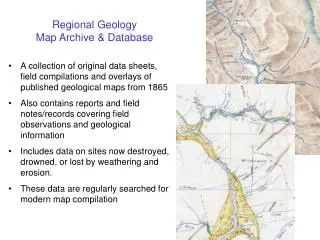
Regional Geology Map Archive & Database. A collection of original data sheets, field compilations and overlays of published geological maps from 1865 Also contains reports and field notes/records covering field observations and geological information

E N D
Regional Geology Map Archive & Database • A collection of original data sheets, field compilations and overlays of published geological maps from 1865 • Also contains reports and field notes/records covering field observations and geological information • Includes data on sites now destroyed, drowned, or lost by weathering and erosion. • These data are regularly searched for modern map compilation
QMAP 1:250 000 Geological Map of New Zealand • ….Quarter million MAP • Replaces first edition of the 1960s • Incorporates new concepts (plate tectonics, terranes etc) • Synthesises existing geological mapping • New field work in poorly known/understood areas • Publish a series of 21 maps • FRST funded
QMAP 1:250 000 Geological Map of New Zealand • Build a GIS database of NZ geology • ArcInfo GIS software • Information as layers (points, lines, polygons) • Database design in 1994 - little subsequent modification • “Flat-field” structure • Minimal abbreviation and coding • Currently metadata poor • Data-rich attributes
Staggered completion needed to manage GIS & publication resources
Current total: 52 Mb (6 themes for 9 sheets, vector data as Shapefiles) Predicted QMAP Total: 120 Mb (31 Mb WinZIP-compressed)
http://www.gns.cri.nz/research/qmap/qmapproducts.html#digitalhttp://www.gns.cri.nz/research/qmap/qmapproducts.html#digital GIS DataGeological data from published QMAPs will soon be available on CD as ARC/INFO coverages and ArcView shapefiles. The QMAP Data Dictionary will be included with data. DownloadsLow resolution MrSid images for published QMAPs are available for download. A free viewer for MrSid images can be found here: www.lizardtech.com. Follow the arrow at the left of the page and download the MrSid Browser Plugin or MrSid Geoviewer. MrSid images are also supported by most GIS software including ArcInfo, ArcView, and MapInfo.These downloads are in PKZIP format.Dunedin (1.3 mb)Kaitaia (1.4 mb)Nelson (1.9 mb)Wellington (1.9 mb)Wakatipu (2.3 mb)Raukumara (1.8 mb)Auckland (2.5 mb)Waitaki (2.0 mb)
http://www.gns.cri.nz/research/qmap/qmapproducts.html#digitalhttp://www.gns.cri.nz/research/qmap/qmapproducts.html#digital
QMAP aspirations • Complete sheet by sheet compilation (c. 2009 through FRST funding) • Edgematch, update earlier sheets and make seamless (c. 2010 through FRST funding) • Move to ArcSDE Oracle environment • Integrate with GNS/GSNZ databases (e.g. StratLex, Bibliographic) • Serve to public at cost-of-retrieval or free via Web • Maintain and update to keep “live” - funding required