Download
1 / 27
270 likes | 310 Views
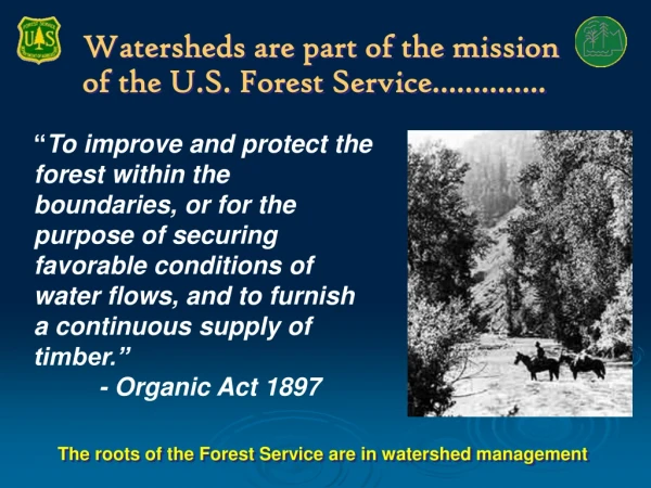
Watersheds are part of the mission of the U.S. Forest Service…………. “ To improve and protect the forest within the boundaries, or for the purpose of securing favorable conditions of water flows, and to furnish a continuous supply of timber.” - Organic Act 1897.

E N D
Watersheds are part of the mission of the U.S. Forest Service………….. “To improve and protect the forest within the boundaries, or for the purpose of securing favorable conditions of water flows, and to furnish a continuous supply of timber.” - Organic Act 1897 The roots of the Forest Service are in watershed management
What is PART? • Program Assessment and Rating Tool (PART): A diagnostic tool used by OMB to assess the performance of Federal programs and to drive improvements in program performance. • PART reviews help inform budget decisions and identify actions to improve results. • Agencies are held accountable for implementing PART follow-up actions (improvement plans) for each of their programs. • PART measures for watershed improvements are now included in the Forest Service FY 2009 Budget Justification
Watershed PART Framework • Assessment of Risk to the Condition of Watersheds • Focuses work in Priority Watersheds • Scale: 6th Code Sub-watershed (10k – 40k acres) • Tied to Restoration / Maintenance Activities
Brown & Froemke (2008) Rocky Mountain Research Station Phase 4 Non-FS Watersheds Phase 1 Assessment Completed
Brown & Froemke (2008) Phase 2 Assessment • Forest Validation - Phase 1 Assessment Forest Staff Validate Update White Mountain NF
Phase 2 Assessment Watershed Condition Class (WCC) The state of a watershed based upon physical and biological characteristics and processes affecting hydrologic and soil functions (FSM 2521)
Types of Indicators Phase 2 Assessment Physical Indicators Chemical Indicators Biological Indicators Roads Mining Erosion Mass Wasting Water Quantity/ Flow Channel Condition Water Quality/ Chemistry Riparian/ Upland Vegetation Native Fauna
Watershed Condition Class Types of Indicators Phase 2 Assessment Physical Indicators Chemical Indicators Biological Indicators Roads Mining Erosion Mass Wasting Water Quantity/ Flow Channel Condition Water Quality/ Chemistry Riparian/ Upland Vegetation Native Fauna WCC
5 Classes Watershed Condition Class National Scope Phase 2 Assessment Physical Indicators Chemical Indicators Biological Indicators WCC - I WCC - II WCC WCC - III WCC - IV WCC - V S9
Watershed Risk Brown & Froemke (2008) Monday Creek Watershed 5th Code HUC 116 sq. mi. Putting It All Together Eastern Region USDA Forest Service Wayne NF Update WCC
Watershed Risk Brown & Froemke (2008) Monday Creek Watershed 5th Code HUC 116 sq. mi. Update WCC Putting It All Together Eastern Region USDA Forest Service
4-Phase Process Opportunities Phase 1: National Watershed Risk Assessment Phase 2: Forest Assessment of WCC • Validate / Update National Risk Assessment • Identify watersheds where FS can improve WCC • Prioritize based on Cost / Resource Values • Identify Essential Projects • Implement Projects • Track costs / accomplishments Phase 3: Monitor, evaluate and adapt Phase 4: Address Mixed-Ownership Watersheds
Phase 2 Identify Sub-watersheds FS can Improve WCC 85% FS Owned 25% FS Owned Partnership
Summary Phase 1: National Watershed Risk Assessment Phase 2: Forest Assessment of WCC • Validate / Update National Assessment • Identify watersheds where FS can improve WCC • Prioritize based on Cost / Resource Values • Identify Essential Projects • Implement Projects • Track costs / accomplishments Phase 3: Monitor, evaluate and adapt Phase 4: Address Mixed-Ownership Watersheds
Prioritize Watersheds Hoosier NF
EMDS • Ecosystem • Management • Decision • Support • System
EMDS • Logic Model • Assessment tool • Decision Model • Helps to set priorities and identify where you want to do restoration
Fire Danger Fire Vulnerability Fire Severity Ignition Risk Surface fuels Palmer drought severity index Fire behavior fuel model Spread rate Fuel characterization class Keetch-Byram drought index Flame length Crown fuels Crown bulk density NDVI relative greenness Fire line intensity Crown base height Crown fire potential Fire regime condition class Lightning strike
The USFS Natural Resource Information System Water Module (NRIS Water) is an Oracle database/GIS application and set of analysis tools designed to implement corporate data standards and promote integrated management of aquatic maps, graphs, images and related data about aquatic ecosystems, water uses and rights, and watershed improvement projects. This information can be analyzed and presented at multiple geographic scales, both within and across administrative and jurisdictional boundaries. The goal of the Water Team is to provide users with a tool that: 1) manages aquatic information common to all Forests Service administrative units; 2) is efficient, user-friendly and adaptable; 3) integrates hydrology, fisheries and aquatic ecology information with other corporate information management tools; and 4) builds a bridge between legacy data and corporate information resources. Previously there were 125 different aquatic information systems agency wide. The WBD is the framework dataset that now accommodates this one common reporting structure.
Credits • Ted Geier, USFSMark Jensen, USFS Region 1, MT • Keith Reynolds-USFS PNW Research Station • Greg Enstrom, USFS NRIS Program