Download
1 / 30
300 likes | 444 Views
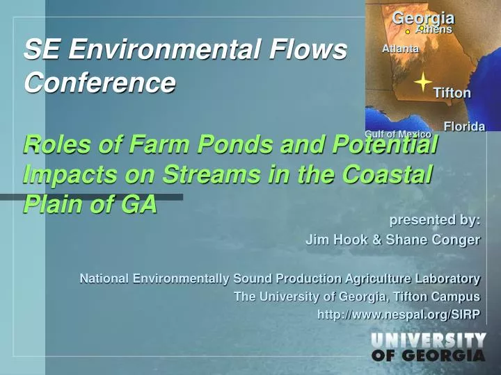
Georgia. Athens. Atlanta. Tifton. Florida. Gulf of Mexico. SE Environmental Flows Conference Roles of Farm Ponds and Potential Impacts on Streams in the Coastal Plain of GA. presented by: Jim Hook & Shane Conger National Environmentally Sound Production Agriculture Laboratory

E N D
Georgia Athens Atlanta Tifton Florida Gulf of Mexico SE Environmental Flows ConferenceRoles of Farm Ponds and Potential Impacts on Streams in the Coastal Plain of GA presented by: Jim Hook & Shane Conger National Environmentally Sound Production Agriculture Laboratory The University of Georgia, Tifton Campus http://www.nespal.org/SIRP
Assessment of Farm Ponds • Rationale: • Recognizing its importance for current and its potential for future water supply for irrigation, we began a study of on-farm ponds. • That has proven to be good start on the State Plan’s Assessment of surface water supply stored in its numerous small constructed and natural ponds. • Objectives: • Determine quantity and their hydrologic significance • Determine their use and utility for irrigation supply • Influence on stream flow • Explore the potential for regional reservoirs
Assessment of Farm PondsQuantity and their hydrologic significance The Study Area: South Georgia HUC08 (Sub-basins)
Natural Ponds in the Coastal Plain Landscape • Natural ponds and marshes • USGS NHD+ 2006 Waterbodies So. Ga. HUC08’s • Swamps/Marshes – 3676 – excluding mapped wetland areas • Range (1 ha to 1480 km2) • Median – 38 ha; mean - 225 ha • Total area swamps/marshes – 8,223 km2 • GA DOT 2003 Waterbodies So. Ga. HUC08’s • Swamps/Marshes – 89,059; • Range 0.001 to 456 km2) • Median – 1.3 ha; mean - 12.3 ha • Total area swamps/marshes – 10,900 km2 • Note Swamps/marshes are often mapped in several smaller segments even when they are connected during high water periods. Includes Lake/Pond waterbodies relabeled as Swamp/Marsh after examination of aerial images and Swamps/Marshes already so labeled by USGS or DOT.
Assessment of Farm PondsQuantity and their hydrologic significance Study area: South Georgia HUC08 Sub-basins
Man-made Ponds in the Coastal Plain Landscape • Man-made ponds and reservoirs • USGS NHD+ 2006 Waterbodies So. Ga. HUC08’s • Lake/Ponds – 8000 • Range (0.1 ha to 2,600 ha) • Median – 3.3 ha; mean - 7.3 ha • Total area lake/ponds – 586 km2 • GA DOT 2003 Waterbodies So. Ga. HUC08’s • Lake/Ponds – 81,500; • Range 0.001 to 3,400 ha • Median – 0.5 ha; mean - 1.4 ha • Total area lake/ponds – 1132 km2 • Note Lakes are often mapped in several smaller segments even when they are connected during high water periods.
Candler Co NHD/DOT Ponds
Transects to characterize a sample of study area ponds Random vectors 140 transects 25-60 km long 0.33 km wide
Transects to characterize a sample of study area ponds Any pond w/in or touched by buffered line USGS mapped DOT mapped Visible unmapped
Assessment of man-made ponds • Transects • Currently completed 100 transects intersecting 190 ponds (02/01/08) • Data results: Ponds size 0.09 to 90 ha • Average size of all visible ponds was 4.5 ha; median 2 ha • Average visible area mapped was 8.3 ac vs 10.6 acres for same ponds – NHD+ ponds drawn larger than current
Assessment of man-made ponds • Transects • Character of location re stream order • 46% on upland or unmapped ephemeral streams • 0% on mapped ephemeral • 42% on 1st order streams • 11% of 2nd order streams • 1% on 3rd or higher order
Assessment of man-made ponds • String of beads
Assessment of man-made ponds • Transects • Pond Clusters: distance to upstream and downstream ponds • 30% had nearby upstream pond • Half within 0.41 km • 50% had nearby downstream pond • Half within 0.33 km
Assessment of man-made ponds • Catchment areas – small to medium • Mean 143 ha; • Median 78 ha • Range 69 ha to 6800 ha • With the average size pond and average size catchment area, it requires 60 mm runoff to fill if empty • Range 2.5 mm to 250 mm
Assessment of man-made ponds • Proximity and Use for irrigation • 83% within 0.6 km of farm field • 64% adjacent to farm field • 25% had existing pump or permitted withdrawal present • Within Ga, 12,700 permits for ag water withdrawal from ponds
Assessment of man-made ponds • Begin to look at how ponds impact stream flow • When full most of the water is passed through during rain events • Acts by shaving peak flows (even small ponds designed to store 1-yr floods) moving some to base. • Seepage adds to base flow – but only from lowest in string
Assessment of man-made ponds • Begin to look at how ponds impact stream flow • During rainless periods ET loses; • If ponds remain full, in effect portion of channel flow or seepage lost to ET • That direct pond evaporation must be compared with ET from wetlands and forests that would otherwise occupy these pond spaces.
Assessment of man-made ponds • Begin to look at how ponds impact stream flow • During irrigation season, first or all of runoff will be used in refilling pond, further shaving peak and also base flow. • Act similarly to storm water retention facilities counter balancing effects of enhanced runoff from bare soils and hard surfaces.
Assessment of man-made ponds • Begin to look at how ponds impact stream flow • As irrigation supplies: • As alternative to direct stream withdrawals during dry periods that trigger irrigation • As alternative to GW withdrawals from aquifers that sustain base flow • As alternative to GW withdrawals that lower heads in areas with long term decline (confined aquifers)
Assessment of man-made ponds • Plea for inclusion of ponds in models of behavior of watersheds • Incorrect to assume that this is a stream dominant flow system. Ponds are so ubiquitous in Georgia Coastal Plains that they must be considered in runoff - stream discharge models used water planning as well as water resources
Assessment of man-made ponds • Recommendations • Multi-agency and farmer assessment of pond data and pond design to address ways to improve existing pond sites for irrigation water supplies. • Assessment of pond location and pond use on flows downstream in the region’s watersheds. • Assessment of farm ponds on species and habitats in South Georgia