Download
1 / 15
150 likes | 356 Views
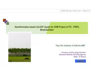
CDM Barrier removal – Meet III. Geoinformatics based LULUCF inputs for CDM Project of ITC - PSPD, Bhadrachalam. Pujar GS, Sudhakar, S & Murthy MSR . Forestry and Ecology Division National Remote Sensing Agency Dept. of Space.

E N D
CDM Barrier removal – Meet III Geoinformatics based LULUCF inputs for CDM Project of ITC - PSPD, Bhadrachalam Pujar GS, Sudhakar, S & Murthy MSR Forestry and Ecology Division National Remote Sensing Agency Dept. of Space
Land use/cover change matrix required to be addressed as per Good Practice Guidelines (IPCC) Best possible positive change Moderate degree positive change Severe degree negative change Moderate negative change
Geomatics can facilitate relevant products Snapshot of landscape at the start of the project Spatial explicitness of boundaries Amenability for spatial modeling to prove additionality Potential to collate multisource information for barrier reduction
Geomatics can cater to steps of PDD RS GIS GPS * RS med res & h-res * SCALE DEPENDENT
Temporal Issues in PDD formation Prediction/Addnlty Project Period Reforestation Compliance Plantation growth Geomatics Compatibility
Afforestation – Requires assessment data using 50 year old data Satellite data not available for the period Compilation of such data if exists in to spatial form needs separate effort, ? LISS III/IV 1955 2005 Reforestation – Requires assessment data using data since 31st Dec 1989 Assessment of non forest lands possible using available IRS data during 1990 forest LISS I/II/ TM 1990 2005 LISS III/IV agril Nonforest Issue of afforestation and reforestation
Phases of study Appraisal of technology potential to PDD facilitator Selection of satellite datasets suiting the requirement Image analysis for land cover delineation and plantation mapping Plantation mapping aided by ground based ownership Information Generation of sink boundaries and erstwhile land cover content Prediction of plantation position and spread Sink boundary and position for validation Information fine tuning for final submission
Specialities of social forestry sink Social forestry or similar initiative generally has to occupy smaller Land parcels due to socio-economic factors connected to it Promoted plantations may not have copy-book implementation Of package of practices Marginal lands means relatively higher probability of constrained success. Generally lands prevail adjacent to slopy/forest area & hence may not be best habitat available. These factors result in mixed response of reflectances at sensor Level and hence will induce difficulty in mapping
Methodology for land cover change in Social Forestry Mandals
Vegetation and Land cover 1990 Vegetation and Land cover 2005 Land cover Changes Forest area exclusion Plantation increase Amenable slopes in Amenable elevations Rate of increase In 5 km pixels Scrub and adjacency Predicting of plantation Occurrence Approach Categorization of Rates Suitability Surface Stratified random Allocation of sites Size based buffers Site delineation Plantation Site predictions Elimination of small patches Probability of sites
Sink boundaries