Download

1 / 23
230 likes | 317 Views
Fish Remains from Homestead Cave and Lake Levels of the Past 13,000 Years in the Bonneville Basin. By Jack M. Broughton, David B. Madsen, and Jay Quade. Introduction.

E N D
Fish Remains from Homestead Cave and Lake Levels of the Past 13,000 Years in the Bonneville Basin By Jack M. Broughton, David B. Madsen, and Jay Quade
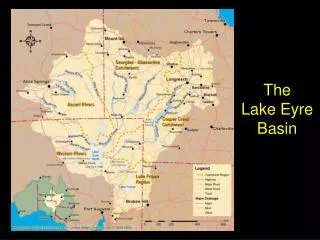
Introduction • Lake Bonneville and its Holocene remnant, Great Salt Lake, have been used to evaluate global-scale climatic changes and forcing mechanisms. • Timing of the regression of Lake Bonneville from the Provo shoreline, at ~14,000 yr ago, until the final retreat from the Gilbert shoreline, is poorly understood. • Lake history can be obtained by analyzing fossil fish sequences. • The authors present species composition, size structure, and ⁸⁷Sr/⁸⁶Sr ratios of precisely dated ichthyofauna from Homestead Cave. • This data is used to evaluate Pleistocene and Holocene lake history in the Bonneville basin.
Homestead Cave • Homestead Cave is located several km west of Great Salt Lake on a northwestern spur of the Lakeside Mountains. • The cave is at 1406 m, ~100 m below the Provo shoreline of Lake Bonneville and ~90 m above the Gilbert shoreline. • A 1 m³ sample column was excavated in the rear cave floor deposits. • Well defined deposits were separated into 18 excavatable strata. • Carbon 14 dates suggest that the deposits were laid down sequentially between ~11,300 and ~1000 yr B.P.
View of Homestead Cave from the top of the highest Holocene shoreline of Great Salt Lake showing: (B)the Bonneville shoreline, (P) the Provo shoreline,(E) erosion channels in a Post-Provo regressive shoreline, (H) Homestead Cave, (S) the Stansbury shoreline complex, and (G) the Gilbert shoreline.
Fish Remains • Fish remains were heavily concentrated in stratum I. • Four radiocarbon assays taken on fecal pellets within the 10 cm of strata revealed dates ranging from 11,201± 76 yr B.P. in the lower 5 cm to 10,160 ± 85 yr B.P. in the upper 5 cm. • 14,866 fish specimens representing 11 freshwater species were identified in the cave. • Four of the identified species ( Salvelinus confluentus, Prosopium abyssicola, Richardsonius balteatus, and Catostomus discobolus) represent the first records for lake Bonneville.
Evidence shows that owls were the agents that deposited the cave fauna. • Owl pellet cones • Owl bones • Fish bones with pellet material adhering to them
Evidence of humans and carnivore involvement is sparse.No evidence for water-laid deposits.
Tyto alba and Bubo virginianus • Roost and nest in deep, open caves • Scavenge fish carcasses • Take fish exposed in very shallow water
Bubo virginianus the larger of the two species can carry ~1.5 kg. • Larger fish specimens from the cave are estimated >~2.6 kg live weight • This gives evidence that the owls did not take the fish whole but, scavenged them in parts.
The maximum distance from roost to foraging areas reported for the owls is 5.6 km. • Thus, the aquatic habitats that supported the fish likely existed within a ~6 km radius from the cave during periods of fish-bone deposition.
Strontium Ratios • ⁸⁷Sr/⁸⁶Sr ratios of lake water are identical to the ratio of any carbonate. • Analysis of tufas and shells from the high Provo shorelines at Bonneville shows strontium levels at an average value when compared to all the rivers feeding into the lake.
Strontium Ratios Continued • Shells from southern basin filled by paleolake Gunnison have low ratios (0.7098). • Tufa and shells from the northern basin filled to the Gilbert shoreline in the late Pleistocene give ratios of 0.7120-0.7144. • Ratios of six stratum I fish specimens from the cave pinpoint the the level at which the fish lived. • 0.7125-0.7129.
What does this imply? • The presence of a freshwater fish taxa with such strontium levels implies the presence of a shallow but freshwater lake within the the raptor foraging radius (~6 m) between ~11,200 and 10,400 yr B.P.
Fish size and taxonomic Abundance • Low adult mortality is low individuals leave more descendants by growing larger and producing more young over several seasons. • The maximum diameters of vertebral centra, as a measure of size, differ distinctly between stratum Ia and Ib: the later has a smaller maximum size than the former.
Relative taxonomic abundances • O. clarki and G. atraria tolerate waters with moderate salinities and are overrepresented in stratum Ib. • C. ardens and G. atraria tolerate warm water (>~27°C) are significantly overrepresented in stratum Ib as well.
A Lake in Decline • The overrepresentation of fishes more tolerant of high temperatures or salinities in stratum Ib suggest those taxa were relatively more successful at reinvading the lake during lake level fluctuations. • The changes are in the direction expected of a lake level decline and are consistent with other data that suggest that the assemblage resulted from die-offs.
~11,200 yr B.P. • Die-offs begin and end prior to ~10,400 yr B.P. • Conflicts with chronologies that suggest that a near-desiccation of the lake occurred between 13,000 and 12,200 yr B.P.
Younger Dryas • Responsible for lake level fluctuations? • Recent stratigraphy data suggests that Bonneville did not trangress to Gilbert levels during this time. • Several Great Salt Lake fluctuations in the Holocene.
Conclusion • Fish materials from Homestead Cave are concentrated in the lowest stratum. • Fish remains appear to have been accumulated by scavenging owls. • ⁸⁷Sr/⁸⁶Sr values from stratum I fish suggest they were from a low-level lake. • Inititial die off of Bonneville fish fauna occurred ~11,200 yr B.P. • The lake may have rebounded with a Younger Dryas age transgression. • By ~10,400 yr B.P. fish were gone. • Frequency peaks of G. atraria in the upper strata imply two late Holocene highstands.