Download
1 / 27
270 likes | 357 Views
Marine monitoring and Natural England . Plymouth Sound and the Tamar Estuaries Complex. Gavin Black Specialist Marine Monitoring Gavin.black@naturalengland.org.uk. Overview. Natural England’s remit Legislation and drivers MPAs and reporting

E N D
Marine monitoring and Natural England Plymouth Sound and the Tamar Estuaries Complex Gavin Black Specialist Marine Monitoring Gavin.black@naturalengland.org.uk
Overview • Natural England’s remit • Legislation and drivers • MPAs and reporting • Monitoring Plymouth’s features and assessing condition
Natural England’s remit • Natural England is a non-departmental public body • We are Government’s Statutory adviser on the natural environment. • Provide advice on the marine environment to sea-users and managers around England out to 12 nautical miles. • ‘ensure that the natural environment is conserved, enhanced and managed for the benefit of present and future generations, thereby contributing to sustainable development’. • Lead role in monitoring and reporting on the state of an English MPA network
Key legislative drivers and MPAs • Habitats Directive (1992) & Birds Directive (1979) • Natura 2000 network (SACs and SPAs) • OSPAR Convention (1992) • to establish a network of marine protected areas which is both ecologically coherent and well-managed by 2016. • Wildlife & Countryside Act 1981 (WCA 1981) • Sites of Special Scientific Interest (SSSIs) • Marine and Coastal Access Act (MACAA 2009) • Marine Conservation Zones (MCZs) • Marine Strategy Framework Directive (MSFD 2008) • Wider marine environment
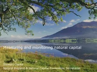
Conservation objectives & MPAs • The objective of English MPAs is to reach and remain in favourable condition • For European sites favourable condition is a site-specific expression of how a site contributes to Favourable Conservation Status and whether features are healthy • Described using attributes set by JNCC’s Common Standards Monitoring guidance • Ecological attributes: extent, biotope composition • Environmental attributes: water clarity, sedimentation rate • Mandatory attributes for each feature plus discretionary attributes • Targets relate to baselines at or near designation
Assessing England’s SAC features • Assessment in late 2012 • Assessed 32 marine Special Areas of Conservation (SCI) • 85 habitats & 155 sub-features assessed • 734 habitat attributes assessed • 1350 sources of evidence used – internal monitoring reports and external literature and data • Other information included WFD monitoring outputs and assessments • Resources have increased but we can only monitor a proportion of attributes per year Need to prioritise Paul Kay
Considerations in targeting monitoring effort - to support adaptive management • Risk from anthropogenic impact: • Sensitivity of features to potential pressures • Exposure to potential pressures, existing management & future threats • Age / quality of existing data sets • Natural temporal variability • Constraints / opportunities: • Reporting requirements e.g. 6 year cycle • Survey logistics - integration with other programmes
A working solution... • Auditable, repeatable, syntax driven, process, supported by Access database
Special Area of Conservation (SAC) • The Plymouth Sound and Estuaries SAC is regarded to be of international conservation importance due to diverse salinity conditions, sedimentary and reef habitats. The wide variety of habitats gives rise to communities representative of ria systems with unusual features, such as populations of Mediterranean and Atlantic species rarely found in British waters. • 1110 Sandbanks which are slightly covered by sea water all the time • 1130 Estuaries • 1160 Large shallow inlets and bays • 1170 Reefs • 1330 Atlantic salt meadows • 1140 Mudflats and sandflats not covered by seawater at low tide • 1441 Shore dock • 1102 Allis shad
Special Protection Area (SPA) • Tamar Estuaries Complex classified in 1997 • Internationally important numbers of: • Egrettagarzetta(little egret) and Recurvirostraavosetta (avocet).
Sites of Special Scientific Interest (SSSIs) • Yealm Estuary SSSI • Littoral sediment; Littoral rock • Wembury SSSI • Littoral sediment; Littoral rock; Maritime cliff and slope; Cirl bunting; Woodland • Plymouth Sound Shore & Cliffs SSSI • Littoral rock; Geology • St John’s Lake SSSI • Wintering birds (black-tailed godwit, wigeon); Mudflats; Saltmarsh • Lynher Estuary SSSI • Wintering birds (black-tailed godwit); Mudflats; Saltmarsh; Bulbous foxtail; Woodland • Tamar Tavy SSSI • Saltmarsh; Vascular plant assemblage; (triangular clubrush); Wintering birds (avocet); Woodland
Marine Conservation Zone (MCZ) • Tamar Estuary MCZs • Intertidal biogenic reefs • Intertidal coarse sediment • Blue mussel (Mytilusedulis) beds • Native oyster (Ostreaedulis) • Smelt (Osmeruseperlanus) • One of 27 MCZs declared on 21st November 2013
Condition assessment • Favourable condition of the reefs in the SAC will be determined by: • Extent and distribution of the habitat; • Diversity of the habitat and it’s component species; • Community structure of the habitat • e.g. population structure of individual notable species and their contribution to the functioning of the ecosystem • Natural environmental quality and processes • e.g. water quality, suspended sediment levels, etc.
Recent surveys • 2009 diving survey of seagrass beds • 2010 intertidal surveys of Lynher and Tamar • 2011 subtidal sediment grab sampling • 2011 subtidal cobble communities video survey • 2012 diving survey of kelp communities • 2012 diving and video survey of seagrass beds • 2013 diving survey of subtidal reefs • 2013 saltmarsh survey • Ongoing informal assessment of Allis shad
Anticipated future surveys • 2014 baseline conditions for MCZ features • 2015 intertidal rocky shore survey • 2016 estuarine subtidal sediment and reef survey • 2016 subtidal sandbanks survey • 2017 kelp forest survey • 2017 seagrass survey
Issues and limitations • Resources dictate survey effort • Surveys represent snapshots in time (ca. 6 years between surveys) • Ensuring sufficient sampling effort to determine significant levels of change • Determining causes... are changes natural or anthropogenic? • Reliant on other data to inform our assessment of condition particularly activities data • Are we seeing whole picture?
Opportunities for sharing resources and data • Water Framework Directive (WFD), MSFD, Civil Hydrography Programme (CHP) and other statutory drivers all involve data collection • Partnerships and other collaborations offer many opportunities • Public sector: EA, Cefas, MCA, IFCAs, PCC, CCO etc • Institutions and NGOs: Plymouth University, MBA, Seasearch etc • Open Government License seeks to share data • “Gather once, use many times”
Future improvements • Establish a continuous process for capturing feature exposure to activities • Collaborative approach provides further opportunities to refine our approach e.g. allowing more frequent sampling • Expand programme to include MCZs, SPAs, SSSIs • UK Marine Biodiversity Monitoring R&D programme will identify options for delivering integrated monitoring: inside and outside MPAs Prioritisation process will change, but should retain key elements of Risk Based Approach
Summary • Scale of the task and limited resources force us to prioritise • Makes sense to prioritise monitoring on those features subject to most risk for more frequent survey to detect deterioration & support adaptive management • Collaboration with other marine agencies provides efficiencies and increased capacity • Explore feasibility of a combination of periodic ‘intensive survey’ with more frequent, but less intensive sampling to better assess natural variability & detect deterioration / recovery
Thank youGavin BlackMarine Monitoring Specialist0300 060 2424gavin.black@naturalengland.org.ukwww.naturalengland.org.uk
Plymouth in context • Diverse conditions • open coast • large, sheltered bay • confluence of 5 estuaries • diverse shores and seabed substrates • Huge range of habitats and species • Internationally important European Marine Site (EMS) = SAC+SPA
Subtidal sandbanks • Range of sandy sediments inc. • Tide-swept sandy banks in estuaries • Sandy muds north of Breakwater with seapens • Muddy sands in Jennycliff Bay • Fine sands with eelgrass beds at Cellars Cove and Cawsands • One of biggest areas of eelgrass in Devon and South-West
Reefs • Diverse range of reefs • Rich limestone shore communities • Kelp forests • Nationally rare sponges, corals, anemones and crustaceans