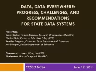
Challenges for ESD Data Systems
Challenges for ESD Data Systems. Tony Freeman JPL Oct 20, 2009. Introduction. EOSDIS is a jewel in the crown of NASA – its one of the critical ingredients that makes our Earth Observation System the world leader it is. The open data policy adopted in the early days of EOS was a masterstroke.

Challenges for ESD Data Systems
E N D
Presentation Transcript
Challenges for ESD Data Systems Tony Freeman JPL Oct 20, 2009
Introduction EOSDIS is a jewel in the crown of NASA – its one of the critical ingredients that makes our Earth Observation System the world leader it is. The open data policy adopted in the early days of EOS was a masterstroke. But, we can’t rest on our laurels…
Research Education Value-Added Providers EOSDIS Data Centers* REASoNs/ MEaSUREs Earth System Models International Partners Decision Support Systems ESDS View Science Data Processing, Data Mgmt., Interoperable Data Archive & Distribution Distribution and Data Access, Flight Ops Data Capture, Initial Processing, Backup Archive Data Acquisition Data Transport to DAACs Tracking & Data Relay Satellite (TDRS) Spacecraft W W W ECHO* NASA Integrated Services Network (NISN) Mission Services Data Processing & Mission Control Interagency Data Centers ACCESS Ground Stations ACCESS Science Teams (SIPS)* Polar Ground Stations Measurement Teams *EOSDIS Elements Courtesy: Emily Law, JPL
Overview • # of NASA missions is decreasing, and the international community is (finally) stepping in to fill the gaps • Data rates from individual NASA missions are increasing • Earth Science and Applications Decadal Survey calls for more than a list of flight missions • Link between our data and models needs (a lot of) work • Push for greater societal relevance • Time to re-evaluate our engagement with CEOS? • Four Challenges
20 Years ago…. Waleed Abdalati: ESS @ 20 symposium, June 2009
Current EOS Question: What was the purpose of our current EOS system conceived in the 1980’s? Answer: To understand and characterize the Earth system
Current EOS Question: What was the purpose of our current EOS system conceived in the 1980’s? Answer: To understand and characterize the Earth system
Monitoring the atmosphere from spaceA-train suite I Afternoon or "A-Train“ 5 satellites around the globe: Initially, the NASA Aqua and Aura satellites and the CNES (France) PARASOL satellite. CALIPSO and CloudSat were inserted in April 2006. OCO and Glory will join in 2009.
Earth Observations NASA ESD has a full plate of upcoming missions and pressure to fly more • Legacy Missions: • Aquarius (2010) • Glory (2010) • NPP (2011) • LDCM (2012) • GPM (2013) • Decadal Survey Missions: • SMAP (2014) • LiVEX (2016) • CLARREO (2018) • DESDynI (2019) • VENTURES (2015 and 2019) • National Needs Missions: • OCO Reflight (TBD) • Triana (TBD) • GIFTS (TBD) • Operational Missions: • XOVWM (TBD) • Jason-3 • GPSRO • CLARREO
“Decadal Survey” Missions 2010–2013 • Soil Moisture Active-Passive (SMAP) • Ice, Cloud, and Land Elevation Satellite II (ICESAT II) • Deformation, Ecosystem Structure, and Dynamics of Ice (DESDynI) • The Climate Absolute Radiance and Refractivity Observatory (CLARREO) • GPS Radio Occultation (GPSRO) — NOAA 2013–2016 • Hyperspectral Infrared Imager (HyspIRI) • Active Sensing of CO2 Emissions over Nights, Days, and Seasons (ASCENDS) • Surface Water and Ocean Topography (SWOT) • Geostationary Coastal and Air Pollution Events Mission (GEO-CAPE) • Aerosol/Cloud/Ecosystems Mission (ACE) • The Extended Ocean Vector Winds Mission (XOVWM) — NOAA 2016–2020 • Precipitation and All-Weather Temperature and Humidity (PATH) • GRACE-II • Snow and Cold Land Processes (SCLP) • Global Atmospheric Composition Mission (GACM) • Lidar Surface Topography (LIST) • Three-Dimensional Tropospheric Winds (3D-Winds)
Future ChallengesEarth Observations Yet the number of missions NASA ESD has on orbit is still declining… [Based on the 2009 NASA budget projection]
Future ChallengesEarth Observation • NPOESS is (still) coming: • Cross-track InfraRed Sounder (CrIS) • Advanced technology Microwave Sounder (ATMS) • Microwave Imager/Sounder (MIS) • Visible/Infrared Imager/radiometer Suite (VIIRS) • Ozone Mapping and Profiler Suite (OMPS) • Community interest should be in the following measurement transitions: • AIRS CRIS • MODIS VIIRS • AMSR-E MIS • But our preparation for these transitions is minimal
Programme is balanced between systematic missions (Earth Watch) and exploratory measurements (Earth Explorer)
Future ChallengesEarth Observations Which results in a steady increase in the number of ESA missions…
ESA and NASA cooperation • Historically, ESA’s stance on Earth Science wrt NASA has been competitive, not collaborative (in contrast to its position on Space Science) • As a result, there is not a single example to date of an ESA/NASA partnership on an Earth Science mission that involves exchange of flight hardware • NASA scientists do participate in some ESA science teams as individuals (but this is not a coordinated activity) • There are signs of a renewed interest in partnering on both sides • ESA have recently invested heavily in their data system and adopted a more open data policy (e.g. with MERIS ocean color data – of which more later)
Increasing Data RatesRepresentative Mission Examples Note: 1 XOVWM is a turn-key system to be operated by NOAA 2 PGE – Product Generation Executable 3 Large number of radar imaging modes to accommodate variety of science targets; Interferometric and higher level product algorithms (PGEs) are considerably complex and may not be amenable to full automation 4 1X is on the order of 100s of jobs per day 5 Did not go into operations JPL-ESDSWG-SDS
NASA Communication Networks NASA has three operational networks that communicate with spacecraft all over the solar system Space Network - constellation of geosynchronous relays (TDRSS) and associated ground systems Near Earth Network- NASA, commercial, and partner ground stations and integration systems providing space commun-ications and tracking services to orbital and suborbital missions Deep Space Network- ground stations spaced around the world providing continuous coverage of satellites from Earth Orbit (GEO) to the edge of our solar system NASA Integrated Services Network (NISN)- not part of SCaN; provides terrestrial connectivity
Key Requirements, Mission Drivers, and Capabilities Flowdown Today 2015 2020 2025+ Provide space communications and navigation capabilities to existing and planned missions. Develop a unified space communications and navigation network infrastructure Implement internationally interoperable communication protocols Level 0 Requirements Provide the highest data rates technically feasible Implement a networked communication and navigation infrastructure across space Provide anytime/anywhere communication and navigation services for Lunar and Mars human missions Provide communication and navigation infrastructure on Lunar and Mars surfaces • Shuttle/ISS • Mars Landers • Great Observatories • Coordinated Earth Observation • LRO • Orion/ISS • Mars – Coordinated and Complex Science Missions • Lunar Robotic Missions • Human Lunar Missions • Multi-Robotic Missions • Outer Planet – 1 • Mars Sample Return • Landsat-class imaging at Mars and beyond • Lunar Human Outpost • Earth Sensor Web • Mars Exploration Mission Drivers • Up to 1.2 Gbps from the moon (optical) • Lunar far side coverage • Integrated Service Portal with DTN management • Space Internetworking • Ka-band arraying ( Mars) • Up to 300 Mbps (SN) • Up to 150 Mbps (NEN) • Up to 6 Mbps at 1 AU • Radiometric Services • Up to 1.2 Gbps (Near Earth) • Standard TT&C Services • Integrated Services Portal • Up to 150 Mbps – 1 AU • Radiometric Enhancements • Optical Communications to 100 Mbps – 1 Gbps (Mars) • High capacity multi-node • Inter-networking interoperability Capabilities
Future EOS Question: What is the purpose of the new EOS system called for in the NRC’s Earth Science and Applications Decadal Survey?
Decadal Survey Mandates Consider the Earth science decadal survey recommendations which indicate the need for NASA actions beyond implementation of the recommended mission set: “…the missions are but one part of a larger program that is required to translate raw observations of Earth into useful information.” [ESAS, pg 61] “…not only to answer profound scientific questions, but also to effectively apply new knowledge in pursuit of societal benefits”
Decadal Survey* Priorities Analyses Forecasts Models Decision Processes Observations Taking responsibility for developing and connecting these three elements in support of society’s needs represents a new social contract for the scientific community. generating scientific observations and conducting research transforming results into useful information distributing information to public and private sector managers, decision-makers, policy-makers, and the public at large * Earth Science and Applications from Space: National Imperatives for the Next Decade and Beyond Committee on Earth Science and Applications from Space: A Community Assessment and Strategy for the Future
Example: Constraining Models with Observations Ensemble Climate Predictions Observations • Ensemble perturbations: • Physical parameters, e.g. mixing coefficient • Initial conditions, e.g. ocean state • Numerical parameters, e.g. time-step • Structural, e.g., stochastic parameterizations Estimating parameter uncertainty from data TES Observation requirements AIRS Using data to constrain final distributions Mitigation Teixeira et al., 2008 Collins 2007 IPPC 2007 Stott and Forest 2007 Risk Assessment Risk~Likelihood*Impact Observational weighting P(model|data) ~ P(data|model)P(model)
Global and Regional Observations • Need improved understanding of carbon cycles, water cycles, and feedbacks • “Decadal Survey” Missions are critical (NASA, NOAA funded) • Seeking integrated satellite, airborne and ground observing system
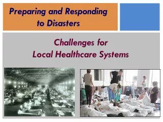
Disasters as Defined inGrand Challenges for Disaster Reduction (http://www.sdr.gov) • Weather • Hurricane • Tornado (not currently funded by NASA) • Winter Storm • Heat wave • Drought • Earth Surface • Volcano • Earthquake • Tsunami • Coastal Inundation • Flood • Landslide and Debris Flow • Wildland Fire NASA missions can and should play a role in reducing the impact of such disasters • Health and well being • Technological Disasters • Human and Ecosystem Health
Applications and Decision Support • Requirements for Applications and Decision Support can be summed up as: • Timeliness of data acquisition • Data latency • Relevance of information
‘Crossover’ Data Sets Question: Why did these data sets successfully cross over into the public domain?
Future EOS Question: What is the purpose of the new EOS system called for in the NRC’s Earth Science and Applications Decadal Survey? Answer: To accurately predict changes in the Earth system To provide that information to decision-makers so they can act on it
Future EOS Question: What is the purpose of the new EOS system called for in the NRC’s Earth Science and Applications Decadal Survey? Answer: To accurately predict changes in the Earth system To provide that information to decision-makers so they can act on it
CEOS Terms of Reference Data acquisition and common products CEOS has three primary objectives: 1. To optimize the benefits of spaceborne Earth observation through cooperation of its Members in mission planning and in the development of compatible data products, formats, services, applications and policies; 2. To aid both its Members and the international user community by inter alia, serving as the focal point for international coordination of space-related Earth observation activities, including the Group on Earth Observations and entities related to global change; 3. To exchange policy and technical information to encourage complementarity and compatibility among spaceborne Earth observation systems currently in service or development, and the data received from them; issues of common interest across the spectrum of Earth observation satellite missions will be addressed. Individual Members of CEOS will use their best efforts to implement CEOS recommendations in their respective Earth observation programs. Societal relevance Space Agency Policies
+ Ocean Color + Ocean Surface Winds
SeaWiFS MODIS CZCS VIIRS Visible NIR SWIR 1 2 3 4 5 6 7 8 Future U.S. OCR Missions (from M. Behrenfeld) NASA Advanced Mission (20XX? ) 8 7 Note: ESA’s MERIS mission also provides “climate quality” data Climate Data Record Quality 6 Desired Trajectory SeaWiFS (1997 - ) 5 Measurement Quality Index * Current trajectory MODIS (2002 - ) 4 VIIRS (201X ) Insufficient for Climate Data Record CZCS (1978-1985) 3 2 1 Measurement Maturity Index
Challenges for the futureof NASA’s Earth Science Data System 1) Provide information about the Earth system that is relevant to society • Keep the open data policy and persuade other space agencies to follow our example (through CEOS?) • Institute a new policy of ‘information transparency’ that documents how information on the Earth system was generated, and allows others to easily (and quickly) replicate or improve on that process • Take a ‘long view’ – acknowledge that the origin of the system we are entrusted with go back as far as 1974 (Landsat TM/MSS) and extend out to 2050 (and beyond?) - and act accordingly
Challenges for the futureof NASA’s Earth Science Data System • Provide information about the Earth system that is relevant to society • Establish a clear, crisp definition of what the societal challenges are for each Mission so that the direction of Data System development can be specific and focused with respect to addressing these challenges • Work with user communities to set requirements for data acquisition, data latency, level at which information is presented • Improve the interface with models for data assimilation and model validation
Challenges for the futureof NASA’s Earth Science Data System • Keep the open data policy and persuade other space agencies to follow our example (through CEOS?) • Renewed engagement with CEOS • Get data from new missions out to user communities quickly
Challenges for the futureof NASA’s Earth Science Data System • Institute a new policy of ‘information transparency’ that documents how information on the Earth system was generated, and allows others to easily (and quickly) replicate or improve on that process • Within the next 5-10 years, Mission Data Systems should enable a graduate student who has invented a new algorithm code to essentially reprocess one or more large sets of instrument data, with all associated ancillary inputs, via their local computer with a 24 hour turnaround.
Challenges for the futureof NASA’s Earth Science Data System • Take a ‘long view’ – acknowledge that the origin of the system we are entrusted with go back as far as 1974 (Landsat TM/MSS) and extend out to 2050 (and beyond?) - and act accordingly • Need to be able to answer questions like: “What did this look like 25 years ago?” “What will this look like 25 years from now?”
Research Education Value-Added Providers EOSDIS Data Centers* REASoNs/ MEaSUREs Earth System Models International Partners Decision Support Systems ESDS View Science Data Processing, Data Mgmt., Interoperable Data Archive & Distribution Distribution and Data Access, Flight Ops Data Capture, Initial Processing, Backup Archive Data Acquisition Data Transport to DAACs Tracking & Data Relay Satellite (TDRS) Spacecraft W W W ECHO* NASA Integrated Services Network (NISN) Mission Services Data Processing & Mission Control Interagency Data Centers ACCESS Ground Stations ACCESS Science Teams (SIPS)* Polar Ground Stations Measurement Teams *EOSDIS Elements Courtesy: Emily Law, JPL