Download
1 / 16
160 likes | 173 Views
Learn about the development of ITSASGIS-5D for marine GIS layers and scientific data interoperability using open-source tools and OGC services. This platform aims to facilitate multidisciplinary research through standardized data management and customized web portals.

E N D
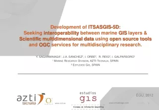
Development of ITSASGIS-5D: Seeking interoperability between marine GIS layers & Scientific multidimensional data using open source tools and OGC services for multidisciplinary research. Y. SAGARMINAGA1, J.A. SANCHEZ2, I. ORBE2, R. REIG2, I. GALPARSORO1 1 Marine Research Division, AZTI-Tecnalia, SPAIN 2EstudiosGis, SPAIN EGU, 2012 www.estudiosgis.com
BACKGROUND ITSASGIS-5D
BACKGROUND ITSASGIS-5D Since 2000, an intense effort was conducted in AZTI’s Marine Research Division to set up a Data Management System to gather all the marine datasets that were being produced by different in-house research projects. • AIMS: • Share data storagetofind & distribute data • Homogenizeformats & terminology • Facilitateinterdisciplinary data analysis ≈ Corporative GIS + nD Data ≈ Marine SDI Time & Technology • & GeneratecustomizedSpatial Data Information mini-portals
ITSASGIS-5D : Corporative GIS developed in 2000 • DataStorage • Data Search&DownloadApplication • http://psrsql/itxasgis/consultaweb/html/es/index.htm SQL SERVER + • Internet Data Viewer (mapserver) • http://www.serviciosgis.com/itsasgis/html/viewer.htm SHP + FDGC Metadata (XML) • Homogenenisation tools ARCGIS 8.1 Administration application Customized Thesaurus Customized ITSASGIS protocol
ITSASGIS-5D Limitations : Achievements & Biology & Fisheries Phytoplancton, Zooplancton, Icthioplancton, Benthos, Fishsamples, CetaceanSightings, Fisherieslogbooks, habitatmaps, etc LandCartography Basic Topographicmaps, Thematicmaps, Aerialimages, etc Uses & Management Administrative& regulatoryoceanlimits, Human activitiesmaps, Water & sedimentpollutionsamples, Impact & pressuremaps, protectedareas, etc… Geology & geomorphology Geomorphologicalmaps & sedimentsamples. Bathymetries Regional, coastal and local bathymetriesfrom differenttechniques (digitalized, single beam, multibeam). Hydrography& Oceanography Climatologicalmaps ,CTD, XBT…casts, data frombuoys Meteorology Meteorological data fromcoastalstations & buoys. • Notproducedbyus • High storagedemand • New WMS servicesavailable • FormatnotapproppriateforMultidimensionality • (Lat, Lon, Date&Time, Depth, Parameter) • SeveralDatasetsout of thesystem • (oceanographicmodels, remotesensing) • Tecnologicaladvancesforhandling Multidimensional Data • (THREDDS, OPENDAP, ncWMS….)
ITSASGIS-5D : New Marine SDI • DataDistribution • DataManagement .SHP WFS • Data Search&DownloadApplication USERS POSTGIS WMS OPENDAP HTTP DATA FUNCTIONS WCS ncWMS KML • Homogenenisation tools • Internet WEB Viewers ( ) Standard Thesaurus… Conventions (CF-1, INSPIRE, ncISO…) Revised ITSASGIS Protocol…
ITSASGIS-5D TheAdministratoris a web clientconnectedto a embebded SQL-lite Database
ITSASGIS-5D Howtocreate a mini portal? • Define Applicationproperties: • Private/Public • CustomizedHeaderframe CreateApplication • Define Layersproperties: • ThematicCategories • Alias in 4 languages • Visibilityby default Deploy Layers Add Data Source link (WMS orncWMS) • AddLayers • AddUsers (ifPrivate) • AddFunctions Define Userproperties: CreateUsers Define Functionsproperties: CreateFunctions URL
ViewerProperties ITSASGIS-5D Open-sourceLibrariesused: Godiva2.js ViewerComposition: HeaderFrame (optional) FunctionsButton bar Visible & Active Layertogglebuttons Map Scrollwindow Legend CollapsibleTable of Contents nD data deployablenavigation panel Deployable INFO Panel 9
ITSASGIS-5D Viewer Properties ViewerFunctions: • GeographicNavigation • MeasureLength & Area • GetLayerInformation • Set Transparencyto active layer • Add/Edit/DeleteCustomUsermarker • Create a vector layer (exportable as kml) • Creategraphicfromtransectgraphics • Importexternal KML/KMZ file • USER Identificationforgeomarkeredition • Chooselanguage (English, French, Spanish, Basque)
INFORMATION TOOL ITSASGIS-5D GeoMARKERS WMS SHOWS SELECTED REGISTERS FROM ATTRIBUTE TABLE • Allowsinteractivityfromexternalusersallowingthemtoinsertdifferentkind of informationwithmarkers. SHOWS NAME & DESCRIPTION FIELD THAT MAY CONTAIN HTML CODE KML NAVIGATE THROUGH MULTIDIMENSIONALITY ANIMATION BETWEEN 2 SELECTED DATES TIME SERIES ON A POSITION BETWEEN 2 SELECTED DATES ncWMS DEPTH PROFILE IN A LOCATION SURFACE & DEPTH PROFILE ALONG A TRANSECT
Integrated GIS & nD DATA via WMS and ncWMS in thesameplatform ITSASGIS
CustomizedURLs ITSASGIS-5D • CustomizedHeaderframesorembeddable URL withoutheader • CustomizedLayers • Customizedfunctions (to be workedout)
DISCUSSION & CONCLUSIONS ITSASGIS-5D ITSASGIS-5D has beendevelopedprimarilyto: Provideaccesstospatialinformationproduced & gathered in ourinstitute. Integrate GIS data withnD data, avoidingparallelviewers. Allowustoeasilycreatecustomized web viewersfocusedonspecificuserneedsinstead of viewersgatheringlots of information. Make a developmentbasedonavailable open-sourcetools, and adoptinginternationalstandards & conventions.
FUTURE PLANS ITSASGIS-5D Upcomingrelease 1.0 and operational test phasetoclear up bugs and improve performance. Development of modular data analysisfunctionalities. Link withmetadatamanagementsystem. Integrate new data sources (WFS, SOS, ¿?...)