Download
1 / 11
110 likes | 182 Views
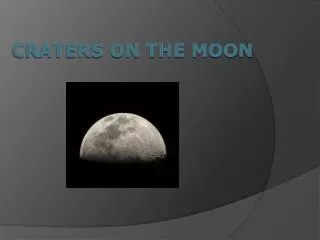
Geoffrey George, Charles Gutierrez Miguel Nze , Matt Malacara, Brandon Rangel, Juan Urquidi , Alex Valdez Robert E. Lee High School/S.T.E.M. RAM Academy San Antonio, Texas. Categorizing 30km Craters on the Lunar Surface. Project Selection.

E N D
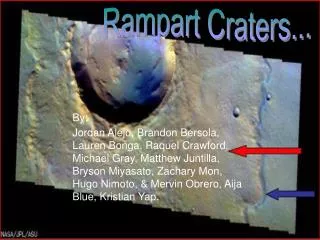
Geoffrey George, Charles Gutierrez Miguel Nze, Matt Malacara, Brandon Rangel, Juan Urquidi, Alex Valdez Robert E. Lee High School/S.T.E.M. RAM Academy San Antonio, Texas Categorizing 30km Craters on the Lunar Surface
Project Selection • We looked through the topics and discussed which one we all had an interest in. • When we got down to three we did our research and found which one had the most resources available. • After about a week of research we came to a consensus about our topic.
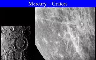
Topic of Study • Categorize lunar impact craters 30km(±4km) in diameter as either Primary or Secondary based upon crater depth, diameter, and regional surroundings
Background Info • Morphology • Primary vs. Secondary • Crater counting
Primary Data Gathering • Gathered crater information (Identity, Diameter, Longitude & Latitude) • Compiled and documented craters that ranged from 26 – 34 kilometers. • Made use of Google Earth’s Moon feature to collect pictures of all the craters registered.
Detailed Data gathering • Examined Crater Region for similar sized impact sites • Calculated a ratio between given Depth and Diameter • Looked for trends between separate sets of data • Predicted Crater type upon the look of the Impact region against the Depth-Diameter Ratio
Data Crater Name: Lambert Location: 25.80°N 21.00°W Depth/Diameter Ratio: .09 Depth: 2.7km Diameter: 30km Regional Appearance; Crater is surrounded by many miniscule craters, Crater appears to have a complex inner geography Link to full spreadsheet: http://bit.ly/dVJH7j
Conclusion • Currently our team lacks sufficient amounts of data to come to determine any sort of trend between the Depth/Diameter Ratio and the appearance of the crater region to determine the classification of the impact sites.
Future Studies • Continue to gather data concerning crater depth and diameter • Possibly expand set of data to include; Crater age, edge slope, and temperature • Build up a website to exhibit set of craters coupled with their related information
References • Google Earth • Map-A-Planet • USGS Map-a-Planet: Explore the Earth's Moon . (n.d.). USGS Astrogeology: Map-a-Planet. Retrieved March 24, 2011, from http://www.mapaplanet.org/explorer • Lunar Republic • The Moon - Official Website Of Luna - Luna Society. (n.d.).The Moon - Official Website Of Luna - Luna Society. Retrieved March 24, 2011, from http://www.lunarrepublic.com/