Download
1 / 64
640 likes | 746 Views
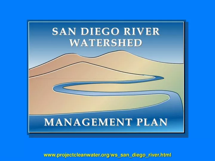
www.projectcleanwater.org/ws_san_diego_river.html. Moorpark. Simi Valley. Camarillo. Thousand Oaks. SAN DIEGO RIVER WATERSHED BOUNDARIES. PURPOSE OF WATERSHED PLANNING. WHY UNDERTAKE A WATERSHED MANAGEMENT PLAN?. Address forecasted population growth Reduce & manage habitat/species impacts

E N D
Moorpark Simi Valley Camarillo Thousand Oaks SAN DIEGO RIVER WATERSHED BOUNDARIES
PURPOSE OF WATERSHED PLANNING WHY UNDERTAKE A WATERSHED MANAGEMENT PLAN? • Address forecasted population growth • Reduce & manage habitat/species impacts • Improve water quality • Navigate increasing regulations • Accrue benefits of a cooperative strategy • Protect & enhance our quality of life
KEY EXPECTATIONS Land use & regional planning authorities need to be involved to implement watershed management ideas A coordinated & consistent effort toward the removal of invasive exotic species is needed Policies developed should allow water to sustain natural communities & prevent health risks to humans from pollutants Buffer zones should be established along riparian corridors to preserve water quality Encourage water conservation to increase availability
KEY EXPECTATIONS Acquiring lands to create wetlands is surest way to preserve & protect water quality Water quality should be improved by creating extensive wetland areas Strategies should be implemented to reduce or eliminate development in the flood plain Riparian habitats are dependent on flood stimulation Outreach programs that engage schools & provide hand-on experienced are needed
PURPOSE OF WATERSHED PLANNING BENEFITS OF COOPERATIVE PLANNING • Coordination of information • Informed decision-making • Improved water quality • Groundwater protection • Habitat & wildlife protection
PURPOSE OF WATERSHED PLANNING ADDITIONAL BENEFITS OF COOPERATIVE PLANNING • Coordinated public plan development – cooperative open structure • Establish cooperative planning & implementation network • Coordinate ideas & innovations • Coordinate related public & private sector actions • Coordinate & maximize funding • Establish permanent watershed data repository
PROJECT APPROACH Public involvement in the development of the WMP has been important from its inception in 2002 Watershed Work Group (WWG) has been instrumental in guiding & shaping the WMP
PROJECT APPROACH • Strategy for WMP development: • Collect existing data • Identify & prioritize stakeholder concerns • Analyze existing data • Address identified concerns
PROJECT APPROACH PROCESS OBJECTIVES • Develop- • Vision • Principals & Goals • Strategies to achieve these goals • Establish framework for developing the WMP • Set stage for WMP implementation
VISION STATEMENT “Enhance the quality of life in our communities by preserving and re-establishing the natural functions and features of the San Diego River Watershed. These natural watershed characteristics will be sustained by protecting and conserving the water, land, and habitats of the San Diego River Watershed, while preserving its cultural heritage.”
GUIDING PRINCIPLES • Enrich the quality of life for future generations • Make watershed decisions in a holistic manner • Base decisions on sound science & best available information • Support the development of new & better information & management practices • Advocate watershed stewardship • Engage an active citizenry
GUIDING PRINCIPLES • Promote stakeholders’ understanding of watershed • Encourage citizens, communities & agencies to communicate, coordinate, cooperate & collaborate • Protect & restore natural watershed functions • Manage water supply & water use in a sustainable manner • Improve water quality • Safeguard cultural & historical resources • Utilize the WMP as a living document
TOOLS UTILIZED IN WMP DEVELOPMENT • Land use plans & other planning documents developed by key stakeholder groups: • Cities (City of San Diego River Park Master Plan) • County • State agencies (Parks & Rec, Caltrans) • Federal resource agencies (USFS, BLM) • Tribal reservations (Barona, Capitan Grande, Inaja & Cosmit) • Regulations & regulatory reports: • The Clean Water Act • The Porter-Cologne Act • The California Environmental Quality Act • Watershed Urban Runoff Management Plans • Jurisdictional Urban Runoff Management Plans • National Pollution Discharge Eliminations System reports
TOOLS UTILIZED IN WMP DEVELOPMENT • Watershed-specific Studies (developed as part of project): • Stakeholder Input Report #1 (Needs & Expectations) • The List of Existing Data & Information Collected • The Watershed Characteristics Inventory Report • The Water Quality Report • The Data & Information Management Plan • The Watershed Assessment Report • Stakeholder Input Report #2 (Strategy through stakeholder input) • Available on Project Clean Water website • (www.projectcleanwater.org/ws_san_diego_river.html)
WATERSHED CHARACTERISTICS • Key Characteristics: • 440 Square Miles (279,557 acres) • Natural vegetation covers 58% of the Watershed • Cleveland National Forest, Cuyamaca State Park & Mission Trails Regional Parks are key open space areas • Is home to 509,000 & expected to grow to 617,000 by 2020 • Averages 9-30 inches of rainfall annually • Supports 5 surface water storage reservoirs
WATERSHED CHARACTERISTICS HYDROLOGIC NETWORK & DIVIDES • Watershed can be divided into 3 major sub-basins: • El Capitan • San Vicente • San Diego
WATERSHED CHARACTERISTICS WATER QUALITY ISSUES 2002 Listed Segments: Famosa Slough Nutrients Lower San Diego River Low dissolved oxygen Bacteria Phosphorus TDS Mouth of San Diego River Bacteria Forester Creek Bacteria pH TDS
WATERSHED CHARACTERISTICS WATER QUALITY ISSUES 2002 Monitoring List: El Capitan Mgmt Area Benzene, MTBE Chlordane Eutropic Exotic species Trash San Vicente Mgmt Area Eutropic San Diego Mgmt Area Chlordane, DDT, Dieldrin, PCBs Eutropic Sedimentation Exotic Species Phosphorus Benzene, MTBE Trash
SURFACE & GROUNDWATER HYDROLOGY EL CAPITAN MANAGEMENT AREA TOPOGRAPHIC LANDFORM
EL CAPITAN MANAGEMENT AREA MONITORING
SENSITIVE SPECIES EL CAPITAN MANAGEMENT AREA VEGETATION COMMUNITIES
MHPA EL CAPITAN MANAGEMENT AREA BCLA
LAND OWNERSHIP EL CAPITAN MANAGEMENT AREA JURISDICTIONS
PLANNED LAND USE EL CAPITAN MANAGEMENT AREA EXISTING LAND USE
IMPERVIOUS SURFACES 2020 2000 EL CAPITAN MANAGEMENT AREA POPULATION DENSITY
SURFACE & GROUNDWATER HYDROLOGY SAN VICENTE MANAGEMENT AREA TOPOGRAPHIC LANDFORM
SAN VICENTE MANAGEMENT AREA MONITORING
SENSITIVE SPECIES SAN VICENTE MANAGEMENT AREA VEGETATION COMMUNITIES
MHPA SAN VICENTE MANAGEMENT AREA BCLA
LAND OWNERSHIP SAN VICENTE MANAGEMENT AREA JURISDICTIONS
PLANNED LAND USE SAN VICENTE MANAGEMENT AREA EXISTING LAND USE
IMPERVIOUS SURFACES 2000 2020 SAN VICENTE MANAGEMENT AREA POPULATION DENSITY
SURFACE & GROUNDWATER HYDROLOGY SAN DIEGO MANAGEMENT AREA TOPOGRAPHIC LANDFORM
SAN DIEGO MANAGEMENT AREA MONITORING
SENSITIVE SPECIES SAN DIEGO MANAGEMENT AREA VEGETATION COMMUNITIES
MHPA SAN DIEGO MANAGEMENT AREA BCLA
LAND OWNERSHIP SAN DIEGO MANAGEMENT AREA JURISDICTIONS
PLANNED LAND USE SAN DIEGO MANAGEMENT AREA EXISTING LAND USE
IMPERVIOUS SURFACES 2000 2020 SAN DIEGO MANAGEMENT AREA POPULATION DENSITY
WATERSHED ISSUES OF CONCERN SURFACE WATER HYDROLOGY • Lack of stream flow monitoring gauges along Forester Creek or San Vicente Creek • Hydromodifications (Channelization, Culverts, Storm Drains) • Lack of guidelines or policies to effectively manage & control • Lack of data about the types, extents & locations of the modifications SURFACE WATER QUALITY • Constituents of Concern • El Capitan: Nutrients, TOC & TDS • San Vicente: Nitrates & Eutropic conditions • San Diego: Bacteria, Low DO, TDS, Turbidity, Copper, Pesticides & Nutrients
WATERSHED ISSUES OF CONCERN GROUNDWATER • Limited amount of recent characterization data • Site specific contaminations from underground storage tanks • Increases in TDS & Nitrate concentrations BIOLOGICAL RESOURCES • Habitat Destruction or Degradation is primary threat to conservation of biological diversity • Exotic Species Control - introduced flora & fauna (amphibians, aquatic, terrestrial & avian) are detrimental to the health & function of the watershed
WATERSHED ISSUES OF CONCERN LAND USE & PLANNING • Interagency cooperation & coordination is needed for successful WMP implementation • Mechanisms to map, manage & control impervious surfaces are needed • A comprehensive & coordinated data management structure is needed to ensure: • Efficient & effective data collection • Identification of spatial & temporal trends • Decision makers are informed
WATERSHED ISSUES OF CONCERN IMPERVIOUS SURFACES
ACTION RECOMMENDATIONS APPROACH TO ACTION RECOMMENDATIONS • Organized by over-arching issue area • Structured to provide long-term flexibility & adaptability to evolving needs & issues • Provides summaries of the problems & contributing factors – identifies early & long-term actions • Identified actions are a starting point & should evolve as the WMP moves forward
ACTION RECOMMENDATIONS Ongoing Collaborative Management & Interagency Cooperation • Summary: • A collaborative management structure should be flexible & adaptable • Structure should be inclusive & streamlined to enable efficient & effective decision-making • Land managers need to coordinate & cooperate • Non-profit & community groups need to be active & engaged • GOAL: develop & implement a process that is structured yet flexible, inclusive yet manageable, & politically connected but not politically driven • Contributing Elements: • The number of active management groups • San Diego River Conservancy • San Diego River Coalition • NPDES Copermittees • MSCP Participants • The complex pattern of land ownership • County & Cities • Tribal Reservations • Military installation • Cleveland National Forest • Cuyamaca State Park
ACTION RECOMMENDATIONS Ongoing Collaborative Management & Interagency Cooperation • Early Actions: • Identify additional stakeholders to engage in process • Develop an initial committee structure • Identify stakeholders to coordinate, cooperate, communicate & collaborate on highest priority issues • Form special working groups that report back to the larger group • Long-term Actions: • Develop a management structure & membership that is stable & broad enough to enable policies to be developed & implemented consistently across jurisdictional & land management boundaries
ACTION RECOMMENDATIONS Stakeholder Education & Outreach • Summary: • Many issues are related to actions taken by individual stakeholders every day • Most individuals do not understand what a watershed is, let alone how their actions effect its health & function • Basic watershed based educational materials & outreach mechanisms are needed to improve understanding & develop stewardship • Topic specific materials & programs are also needed and should be developed in conjunction with the other action recommendations • Contributing Elements: • Watershed planning is a relatively new scientific study merging together diverse disciplines previously un-integrated • Many watershed issues are invisible to the untrained eye • Issues are often perceived as regulatory issues for governmental entities to manage
ACTION RECOMMENDATIONS Stakeholder Education & Outreach • Early Actions: • Identify target groups to focus initial outreach efforts • Determine effective mechanisms for distribution & measuring success • Develop or augment basic outreach materials focusing on the SDRW & its issues • Identify existing programs to integrate into to facilitate information dissemination • Long-term Actions: • Maintain & augment outreach efforts associated with Early Action recommendations • Ensure education & outreach efforts are coordinated & complimentary within all Action Recommendations
ACTION RECOMMENDATIONS Hydromodification • Summary: • Human modifications to surface water hydrology can result in: • Higher flood elevations • Increased flood frequency • Loss of habitat • Decreased groundwater recharge • Elevated base-flows from irrigation return flow & urban runoff • Issues need to be addressed comprehensively & in a coordinated manner • Contributing Elements: • Modifications to the hydrologic system • Land Development • Impervious Surfaces • Irrigation return flows & urban runoff