Download
1 / 21
210 likes | 346 Views
This document provides a comprehensive overview of the ASTER (Advanced Spaceborne Thermal Emission and Reflectance Radiometer) instruments used in volcanic monitoring. It highlights ASTER's capabilities in observing volcanic activity, including gas emissions, thermal anomalies, and topographic analysis. Case studies from Miyake-jima and Sierra Negra demonstrate the effectiveness of ASTER in monitoring volcanic gas emissions and thermal patterns. Additionally, it discusses the ASTER image database for volcanoes, containing images of 964 active volcanoes worldwide, enabling enhanced understanding and disaster management.

E N D
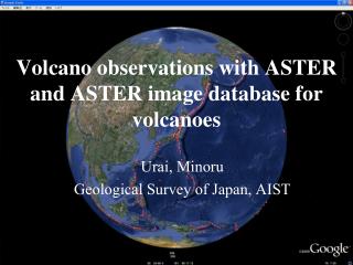
Volcano observations with ASTER and ASTER image database for volcanoes Urai, Minoru Geological Survey of Japan, AIST
Topics • Introduction • Overview of ASTER instruments • Volcano monitoring with ASTER • Volcanic gas monitoring : Miyake-jima, Japan • Thermal anomaly monitoring : Sierra Negra, Galapagos Islands • ASTER image database for volcanoes • Conclusions
Introduction • Resent volcanic hazard • Eyjafjallajokull 2010 : Over 100,000 flights cancelled • Merapi 2006 : 17,000 people were evacuated • Two people were killed by a pyroclasic flow • Pinatubo 1991 : Up to 800 people were killed • In 1992 and 1993, the average temperature in the Northern Hemisphere was reduced 0.5 to 0.6°C • Historic volcanic hazard • Tambora 1815 : 92,000people were killed • Unzen 1792 : 15,000 people were killed
Introduction • ASTER can be used for volcano observations • Topographic and geologic analysis, • Mapping volcanic products, • Eruption plume analysis, • Discolored sea water and crater lake monitoring, • Generating digital elevation models, • Surface temperature mapping,
Overview of ASTER Launch date18DEC1999 Platform Terra satellite Orbit 16days polar orbit Observation time 10:30AM Data recorder yes Subsystems VNIR, SWIR,TIR Stereo function yes Total bands 14+1 Swath width 60km Lifetime 6 years Acquired scene Over 1,800,000 scenes
Overview of ASTER • ASTER has nadir (3N) and backward (3B) looking views. • 3N and 3B compose a stereoscopic pair. • A DEM can be generated from the stereoscopic pair. • However, DEM can not be generated cloud covered area and a DEM covers 60 km by 60 km. ASTER stereo image function. (http://www.ersdac.or.jp/GDEM/E/2.html)
Volcanic gas monitoring : Miyake-jima, Japan • Miyake-jima is located about 180km south of Tokyo • SO2-rich plume absorb thermal emission from sea at 8.6µm • Cyan color indicates that temperature derived from band 11 is lower than others ASTER TIR RGB : 11, 13, 14 On November 8, 2000
Volcanic gas monitoring : Miyake-jima, Japan Nadir viewing image Backward viewing image
Volcanic gas monitoring : Miyake-jima, Japan ASTER stereo pair Atmospheric profile ASTER TIR B13 B11 Plume height and wind velocity analysis MODTRAN Sea surface temperature Plume height MODTRAN Wind velocity SO2 flux estimation 2D- SO2 distribution SO2 flux
Volcanic gas monitoring : Miyake-jima, Japan The estimation of two-dimensional SO2 distribution
Volcanic gas monitoring : Miyake-jima, Japan The estimation of SO2 flux SO2 flux (ton/day) Distance from the vent (km)
Caldera collapse and lava flow : Piton de la Fournaise • Piton de la Fournaiseis one of the most active volcanoes located on the French island of Reunion in the western Indian Ocean. • There are three calderas that were formed by progressive eastward slumping of the volcano.
Caldera collapse and lava flow : Piton de la Fournaise On April 2, 2007, a new 1 km long vent opened at 650 m altitude in the southern part of Grand Brule. The lava flows reached the sea. On April 5 to 6 and over the whole following day, the summit (Dolomieu) crater floor collapsed. ASTER VNIR image taken on June 8, 2005
Caldera collapse and lava flow : Piton de la Fournaise April 17, 2007 October 31, 2006
Caldera collapse and lava flow : Piton de la Fournaise May 6, 2007 (after eruption) June 8, 2005 (before eruption) VNIR images with 100 m contour
Caldera collapse and lava flow : Piton de la Fournaise E-W ASTER DEM profile Depression : 320 m at most Total volume : 9.6 107 m3 ASTER DEM difference
Caldera collapse and lava flow : Piton de la Fournaise New lava deposit area : 3.85 km2 Surface temperature distribution derived from ASTER nighttime observed on May 4, 2007 superimposed on ASTER daytime image observed on June 8, 2005
ASTER image database for volcanoes Global volcano monitoring plan with ASTER △ Rank A (104) △ Rank B (220) △ Rank C (640) Volcanoes monitored by ASTER
ASTER image database for volcanoes Google Earth Version of ASTER image database for volcanoes at http://igg01.gsj.jp/vsidb/image/vsidb.kml
ASTER image database for volcanoes Full resolution display of ASTER image database for volcanoes
Conclusions • The ASTER’s ability to monitor volcanic activities, such as thermal anomalies, topographic changes, volcanic gases, among others, has been validated. • A web-based ASTER Image Database Volcanoes is opened to the public (http://igg01.gsj.jp/vsidb/image/index-E.html). The database contains all ASTER images of 964 active volcanoes.