Comprehensive Analysis Methodology for Spatial Data Evaluation
This presentation outlines a structured approach to conducting a spatial data evaluation, detailing the objectives, criteria, and methodologies used. It covers the development of analytic models and the derivation of intermediate information layers while emphasizing the importance of clarity and readability in visual representations, such as flowcharts. Key inputs, critical derived information, and specific methodologies are systematically outlined to ensure a comprehensive understanding of the data evaluation process, ultimately aiming to generate meaningful outputs for decision-making and further analysis.


Comprehensive Analysis Methodology for Spatial Data Evaluation
E N D
Presentation Transcript
Title Solution Presented by <Student Name> For <Class Name> <Date> Creator's Name, GIS 4850
Instructions - Delete this slide from your presentation • Delete all lines on all slides that are clearly instructions or guides on how to put the presentation together • Points offfor failure to“CLEAN” out the editorial notes from the slides before you submit them Creator's Name, GIS 4850
Objective(s) • [This is an InfinitiveVERB Page] • To develop ..., to examine…, to compare…, to gain .., to evaluate ..etc. Creator's Name, GIS 4850
Model Criteria • [This page is usually only relevant to a model development exercise where constraints & preferences are described. It may not be required for some exercises unless a model with criteria is being developed.] • Criterion 1<substitute the description of the criterion for the Criterion 1 term> • Factor 1 Info [give it a name] = selection or math expression • Criterion 2<substitute the description of the criterion for the Criterion 2 term> • Factor 2 Info = selection or math expression • Criterion 3<substitute the description of the criterion for the Criterion 3 term> • Factor 3 Info = selection or math expression • etc Creator's Name, GIS 4850
Methodology - Overview • [This is an ACTION VERB Page] • [Expand, edit, change as appropriate for your presentation][This page describes your analysis in general. Try to identify the main sub models or main higher level processes into which the project can be divided.] • Develop Analysis plan or Model • Derive Intermediate Information Layers • Analyze, [Combine], [Evaluate] Intermediate Info • Calculate Info Required to meet Final Objective • Generate Material for Report or Presentation Creator's Name, GIS 4850
Methodology - Specific • (This is an ACTION VERB Page) • [This page more specifically describes your analysis, and I don’t mean the specific mouse clicks, or trivial steps like ‘add a data layer’.] • [ Don’t use more than 2 slides for this. If you think you need more than you have not thought enough about the problem to summarize it down to only it’s crucial elements!!!!!!!!!] • Derive Intermediate Information Layers • Step 1: Derive x1 layer • Step 2: Derive x2 layer • Etc. • Generate [Analyze, Evaluate, or Calculate] (etc.) additional Intermediate Layers • Step 3: e.g., Select / Reclass areas meeting Criterion 1 • Step 4: e.g., Select / Reclass areas meeting Criterion 2 • Etc. • Calculate Output • Step 6: Calculate y1 Output Layer Creator's Name, GIS 4850
Required Inputs & Critical,Derived Info • (This is a Data NOUN Page – Do Not Double List Inputs) • Input 1 <substitute actual item name for the Input 1 phrase> • Critical, Derived Intermediate Info 1 • Derived Factor 1 • Input 2 <substitute actual item name for the Input 2 phrase > • Critical, Derived Info 2 • Critical, Derived Info 3 • Input n <substitute actual item name for the Input n phrase >, etc. (Put in graphics of critical layers to help audience visualize) Creator's Name, GIS 4850
Example Flowcharts(Delete this slide from a presentation) • The following slides contain icons of an appropriate size for your presentations. You may cut & paste them into your presentations. • Try to minimize the number of slides used for your flowchart, i.e., put as many processes as clarity and readability will allow onto 1 slide. • DO NOT put only 1 spatial process on a single slide. • You want your audience to be able to “track” where your model/analysis is going. This is enhanced with more processes on fewer slides. Creator's Name, GIS 4850
Formulation Flowchart of Model or Analysis Approach(Use however many slides it takes to fully flowchart the processes) Input 1 Output 1 Function Input 2 <Criteria> Input 2 Output k Function Inter- mediate Factor j Input k Output m Function <Criteria> <Criteria> Function Output n Input n <Criteria> Creator's Name, GIS 4850
Flowchart ofSelection Analysis Approach Cities CitiesGT 500K Selectby Attribute Large Citiesw/I 50 Mi of Quakes GT 6 Large Citiesw/i 50 Mi of Quakes GT 6 Selectby Location ExportSelection Pop > 500,000 Quakes QuakesGT mag 6 Selectby Attribute Mag > 6.0 Large Citiesw/I 50 Mi of Quakes GT 6 ExtractSum of Pop Statistics TableEdit Large Citiesw/I 50 Mi of Quakes GT 6 Add field: Funding, float; Add field: Proportion, float; Calculate proportion = pop1990 / 7228750; Calculate Funding = Proportion * $10 Mil c.m. hay, GIS 2250
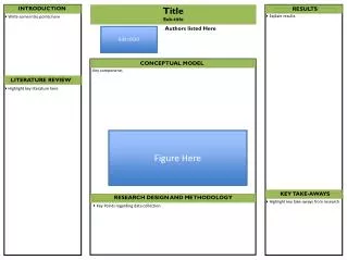
Results: Final Output(describe the desired final output & include a graphic) • (This is a product NOUN Page) • A map displaying the <describe thedesired output information as if your reader were blind> • Other Outputs • <could consist of a table, a histogram, a custom view,... Etc.> Creator's Name, GIS 4850
Discussion of Results • [On this slide DISCUSS your results. DO NOT summarize objective, your methods or your Results. DISCUSS your results, your knowledge gained.] • Were the results as expected? • Were there some surprises (describe)? • Did the results meet your objective(s)? • How successful was the model or analysis approach? Creator's Name, GIS 4850
Conclusions/Final Comments • [On this slide note] • Your final conclusions • how you might improve the model or analysis next time • Your final comments about the analysis Creator's Name, GIS 4850