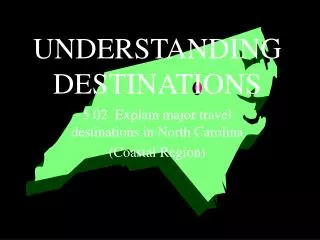
UNDERSTANDING DESTINATIONS
This guide provides crucial insights into map usage, covering essential components such as legends, scales, the equator, geographic grids, latitude, longitude, and the Prime Meridian. It explains how these elements help in understanding distances on the ground, with measurements in miles and kilometers. Learn about cartographical tools like atlases, globes, and GPS, and gain practical tips for giving directions effectively. Whether you're planning a trip or studying geography, this resource helps you navigate the complex world of maps confidently.

UNDERSTANDING DESTINATIONS
E N D
Presentation Transcript
UNDERSTANDING DESTINATIONS 5.01 Demonstrate the use of a map.
Parts of a map • Legend or key • Scale • Equator • Geographic grid • Latitude • Longitude • Prime Meridian
Legend or key The list and explanation for the symbols and colors used on a map
Scale The relationship between a distance on the map and the corresponding distance on the ground • Mile: 5,280 feet; unit of distance used by the US and a few other countries • Kilometer: .6 of a mile; the unit of distance used by the vast majority of the world
Equator The parallel that lies at zero degrees halfway between the North Pole and South Pole
Geographic grid The framework of crossed lines created by lines of latitude and longitude
Latitude • The distance of a place north or south of the equator • Represented by horizontal lines on a geographic grid • Distance from the equator affects climate
Longitude • The distance of a place east or west of the Prime Meridian (also known as the Greenwich Meridian) • Represented by vertical lines on a geographic grid • Longitude affects time
Prime Meridian The reference line at zero degrees longitude
Cartographical aids used in the travel industry • Atlas • Globe • Locator • Global Positions System (GPS) • Online mapping websites
Atlas A collection of flat maps
Globe A three-dimensional representation of the spherical earth
Locator A scheme that uses a grid of numbers and letters rather than degrees of latitude and longitude to pinpoint places on a map Example: Road map
Global Positions System (GPS) A worldwide navigation system that uses radio signals broadcast by satellites to pinpoint positions on earth
Tips for giving directions • Know the area. • Listen. • Use the terms right, left, straight ahead. • Use a map to show directions, or draw a sketch to illustrate directions. • Mention landmarks. • Explain distances in terms of miles, blocks, or kilometers. • Explain the street numbering system. • If you don’t know, refer the traveler to another source. • Be courteous and friendly.