Download
1 / 70
700 likes | 900 Views
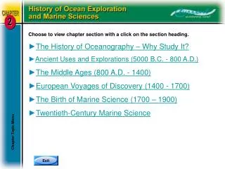
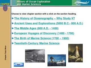
Choose to view chapter section with a click on the section heading. The History of Oceanography – Why Study It? Ancient Uses and Explorations (5000 B.C.- 800 A.D.) The Middle Ages (800 A.D. - 1400) European Voyages of Discovery (1400 - 1700) The Birth of Marine Science (1700 – 1900)

E N D
Choose to view chapter section with a click on the section heading. • The History of Oceanography – Why Study It? • Ancient Uses and Explorations (5000 B.C.- 800 A.D.) • The Middle Ages (800 A.D. - 1400) • European Voyages of Discovery (1400 - 1700) • The Birth of Marine Science (1700 – 1900) • Twentieth-Century Marine Science Chapter Topic Menu
The History of Ocean Explorationand Marine Sciences The History of Oceanography – Why Study It? Chapter 2 Pages 2-2 to 2-3
The History of Oceanography - Why Study It? • Three very good reasons to learn the history of oceanography: • The history of oceanography is connected to the world’soverall history. • Oceanography’s past helps us understand why and howpeople apply marine sciences today. • It is interesting. The History of Oceanography – Why Study It? Chapter 2 Pages 2-2 to 2-3
The History of Oceanography - Why Study It? • The history of oceanography can be divided into four stages: • Ancient Uses and Explorations (5000 B.C. - 800 A.D.) • The Middle Ages (800 - 1400) • European Voyages of Discovery (1400 - 1700) • The Birth of Marine Science (1700 - 1900) The History of Oceanography – Why Study It? Chapter 2 Pages 2-2 to 2-3
Ancient Uses and Explorations(5000 B.C. – 800 A.D.) Ancient Uses and Explorations (5000 B.C. – 800 A.D.) Chapter 2 Pages 2-4 to 2-15
Prehistory and the Rise of Seafaring • Three primary reasons for early civilization to interact with the ocean: • To obtain food. • Trade with other cultures. • To discover new lands. • The earliest recorded sea voyage appears to be 3200 B.C. under the auspices of Egyptian Pharaoh Snefru. Ancient Uses and Explorations (5000 B.C. – 800 A.D.) Chapter 2 Pages 2-4 to 2-5
Ancient PhoenicianExplorations and Discoveries • The Phoenicians contributed to ocean exploration by establishing the first trade routes throughout the Mediterranean, even as far north as Great Britain. Ancient Uses and Explorations (5000 B.C. – 800 A.D.) Chapter 2 Pages 2-5 to 2-6
Ancient Polynesian Explorations and Discoveries • The significance of Polynesian seafaring is that it is the earliest known regular, long-distance, open-ocean sailing beyond sight of land. Ancient Uses and Explorations (5000 B.C. – 800 A.D.) Chapter 2 Pages 2-7 to 2-8
Ancient Polynesian Explorationsand Discoveries • Spreading eastward from Fiji, Tonga, and Samoa, Polynesians settled islands in an area of about 26 million square kilometers (10 million square miles). Ancient Uses and Explorations (5000 B.C. – 800 A.D.) Chapter 2 Pages 2-7 to 2-8
Ancient Greek Explorations and Discoveries • The Greeks used references on shore to navigate. This is called piloting. • As seafaring advanced they learned to use the sun, constellations, the North Star and sea conditions to navigate in the open ocean. • The Greeks knew the Earth was a sphere, not flat. Ancient Uses and Explorations (5000 B.C. – 800 A.D.) Chapter 2 Pages 2-8 to 2-10
Ancient Greek Explorations and Discoveries • Pytheas noted that he could predict tides in the Atlantic based on the phases of the moon. • He could determine how far North or South one was from the North Star by measuring the angle between the horizon and the North Star. • This was a significant improvement in navigation. Ancient Uses and Explorations (5000 B.C. – 800 A.D.) Chapter 2 Pages 2-8 to 2-10
Ancient Greek Explorations and Discoveries • Eratosthenes (264-194 B.C.) is credited with two contributions: • He calculated the Earth’s circumference. • He invented the first latitude/longitude system. Ancient Uses and Explorations (5000 B.C. – 800 A.D.) Chapter 2 Pages 2-8 to 2-10
Ancient Greek Explorations and Discoveries • In 127 B.C., Hipparchus improved Eratosthenes’ maps by inventing the regular grid system. • In 450 B.C., Herodotus published a detailed history of Greece’s struggles with the Persian Empire. This work was significant because it was one of the earliest published maps of the world the Greeks knew. Ancient Uses and Explorations (5000 B.C. – 800 A.D.) Chapter 2 Pages 2-8 to 2-10
Ancient Greek Explorations and Discoveries • In 63 B.C.-24 A.D., Strabo published a 17-book workcalled Geographic that contained a map expandingknowledge/accuracy about the world. Ancient Uses and Explorations (5000 B.C. – 800 A.D.) Chapter 2 Pages 2-8 to 2-10
Ancient Greek Explorations and Discoveries • In 100-168 A.D., Ptolemy developed the first known map to show a portion of the Earth as a sphere on flat paper. • It showed latitude/longitude by dividing the grid into degrees, minutes, and seconds of the arc. Ancient Uses and Explorations (5000 B.C. – 800 A.D.) Chapter 2 Pages 2-8 to 2-10
Measuring The Size of theEarth – Ancient Greek Style Step 1: 7.2°/800km =360°/Earth circumference in km Step 2: 7.2° x Earth circumference in km =800 km x 360° Step 3 - Solve: Earth circumference in km =800 km x 360°/7.2° Earth circumference in km =288,000° km/7.2° Earth circumference in km =40,000 km (24,840 miles) Ancient Uses and Explorations (5000 B.C. – 800 A.D.) Chapter 2 Page 2-11
Latitude/Longitude System • The purpose of the latitude and longitude mapping system is to identify specific locations on the Earth’s surface, even in the absence of landmarks. Ancient Uses and Explorations (5000 B.C. – 800 A.D.) Chapter 2 Pages 2-12 to 2-14
Latitude/Longitude System • Latitude Lines: • Also called parallels. • Run east-west. • 0º parallel is also called the equator. Ancient Uses and Explorations (5000 B.C. – 800 A.D.) Chapter 2 Pages 2-12 to 2-14
Latitude/Longitude System • Longitude Lines: • Also called meridians. • Run north-south. Ancient Uses and Explorations (5000 B.C. – 800 A.D.) Chapter 2 Pages 2-12 to 2-14
Latitude/Longitude System • Prime Meridian is located on the longitude of the Royal Naval Observatory in Greenwich, England. Ancient Uses and Explorations (5000 B.C. – 800 A.D.) Chapter 2 Pages 2-12 to 2-14
Latitude/Longitude System • Further Accuracy: • Degrees are subdivided into 60 minutes, minutes are subdivided into 60 seconds. • Most scientists use decimal degrees. Ancient Uses and Explorations (5000 B.C. – 800 A.D.) Chapter 2 Pages 2-12 to 2-14 Titanic Location49.9469˚ W41.7325˚ NAs expressed inDecimal Degrees
The Middle Ages (800 A.D.-1400) The Middle Ages (800 A.D. – 1400) Chapter 2 Pages 2-16 to 2-19
The European Middle Ages • Decline of the Roman Empire broke Europe into many isolated communities. • This breakup hindered communication of scientific discoveries and knowledge. • The Catholic Church rose to power, which may have influenced the communication of scientific discoveries. • Also known as the Dark Ages because during this time further advancements in the knowledge of geography and science were suppressed in Europe. • Little ocean exploration by Europeans was made, only trade continued. The Middle Ages (800 A.D. – 1400) Chapter 2 Pages 2-16
Viking Explorations and Discoveries • The Vikings were the only people with significant exploration taking place in Europe during the Dark Ages: • They established trade routes throughout Britain, Ireland, Southern Europe, North Africa, and Central Asia. • In the 9th century there was a global warming that freed the North Atlantic of ice allowing the Vikings to explore westward discovering Iceland, Greenland, and North America. The Middle Ages (800 A.D. – 1400) Chapter 2 Pages 2-17
Chinese Explorations and Discoveries • The Chinese were very active explorers during the Middle Ages and were responsible for many important contributions. • Probably the most important of their discoveries was the magnetic compass dating about 1000 A.D. and in widespread use about 1125. • Europe’s first reference to the compass was in 1190 in a poem, but was not widely used until the 1400s. The Middle Ages (800 A.D. – 1400) Chapter 2 Pages 2-18
Chinese Explorations and Discoveries • By the mid 1400s in China, shipbuildingwas well established. • Chinese ships from that period had central rudders and watertight compartments – these are part of today’s modern ships. The Middle Ages (800 A.D. – 1400) Chapter 2 Pages 2-18
European Voyages of Discovery (1400-1700) European Voyages of Discovery (1400-1700) Chapter 2 Pages 2-19 to 2-22
The End of the Middle Ages and a Route Around Africa • The period of 1400-1700 is called the Renaissance. A new interest in long ocean expeditions and travel in the 15th century was motivated by economics, politics and religion. • Three explorers tried to establish a route to the East around Africa: • The first of these was Prince Henry the Navigator of Portugal in the early 1400s. He went down the west coast of Africa, but did not find a route around the Cape of Good Hope. • The second was Bartholomeu Dias who completed a voyage around the Cape of Good Hope in 1487, but did not make it all the way to India. European Voyages of Discovery (1400-1700) Chapter 2 Pages 2-19 to 2-20
The End of the Middle Ages and a Route Around Africa • The third was Vasco da Gamma (1469-1524). He led the first expedition around the Cape of Good Hope all the way to India. European Voyages of Discovery (1400-1700) Chapter 2 Pages 2-19 to 2-20
Exploration of the New World • Like other explorers of the time, Christopher Columbus was seeking a route to Asia for trade with Europe. • Columbus’ estimate of the world’s size was too small because he used Ptolemy’s estimates. This is why he thought he could reach India easier by sailing west instead of sailing east. • When he landed on a Caribbean island, he thought he’d reached India. It was later realized he’d found a continent unknown to Europeans. European Voyages of Discovery (1400-1700) Chapter 2 Pages 2-20 to 2-22
Exploration of the New World • Between 1454-1512, Amerigo Vespucci voyaged to South America. • He explored much of the east coast, the mouth of the Amazon River, and is credited as the first European to recognize that South America was a new continent. • The Americas are named in honor of Vespucci. European Voyages of Discovery (1400-1700) Chapter 2 Pages 2-20 to 2-22
Exploration of the New World • In the early 1500s, Vasco Nuñez de Balboa led an expedition that crossed the Isthmus of Panama and discovered the Pacific Ocean. Balboa was the first European to sail in the Pacific. • News that the Pacific lay beyond the Americas renewed the hope that one could sail around the world west-to-east. European Voyages of Discovery (1400-1700) Chapter 2 Pages 2-20 to 2-22
Exploration of the New World • In 1519, Portuguese explorer Ferdinand Magellan led the first expedition to circumnavigate the world. He had five ships and about 260 men. • Magellan died in the Philippines in a fight with islanders. • One ship and 18 mencompleted thejourney in 1522. European Voyages of Discovery (1400-1700) Chapter 2 Pages 2-20 to 2-22
Exploration of the New World • The second successful circumnavigation of the world was made in 1577 by Francis Drake. • He left England for the New World with the purpose of raiding Spanish ships and settlements for treasure. • Drake returned to England in 1580 where he was knighted for his exploits as well as for bringing back treasure and spices worth a fortune. European Voyages of Discovery (1400-1700) Chapter 2 Pages 2-20 to 2-22
The Birth of Marine Science (1700-1900) The Birth of Marine Science (1700-1900) Chapter 2 Pages 2-23 to 2-32
Cook’s Expeditions • The voyages of Captain James Cook receive credit as the first sea expeditions devoted to methodical, scientific oceanography: • His reports changed the western view of the world. • He discovered Australia, New Zealand, many islands in the South Pacific, the Hawaiian Islands, the West Coast of the US and Canada, the Bering Strait and the Antarctic Circle. The Birth of Marine Science (1700-1900) Chapter 2 Pages 2-23 to 2-26
Cook’s Expeditions The Birth of Marine Science (1700-1900) Chapter 2 Pages 2-23 to 2-26
Cook’s Expeditions • A major contribution to Cook’s voyageswas the invention of the chronometer: • In 1735, John Harrison invented a clockthat runs accurately at sea. This made itpossible to determine longitude accurately. The Birth of Marine Science (1700-1900) Chapter 2 Pages 2-23 to 2-26 Harrison H1 H4
The United States Exploring Expedition • Under command of Lt. Charles Wilkes, it was one of the first significant scientific expeditions launched by the US: • The objective was to explore the southern Atlantic and Pacific Oceans, to collect specimens, and to map, illustrate and provide text to document their discoveries. The Birth of Marine Science (1700-1900) Chapter 2 Pages 2-27
The United States Exploring Expedition • The most outstanding achievement of the US Exploring Expedition was proving the existence of Antarctica. The Birth of Marine Science (1700-1900) Chapter 2 Pages 2-27
Matthew Maury:Father of Physical Oceanography • Between 1842-1855, Matthew Maury published many detailed works on sea navigation. He earned global acclaim for his work and his data was adopted worldwide: • In 1855, he published The Physical Geography of the Sea, which is now considered the first textbook on modern oceanography and he is remembered today as the father of physical oceanography. The Birth of Marine Science (1700-1900) Chapter 2 Pages 2-28
Darwin and the H.M.S. Beagle • The Beagle began its five-year voyage with Charles Darwin as the ship’s naturalist in 1831. The H.M.S. Beagle ultimately circled the Earth. The Birth of Marine Science (1700-1900) Chapter 2 Pages 2-29 to 2-30
Darwin and the H.M.S. Beagle • Darwin noted that coral grows in relatively shallow, warm, upper depths: • But, coral reefs extend deeper than coral grows. Darwin observed the massive reefs must form when the sea floor slowly sinks and coral grows upward from its base to remain in shallow water. The Birth of Marine Science (1700-1900) Chapter 2 Pages 2-29 to 2-30
Darwin and the H.M.S. Beagle • Darwin is renowned for his theories on natural selection and the evolution of species. • In 1859, he published On The Origin of Species By Means Of Natural Selection. The Birth of Marine Science (1700-1900) Chapter 2 Pages 2-29 to 2-30
The Challenger Expedition • The Challengerexpedition (1872-1876), is known and recognized as the first devoted entirely to marine science: • The two men responsible for the mission were Scottish professor,Sir CharlesWyville Thomson and Britishnaturalist, Sir John Murray. The Birth of Marine Science (1700-1900) Chapter 2 Pages 2-30 to 2-32
The Challenger Expedition • Among its accomplishments and discoveries, the expedition: • Took the first soundings deeper than 4,000 meters (13,123 feet) – 8,200 meters (26,900 feet) in the Marianas Trench. • Captured biological samples in midwater and along the bottom with a towed device. • Discovered marine organisms in the deepest parts of the ocean, contrary to popular belief at the time. • Sampled and illustrated plankton in varioushabitats and depths not previously studied. • Cataloged and identified 715 new generaand 4,717 new species. The Birth of Marine Science (1700-1900) Chapter 2 Pages 2-30 to 2-32
Twentieth-Century Marine Science Twentieth-Century Marine Science Chapter 2 Pages 2-33 to 2-48
The Oceanography Explosion • The Industrial Revolution spearheaded the growth and expansion of marine sciences. This included: • Better ships made of iron with steam engines. • Improvements in the design and building of research equipment. • The advent of the submarine. • Global conflict helping toaccelerate research inscience and technology. Twentieth-Century Marine Science Chapter 2 Pages 2-33 to 2-34
Three Expeditions • The German Meteor Expedition (1925) • Crossed the Atlantic 14 times in two years. • Data collected established patterns for ocean water circulation, nutrient dispersal, and plankton growth. • Primary accomplishment wasmapping the Atlantic seafloorwith echo-sounding technology. Twentieth-Century Marine Science Chapter 2 Pages 2-34 to 2-35
Three Expeditions • The United States Atlantis Expedition – 1931 • The first ship specifically designed and built for ocean studies. • Atlantis added to the work of the Meteor as well as confirmed the existence of the Mid-Atlantic Ridge and mapped it. Twentieth-Century Marine Science Chapter 2 Pages 2-34 to 2-35