Download
1 / 55
550 likes | 643 Views
FOT 2213 Applications of GPS/GIS in Forestry. G lobal P ositioning S ystem. Prepared by the Eddie L. Moore Itawamba Community College. Where on Earth am I?. Have you ever asked yourself this question when you were in unfamiliar surroundings?. Technology to the Rescue.

E N D
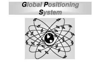
FOT 2213 Applications of GPS/GIS in Forestry Global Positioning System Prepared by the Eddie L. Moore Itawamba Community College
Where on Earth am I? Have you ever asked yourself this question when you were in unfamiliar surroundings?
Technology to the Rescue • One of the most exciting technologies to evolve in the past decade is now available practically to everyone. • More and more people and businesses are using this technology for a variety of applications. • What is this technology called?
G P S Global Positioning System
What is GPS? • GPS is a satellite navigation system that allows a properly equipped user to determine his or her exact position on the earth anytime, in any weather, and in most any location. • The GPS satellites are operated and maintained by the United States Department of Defense. • NAVSTAR is the official U.S. Department of Defense name for GPS.
GPS –A New Constellation • GPS is the most significant recent advance in navigation and positioning technology. In the past, the stars were used for navigation. Today's world requires greater accuracy. The new constellation of artificial stars provided by the GPS serves this important need. • GPS is an aerospace technology that uses satellites and ground equipment to determine position anywhere on Earth. Anyone with a small receiver can use the system at no cost. GPS has drastically changed methods of navigation and is fast becoming important in everyday life.
The GPS Revolution • During the 1960s the military worked on a number of navigation systems for a variety of applications. • In 1973 the Department of Defense directed the services to unify their systems. • The basis for the new system would be atomic clocks carried on satellites. • The Air Force would operate the new system called the Navstar Global Positioning System. • It has since become known simply as GPS.
GPS Goes Public • GPS was designed so that civilian users could not obtain the same accuracy that the military could.Nevertheless, civilian use was also intended from the start. • In 1983, President Ronald Reagan issued a directive that guaranteed GPS signals would be available at no charge to the world. • That directive helped open up a commercial market.
GPS Public Awareness • Deployment of GPS continued at a steady pace through the 1990s. • GPS burst into public awareness during the Persian Gulf War in 1991. • GPS was used extensively during that conflict, so much so that not enough military-equipped GPS receivers were available. • To satisfy demand, the Department of Defense acquired civilian GPS units and temporarily changed GPS transmissions to give civilian receivers access to higher-accuracy military signals.
GPS History and Facts • First satellite launched in 1978. • Initial operational capability Dec. 8, 1993 • Full constellation of 24 satellites was achieved in 1994. Fully operational April 27, 1995. • Each satellite is built to last about 10 years. • Transmitter power is only 50 watts or less.
Advantages of GPS • Operates in all weather. • Available 24 hours a day. • Available anywhere on earth. • No subscription or set-up fees.
Who Uses GPS? • GPS has a variety of applications on land, at sea and in the air. • GPS allows you to record or create locations for places on the earth and help you navigate to and from those spots. • Airborne applications include navigation by private and commercial aircraft. • On the water, GPS is used for navigation by boaters and fishing enthusiasts.
Land Based Applications • GPS has become popular with hunters, hikers, bikers, cross-country skiers, etc. • Delivery trucks can receive GPS signals and instantly transmit their position to a central dispatcher. • Police and emergency services use GPS to dispatch vehicles with reduced response time. • Foresters and surveyors use GPS for an ever increasing portion of their work.
GPS in Education • GPS Technology is becoming more widely use in a variety of educational programs. • The latest editions of Forestry, Surveying, Geography and other textbooks have added sections and/or chapters devoted to GPS Technology and related applications. • GPS courses of study have been added to program curriculum. • GPS textbooks are being published.
GPS Segments The Global Positioning System is made up of three segments: • Space Segment • Control Segment • User Segment
Space Segment Consists of the GPS satellites (space vehicles) which send radio signals from space. • The GPS constellation consists of 24 satellites that orbit the earth in 12 hours. • There are six orbital planes with four satellites in each plane. • The constellation provides the user with 5 to 8 visible satellites from any point on earth. • The satellites send orbital data to GPS receivers via radio signals.
Space Segment Satellite
Control Segment Consists of a system of tracking stations located around the world. • The Master Control facility is located at Schriever (Falcon) Air Force Base in Colorado. • These control stations monitor data from the satellites to compute precise orbital data and clock corrections for each satellite. • The Master Control station uploads corrected orbital and clock data to the satellites.
User Segment Consists of the GPS receivers and the user community. • GPS receivers convert satellite signals into position, velocity, and time estimates. • Four satellites are required to compute the four dimensions of X,Y, Z (position) and Time. • GPS receivers are used for navigation, positioning, and other research.
GPS Receiver A specialized electronic device with the ability to determine the user’s position on earth by processing signals received from satellites orbiting the earth.
How Does GPS Work? • Global Positioning System satellites transmit signals to equipment on the ground. • Each GPS satellite transmits data that indicates its location and the current time. • Distance from GPS receiver to the each satellite is determined by estimating the amount of time it takes for the signal to reach the receiver. • When the receiver estimates the distance to at least four GPS satellites, it can calculate its position in three dimensions by a process known as trilateration.
The GPS Receiver’s Job • Locate 4 or more satellites. • Calculate the distance to each. • Use this information to determine it’s own location. • This process is ‘Trilateration’.
Indicating Position A GPS unit will normally indicate the user’s 3D position using the World Geographic Grid and will indicate the latitude, longitude and altitude(LLA). In addition to LLA many GPS units can be setup to indicate the position in other grid systems including Universal Transverse Mercator (UTM) and State Plane Coordinates (SPC).
Accuracy of GPS • GPS receivers are extremely accurate due to their parallel multi-channel design. • GPS receivers, on average, are usually accurate to within 15 meters. • GPS receivers equipped with the Wide Area Augmentation System (WAAS) can improve accuracy to within 3 meters on average. • Differential GPS corrects GPS signals to an accuracy to an average of 3 to 5 meters.
Sources of Position Errors • Atmospheric signal delay. • Signal multi-path. • Receiver clock errors. • Orbital errors. • Number of satellites visible. • Satellite geometry. • Selective Availability (this intentional degradation of the satellite signal by the U.S. military was made inactive in May 2000).
Reduction of GPS Signal Errors GPS data can be differentially corrected to remove many of the errors and improve accuracy. These corrections can be done in real time or by post processing on a computer using PC GPS software. In both cases data in obtained from a GPS reference station at a known location. Knowing the exact location the reference station can determine the errors in the satellite signal. This error data is applied to the GPS receiver data to correct many of the errors and improve accuracy.
Satellite Geometry The satellites continuously orbit the earth and therefore their orientation in relation to the GPS receiver in always changing. Therefore, a major factor in determining GPS positional accuracy is the geometry (or spread) of the group of satellites (constellation) from which signals are being received.
Dilution of Precision (DOP) The geometry of the constellation is evaluated for several factors, all of which fall into the category of Dilution of Precision or DOP. DOP is an indicator of the quality of the geometry of the satellite constellation. A lower DOP value indicates a better signal and accuracy.
Good satellite geometry. Greater angles/better spread between satellites. Lowers the DOP and provides a better signal. Satellite Spread
Poor satellite geometry Smaller angles/poorer spread between satellites. Increased DOP and inferior measurement configuration. Satellite Spread
GPS Applications:An Instructional Technology • Forestry • Agriculture • Geography • Surveying • Environment • Natural Resources
GPS Forestry Instruction • GPS units are is being used for instruction and application in the following Forestry classes at Itawamba Community College. • Applications of GPS/GIS in Forestry • Forest Measurements II • Silviculture I • Timber Harvesting
The Forestry classes at ICC use the Corvallis Microtechnology, Inc. March II E GPS
GPS Forestry Applications • The GPS units and PC-GPS software are used to collect and process data for a number of Forestry applications including: • Navigation. • Field acreage determination. • Road, boundary and geographic point layout. • Mapping tracts of timber and other land areas. • Georeferencing GPS data on aerial photos.
ICC Forestry Students Preparing GPS Units for Data Collection
Military Use of GPS More than 9,000 GPS receivers were used by U.S. and coalition forces during Operation Desert Storm.
PROJECT 2005 CONGRESSIONAL MANDATE "LIMITATION ON PROCUREMENT OF SYSTEMS NOT GPS-EQUIPPED: After September 30, 2005, funds may not be obligated to modify or procure any Department of Defense aircraft, ship, armored vehicle, or indirect-fire weapon system that is not equipped with a Global Positioning System receiver."
Land Management GPS and Agriculture GPS receivers installed in farm equipment provide accurate position information. This enables farmers to apply fertilizers and harvest crops with great precision.
Land Management Crop Yield Map Maps of crop yield can be made using agricultural GPS systems. The map shown here indicates how crop yield varies across a field. These maps can be created during harvesting, allowing farmers to accurately plan how the fields should be used and fertilized for future crops.