Download
1 / 30
300 likes | 459 Views
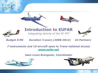
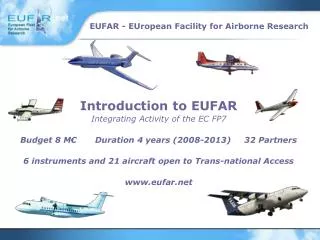
Introduction to EUFAR Integrating Activity of the EC FP7 Budget 8 M € Duration 4 years (2008-2013) 32 Partners 6 instruments and 21 aircraft open to Trans-national Access www.eufar.net. Jülich (DE) ULEI (DE) STFC (UK) USZ (HU) UCAM-DCHEM (UK) UWAR (PL) COSINE (NL) IRSN (FR)

E N D
Introduction to EUFAR Integrating Activity of the EC FP7 Budget 8 M€ Duration 4 years (2008-2013) 32 Partners 6 instruments and 21 aircraft open to Trans-national Access www.eufar.net
Jülich (DE) • ULEI (DE) • STFC (UK) • USZ (HU) • UCAM-DCHEM (UK) • UWAR (PL) • COSINE (NL) • IRSN (FR) • COMAT (FR) • VKI (BE) • UZH (CH) • WU (NL) • USBE (CZ) • TAU (IL) • GFZ (DE) • PML (UK) • PTB (DE) • ONERA (FR) • Météo-France (FR) Coordinator • MetOffice (UK) • DLR (DE) • NLR (NL) • Enviscope (DE) • CNRS (FR) • NERC (UK) • INTA (ES) • FUB (DE) • KIT (DE) • AWI (DE) • CNR (IT) • UNIMAN (UK) • VITO (BE) 14 aircraft or instruments operators and 18 experts in airborne measurements EUFAR Consortium
Long Term Objectives To lay the groundwork of a European distributed infrastructure for airborne research in environmental and geo-sciences … … for each European scientist to get access at "equal terms" to the airborne facility the most suited to his scientific objectives, irrespective of his origin and of where the facility is operated.
Long Term Objectives • EUFAR acts as an interface between aircraft and instruments operators, scientific users and funding institutions, to facilitate the evolution from the existing patchwork of national organisations toward a European distributed infrastructure for airborne research.
Expected Impact • Better service to the users: • The most complete fleet, easy access, strong scientific and technical support • Improved aircraft performance: • Range, ceiling, payload, cost • Reduced duplication • Optimized operation (200 - 600 flight hours/year) • Stronger expertise in airborne instrumentation
Research Funding Institutions Experts in Airborne Instrumentation Future of the Fleet Expert WGs Network of Aircraft Operators Sustainable Structure Standards and Protocols Scientific Advisory Committee Trans-national Access Education & Training Data Base EUFAR Web site Scientific Users EUFAR Activities
Networking Activities – 2 M€ N1.Scientific Advisory Committee (N1SAC-CNRM) N2.Transnational Access coordination (N2TAC-MetOffice) N3.Future of the Fleet (N3FF-Jülich) N4.Expert Working Groups (N4EWG-ULEI) N5.Education and Training (N5ET-VITO) N6. Standards and Protocols (N6SP-DLR) N7.Airborne Data Base (N7DB-STFC) N8. E-Communication (N8EC-CNRM) N9.Sustainable structure (N9SST-CNRM) • Transnational Activities (TA) – 3 M€ • Joint Research Activities (JRA) – 2,4 M€ JRA1. Development and evaluation of new and improved hygrometers for airborne research (DENCHAR-Jülich) JRA2. Quality layers for airborne hyperspectral imagery and data products (HYQUAPRO-VITO) JRA3. Airborne Laser Interferometric Drop Sizer (ALIDS-IRSN) EUFAR Activities
N1SAC – Scientific Advisory Committee • The Scientific Advisory Committee is constituted of about 12 members, with broad scientific background and experience, geographical representation and gender balance • Objectives: To provide the EUFAR Consortium with independent strategic recommendations on EUFAR objectives and long term developments (based on EUFAR accomplishments, difficulties encountered, statistics on the activities of the infrastructures and on their scientific impact)
N2TAC – Trans-national Access Coordination • Objectives: To implement EUFAR Trans-national Access activities in a coordinated way • Designation of the members of the selection panel, implementation of the selection criteria and review procedures • 6 instruments and 21 aircraft open to TA • Support planned for 64 projects: 215 users and 537 flight hours • EUFAR FP6 Achievements: • 74 proposals received • Support allocated to 46 projects: 230 users and 412 flight hours
N3FF – Future of the Fleet • Objectives: • To evaluate the performance of the existing fleet and identify gaps • The availability of a stratospheric aircraft in Europe has already been selected as a priority for the development of the fleet • To provide solutions for the long-term development of the fleet • EUFAR FP6 Achievements: • Launch of the COPAL EC Preparatory Phase project for the construction of a heavy-payload and long-endurance aircraft for multidisciplinary research in the middle and lower troposphere
N4EWG – Expert Working Groups • Objectives: • To compile the knowledge in a high-level handbook on “Airborne Physical Measurements – Methods and Instruments” (state-of-the-art in airborne physical measurement principles and techniques) • To improve the expertise among the specialized scientists in 18 fields of airborne research by organizing experts workshops • To facilitate the transfer of expert knowledge to users, operators, and funding agencies • EUFAR FP6 Achievements: • 12 Expert Working Groups • 13 Expert Workshops organized
N4EWG – Expert Working Groups • List of Expert Working Groups: • Support to airborne measurements: • Certification/Operation • Instrument Integration • Data Processing • Imaging sensors • Cal/Val • Unmanned Aerial Systems • Specific measurement fields: • In-Situ Aerosols • Gas Phase Chemistry • Cloud Microphysics • Radiation • Solid-Earth Geophysics • Thermodynamics • Turbulence • Stratospheric Research • Polar Research • Active Remote Sensing • Hyperspectral Applications for Soil • Hyperspectral Applications for Vegetation • Hyperspectral Applications for Water
N5ET – Education and Training • Objectives: To promote airborne research in the European academic community • To educate and train (theoretically and practically) new early-stage researchers in airborne atmospheric research and airborne hyperspectral remote sensing • To train trainers (e.g. university lecturers) in airborne atmospheric research and airborne hyperspectral remote sensing • 3 opportunities: • Training courses on airborne research • Invited access to existing campaigns • Participation in the design of a new field campaign. Tutoring by experienced scientists • EUFAR FP6 Achievements: • 30 young scientists invited to field experiments (out of 48 applications) • 2 training courses on airborne measurements organised: • Boundary-layer research with airborne instruments (Romania, July 2007): 40 candidates, 27 selected • Airborne cloud and aerosol science (The Netherlands, April 2008): 53 candidates, 20 selected
N6SP – Standards and Protocols • Objectives: • To develop common protocols for airborne hyperspectral remote sensing (compilation, harmonisation and improvement of existing protocols in compliance with existing standards) • To support users and operators with recommendations on best practice and state-of-the-art software for airborne data pre-processing • To develop and publish open source software toolboxes for higher level data products, and data analysis • To define standards for data transfer in real-time
N7DB – Data Base • Objectives: • To provide a centralised gateway to data acquired onboard aircraft (both in situ and remote sensed) along with supporting metadata, collected by the aircraft of the EUFAR Fleet. A data archive and web interface will be set up. This will include providing well documented, centralised access to distributed archives and a secure accessible archive for remaining offline data. Support will be given to data providers to attain community-agreed standard data formats. Once established this service will provide the capacity for “one-stop-shop” access to EUFAR data and will be of benefit to both project partners and the wider scientific community alike.
N8EC – E_Communication • Objectives: To elaborate solutions on Internet for the dissemination of the EUFAR information, for facilitating the electronic submission of trans-national access proposals and their evaluation, and for providing all EUFAR working groups with a secured domain for collaborative activities • EUFAR WEB Front Office: • Information about aircraft, instruments, expert working groups, etc • EUFAR WEB Back Office: • Online evaluation of TA proposals • Documents sharing
N8EC – E_Communication • www.eufar.net: a unique portal for all European airborne activities • 1000 scientists registered
N9SST – Sustainable Structure • Objectives: Todevelop a framework for a sustainable EUFAR structure by: • Evaluating possible models of legal structure for a joint management of the network • Promoting the extension of trans-national access beyond Community support (Equal Terms Trans-national Access) • Compiling information on the activities of the fleet and their scientific impact to support strategic decisions • Developing coordination with the COPAL Preparatory Phase study and the international community of research aircraft operators
JRA1 - Development and evaluation of new and improved hygrometers for airborne research(DENCHAR) • Objectives: Development and characterisation of novel or improved compact airborne hygrometers for different airborne applications within EUFAR; including investigation of the sampling characteristics of different gas/ice inlets and the development of an improved ultra fast thermometer for near- and in-cloud measurements
JRA2 - Quality layers for airbornehyperspectral imagery and data products(HYQUAPRO) • Objectives: • To develop quality indicators and quality layers for airborne hyperspectral imagery • To develop quality indicators and quality layers for higher level data products • To implement and to test quality layers in existing processing chains of airborne hyperspectral imagery • To develop higher performing water and soil algorithms as demonstrators for end-to-end processing chains with harmonized quality measures
JRA3 - Airborne Laser Interferometric Drop Sizer (ALIDS) • Objectives: To design and construct an airborne drop spectrometer based on a new principle, that provides absolute measurements of the drop size and a large sampling section.
JRA - EUFAR FP6 Achievements • EUFAR FP6 Achievements: design and construction of two airborne pods for measurements of physical and optical aerosol properties: • Unique standard for airborne measurements, • Usable on more than 50% of the EUFAR Fleet.
End 5th EUFAR FP7-EUROSPEC Training Course On "Regional Experiments For Land-Atmosphere EXchanges (REFLEX)“ with INTA C-212-200 RS