Download
1 / 17
180 likes | 421 Views
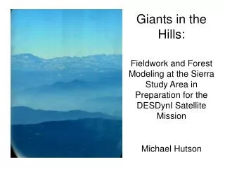
Giants in the Hills: Fieldwork and Forest Modeling at the Sierra Study Area in Preparation for the DESDynI Satellite Mission Michael Hutson. Terrestrial Ecosystems & The Carbon Cycle. http://www.nasa.gov/centers/langley/news/researchernews/rn_carboncycle.html. Cumulative Intensity. 0. 1.0.

E N D
Giants in the Hills:Fieldwork and Forest Modeling at the Sierra Study Area in Preparation for the DESDynI Satellite MissionMichael Hutson
Terrestrial Ecosystems & The Carbon Cycle http://www.nasa.gov/centers/langley/news/researchernews/rn_carboncycle.html
Cumulative Intensity 0 1.0 40 8 km Height (m) 1 km 0 0 100 Intensity 25 m Measuring Terrestrial Ecosystems • LVIS (Aircraft) • ICESat • DESDynI Hurtt et al 2008
Ecosystem Demography Plant Physiology Individual Vital Rates Stand-Level Structure and Fluxes Regional-Scale Ecosystem Structure and Fluxes Ecosystem Biogeochemistry Disturbance and Land Use Change Ecosystem Physiology Height-Structured Ecosystem Model (ED) Hurtt et al 2008 Models 3-D vegetation structure, carbon stocks & fluxes
Earlier Work with ED • Study of biotic & abiotic heterogeneity at Hubbard Brook Experimental Forest in central NH • Updated allometry, ran ED for different elevation bands • Results: accurately predicted biomass stocks, C flux estimates, identified correct reasons • “Fine-scale heterogeneity has important implications on the spatial resolution of LIDAR collection and model simulation” Thomas 2007, Thomas et al in press
The Sierra Field Site:A More Extreme Example Importance of fine-scale climate data: • Local climate greatly influenced by topography • Trees very sensitive to moisture levels Location: Central California End-to-end: approx. 30km Elevation Range: 1215-2454m
Summer 2008 Objectives • Overall: Develop modeling capabilities for vegetation structure in Sierra study site • Three components: • help collect new data on vegetation structure • assess need for climate data, find if necessary • preliminary run of ED model, suggestions for future development
The Field Campaign Crew: Boston University, University of Maryland Objectives: ground-based measurements to develop & validate remote sensing metrics of vegetation structure Selection of sites: pre-existing, within 100m of road, accessible to ECHIDNA team Measurements taken subplots: DBH over 10cm, species ID, heights of crown-forming trees, estimated heights of dead snags center plots: all of above, plus crown height & width, distance & bearing from center, and heights for every tree
= LVIS = ED ED vs. LVIS: Tree Height LVIS study area canopy heights (2006)
= LVIS = ED ED vs. LVIS: Biomass LVIS
/ED Different Species,Different Allometries • Halliwell, D. H. and M. J. Apps.1997. Boreal Ecosystem-Atmosphere Study (BOREAS) biometry and auxiliary sites: overstory and understory data. Canadian Forest Service Report • DESDynI field crew – unpublished data
Different Species,Different Allometries http://www.fs.fed.us/ne/newtown_square/publications/technical_reports/pdfs/2004/ne_gtr319.pdf
Next Steps to Refine & Test ED • Update plant functional types to include firs & sequoias • new allometric data • wood density • leaf traits (longevity, specific leaf area) • Integrate fine scale climate & soil variability • Obtain high-resolution data • Incorporate • dropping ED resolution vs. tracking sub-gridscale • Reincorporate fire module • Assess need • Revise as necessary • Validate results • Comparison to field data • Comparison to repeat LIDAR data
NASA Relevance NASA Science Questions • How is the global Earth system changing? • What are the primary causes of change in the Earth system? • How does the Earth system respond to natural and human-induced changes? • How will the Earth system change in the future? NASA Research Objective • Quantify global land cover change and terrestrial and marine productivity, and improve carbon cycle and ecosystem models. NASA Strategic Goal • To study planet Earth from space to advance scientific understanding and meet societal needs ROSES 2008
Thanks to… George Hurtt, UNH Justin Fisk, UNH Ralph Dubayah, UMD Research & Discover @ UNH …and many more!
References Bartholome, E., and A. S. Belward. "GLC2000: a new approach to global land cover mapping from Earth observation data." International Journal of Remote Sensing 26 (2005): 1959-977. Coops, Nicholas C., Richard H. Waring, and Beverly E. Law. "Assessing the past and future distribution and productivity of ponderosa pine in the Pacific Northwest using a process model, 3-PG." Ecological Modeling 183 (2005): 107-24. DESDynI. 5 Aug. 2008 <http://desdyni.jpl.nasa.gov/>. DESDynI field crew – unpublished data Dixon, R. K, et al. "Carbon Pools and Flux of Global Forest Ecosystems." Science 263 (1994): 185-90. Dulitz, David J. "Growth and Yield of Giant Sequoia." Proceedings of the workshop on management of giant sequoia (1986): 14-16. Friedl, M. A. "Global land cover mapping from MODIS: algorithms and early results." Remote Sensing of Environment 83 (2002): 287-302. Halliwell, D. H. and M. J. Apps.1997. Boreal Ecosystem-Atmosphere Study (BOREAS) biometry and auxiliary sites: overstory and understory data. Canadian Forest Service Report. Hansen, M. C., and B. Reed. "A comparison of the IGBP DISCover and University of Maryland 1 km global land cover products." International Journal of Remote Sensing 21 (2000): 1365-373. Hubbard Brook Ecosystem Study. 5 Aug. 2008 <http://www.hubbardbrook.org/index.html>. Hurtt, George C, et al. "ED & LIDAR." 5 Aug. 2008. Jenkins, Jennifer C., David C. Chojnacky, Linda S. Heath, and Richard A. Birdsey. Comprehensive Database of Diameter-based Biomass Regressions for North American Tree Species. Rep.No. NE-319. Northeastern Research Station, USDA Forest Service. 5 Aug. 2008 <http://www.fs.fed.us/ne/newtown_square/publications/technical_reports/pdfs/2004/ne_gtr319.pdf>. Kilgore, Bruce M., and Dan Taylor. "Fire History of a Sequoia-Mixed Conifer Forest." Ecology 60 (1979): 129-42. Lorentz, Katie. "Humans and the Global Carbon Cycle: A Faustian Bargain?" NASA Researcher News. 12 Apr. 2007. 5 Aug. 2008 <http://www.nasa.gov/centers/langley/news/researchernews/rn_carboncycle.html>. Mayaux, Philippe, Etienne Bartholome, Steffen Fritz, and Alan Belward. "A new land-cover map of Africa for the year 2000." Journal of Biogeography 31 (2004): 861-77. Mayaux, Philippe, Frederic Achard, and Jean-Paul Malingreau. "Global tropical forest area measurements derived from coarse resolution satellite imagery: a comparison with other approaches." Environmental Conservation 25 (1998): 37-52. Research Opportunities in Space and Earth Sciences (ROSES) - 2005. NASA. Science Mission Directorate. Washington, D.C., 2005. Research Opportunities in Space and Earth Sciences (ROSES) - 2008. NASA. Science Mission Directorate. Washington, D.C., 2008. Thomas, R. Q. "Consequences of Fine-Scale Heterogeneity for Predictions of the Carbon Cycle Using Lidar Data and a Height-Structured Ecosystem Model." Research & Discover. 5 Aug. 2008 <http://www.eos.unh.edu/researchanddiscover/fellows_05_07.shtml>. Thomas, R. Q., G. C. Hurtt, R. Dubayah, and M. H. Schilz. "Using lidar data and a height-structured ecosystem model to estimate forest carbon stocks and fluxes over complex mountainous terrain." Canadian Journal of Remote Sensing (In press). Weatherspoon, Phillip C. "Silvics of Giant Sequoia." Proceedings of the workshop on management of giant sequoia (1986): 4-10.