Download
1 / 19
190 likes | 431 Views
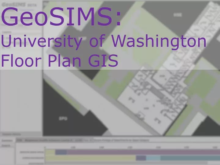
GeoSIMS: University of Washington Floor Plan GIS. Why GIS for Floor Plans?. Space is a resource : Governmental & institutional requirements for records, reporting, analysis and planning Efficient management of space After our people, space is our most valuable asset.

E N D
GeoSIMS: University of Washington Floor Plan GIS
Why GIS for Floor Plans? Space is a resource: Governmental & institutional requirements for records, reporting, analysis and planning Efficient management of space After our people, space is our most valuable asset
Floor Plan Geometry What does this mean for the UW Data? ~700 Buildings, >300 with floor plans ~1,600 Floors (a single CAD floor plan for each) > 66,000 rooms > 21,000,000 square feet of space
What is Being Revised Map Interface Web Application (SIMSGeoSIMS) Stand-Alone Data Interface (SIMSGeoSIMS) Reports (SIMSDSS) Database Tweaks (For the most part, not visible to SIMS users)
Geometry Requirements In developing the floor plan GIS, we had these needs: CAD will be the source for GIS Must maintain CAD and GIS geometry simultaneously (Generally, engineers and architects wanted CAD, planners wanted GIS) Geometry is the source for room #s and square feet Each data theme (Rooms, GSF, Lines) will have all buildings in a single layer (for queries)
Questions? Jeffrey Linn jefflinn@uw.edu Eric Darst ejdarst@uw.edu http://www.washington.edu/admin/pb/home/