Download
1 / 23
230 likes | 335 Views
Islamic Republic of Mauritania. Facts and Figures. Total Surface Area: 1 025 520 km 2 Estimated Population in 2006: 3 158 000. The eye of Mauritania, thought to have been caused by uplifted sedimentary rock layers sculpted by erosion, is nearly 50 kilometres across.

E N D
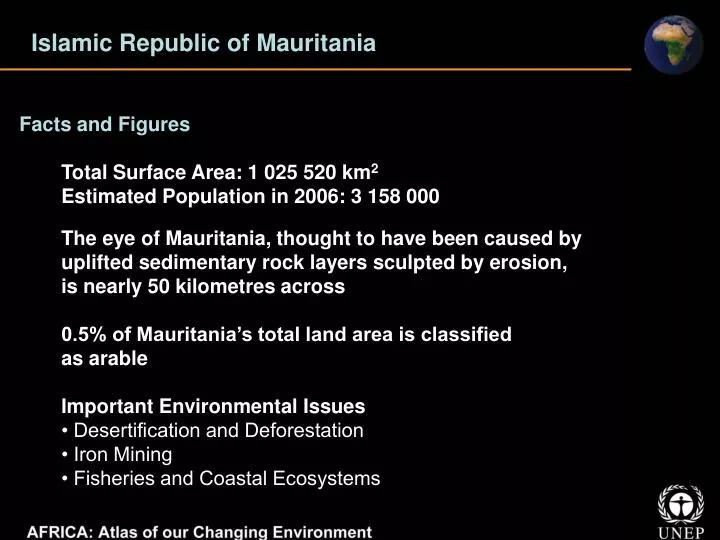
Islamic Republic of Mauritania Facts and Figures Total Surface Area: 1 025 520 km2 Estimated Population in 2006: 3 158 000 The eye of Mauritania, thought to have been caused by uplifted sedimentary rock layers sculpted by erosion, is nearly 50 kilometres across 0.5% of Mauritania’s total land area is classified as arable Important Environmental Issues • Desertification and Deforestation • Iron Mining • Fisheries and Coastal Ecosystems
Islamic Republic of Mauritania Wetlands around Diawling National Park Drought had already begun to impact the wetlands before construction of the dams in the 1980s (1979 image) The construction of the Diama Dam in 1986 (yellow arrow) disrupted the cycle of flooding and evaporation in the Senegal River delta wetlands The 2006 image shows the restored wetlands in and around Diawling National Park
Islamic Republic of Mauritania Along the Rosso-Nouakchott Highway North of the border between Mauritania and Senegal, National Highway 2 connects Nouakchott with Rosso In the 1972 image, bright reflection from the sandy soils surrounding the highway is mixed with some vegetation (shades of green) In the 1990 image, the path of the highway shows as a bright yellow corridor from northwest to southeast through El Haedi The 2006 image shows the same pattern of vegetation loss along the highway
Republic of Mauritius Facts and Figures Total Surface Area: 2 040 km2 Estimated Population in 2006: 1 256 000 Population of the Echo Parakeet (Psittacula eques), found in Black River Gorges National Park, increased from 10 in the 1980s to over 320 in 2000 Important Environmental Issues • Coastal Water Pollution • Threats to Biodiversity
Republic of Rwanda Threatened Coral Reefs in Mauritius In these satellite images, coral reefs (yellow arrows) form a fringe along the island’s shores and create shallow lagoons that are extremely important to the fishing and tourist industries Coral reefs almost surround Mauritius, these are complex ecosystems, rich in biodiversity yet only able to survive in very clear, warm and nutrient-poor ocean waters
Kingdom of Morocco Facts and Figures Total Surface Area: 446 550 km2 Estimated Population in 2006: 31 943 000 The oil-yielding Argan tree (Argania spinosa) is unique to Morocco and grows only in the Souss Valley of the southwest Percentage of the country’s fresh water used for agricultural production 90% Important Environmental Issues • Drought and Desertification • Water Scarcity • Pollution
Kingdom of Morocco The Sustainability of Al Wahda Dam Al Wahda Dam is the second-largest dam in Africa and the largest in Morocco The 1987 image shows the area before the dam was built in 1996 More recently natural and human-caused erosion is filling the dam with silt and is threatening its long term sustainability
Kingdom of Morocco Greenhouse Agriculture: Souss-Massa Valley In the 1970’s greenhouse agriculture was introduced to the area The 1988 satellite image shows a few greenhouses (light blue squares) scattered throughout the valley The 2003 image shows the expansion that has occurred in greenhouse agriculture, with greenhouses (white squares) covering a substantial portion of the valley’s agricultural land
Republic of Mozambique Facts and Figures Total Surface Area: 801 590 km2 Estimated Population in 2006: 20 158 000 Mozambique has roughly 5 000 km2 of mangroves along its coast, the most of any country along Africa’s Indian Ocean shoreline 5 087 865 reported malaria cases in Mozambique in 2003 Important Environmental Issues • Water Access and Natural Disasters • Land Use • Protecting Wildlife and Forests
Republic of Mozambique Cahora Bassa Dam in Zambezi River The 1972 image shows a 250-km stretch of the Zambezi River prior to the construction of the Cahora Bassa Dam The 2006 image shows the current extent of the reservoir
Republic of Mozambique Fire Scars in Beira The 21 May 2006 satellite image was acquired at the beginning of the 2006 dry season, before many fires had left their mark Especially large number of fires was recorded in August 2006 The 9 August 2006 image shows the same area roughly 2.5 months later - pink, dark red, and black fire scars cover much of the landscape
Republic of Namibia Facts and Figures Total Surface Area: 824 292 km2 Estimated Population in 2006: 2 052 000 At 55 million years, Namib in Namibia is the world’s oldest desert Length of Namibia’s ”Fish River” the largest canyon in Africa is 160 km • Important Environmental Issues • Land Degradation and Desertification • Aridity and Water Scarcity • Threats to Biodiversity
Republic of Namibia Kavango Region The Kavango Region, located in Namibia’s relatively wet northeastern corner, is part of the 8% of the country that receives about 500 mm of rain per year—the minimum considered necessary for non-irrigated agriculture These images, from 1973 and 2007, show the dramatic increase in the land area cleared for agriculture (light yellow patches) around Rundu and elsewhere along the river
Republic of Namibia Walvis Bay Salt Production and Wetlands Walvis Bay’s solar evaporation facilities process 24 million metric tonnes of seawater each year - producing more than 400 000 metric tonnes of high-quality salt In 1973 the salt evaporation ponds were still relatively small (red and blue rectangles in the centre of the image) By 2005 they had grown to cover 3 500 hectares in the lagoon
Republic of Niger Facts and Figures Total Surface Area: 1 267 000km2 Estimated Population in 2006: 14 426 000 Niger is one of the hottest countries in the world, with four-fifths of its territory lying in the Sahara desert Percentage of Niger’s labour force employed in agriculture 90% Important Environmental Issues • Desertification and Deforestation • Threats to Wildlife • Environmental Consequences of Mining
Republic of Niger Forest Degradation in Baban Rafi Forest Baban Rafi Forest is the most significant area of woodland in the Maradi Department These satellite images show the loss of a significant fraction of the natural landscape (darker green areas) of Baban Rafi Forest to agriculture between 1976 and 2007
Republic of Niger Revitalised Land: Tahoua Province In recent decades, Niger’s climate and its demographic problems have negatively impacted its agricultural land by forcing agriculture onto land that had been historically used for livestock Intense pressure on fragile lands led to acute environmental degradation (1975 image) A recent study revealed 10 to 20 times the number of trees across three of Niger’s southern provinces than there were in the 1970s (2005 image)
Federal Republic of Nigeria Facts and Figures Total Surface Area: 923 768 km2 Estimated Population in 2006: 134 375 000 Nigeria is the largest producer of oil in Africa and the eleventh largest producer of crude oil in the world Nigeria’s arable land as a proportion of the total land area is 33% Important Environmental Issues • Desertification • Deforestation and Threats to Biodiversity • Oil Pollution
Federal Republic of Nigeria Impacts of Challawa Dam The Challawa Dam in Kano State, Nigeria, was built to control flooding caused by seasonal and variable rainfall and to support irrigation The Challawa Dam has tamed highly seasonal downstream flooding at the expense of the Hadejia-Nguru wetlands
Federal Republic of Nigeria Oil Development in the Niger River Delta Currently, about 66 gas fields and over 500 oil wells are located in the delta area The 1984 image shows the delta 20 years after oil operations began in the early 1960s Between 1976 and 1996 there were more than 4 640 oil spills totaling three million barrels of oil The 2003 image shows concentrations of oil wells (small yellow arrows), pipelines connecting them and storage facilities (large yellow arrow)
Republic of Rwanda Facts and Figures Total Surface Area: 26 338 km2 Estimated Population in 2006: 9 230 000 Rwanda’s Nyungwe National Park is the largest block of montane forest in East and Central Africa, and among the largest on the continent. In 2007, Rwanda had the highest population density in mainland Africa at 394 people per km2 Important Environmental Issues • Population Pressure on Land • Soil Erosion and Sedimentation • Deforestation and Threats to Biodiversity
Republic of Rwanda Fire Scars: Akagera National Park Fire is common in the savannah portions of the park Images from July 1980 and June 1984 show the area surrounding Akagera National Park with large fire scars (dark purple patches) 1999 image shows the regional during rainy seasons when fires occur infrequently In contrast 2004 images has fire scars as fires that year burned nearly one-third of the park
Republic of Rwanda Dramatic Deforestation: Gishwati Forest The 1978 satellite image shows the Gishwati Forest Reserve as a dark-green carpet of dense forest nearly covering the entire protected area The 2006 image shows that most of the forest has been cleared Only a fraction of the forest that was intact in 1978 remains (in degraded condition)