Download
1 / 36
360 likes | 484 Views
Gulf Surges, the Diurnal Cycle, and Convective Outflows as Revealed by the NCAR ISSs in NAME. Richard H. Johnson, Peter J. Rogers, Paul E. Ciesielski, Brian D. McNoldy, and Richard K. Taft. Colorado State University.

E N D
Gulf Surges, the Diurnal Cycle, and Convective Outflows as Revealed by the NCAR ISSs in NAME Richard H. Johnson, Peter J. Rogers, Paul E. Ciesielski, Brian D. McNoldy, and Richard K. Taft Colorado State University Acknowledgments: NSF, NOAA, NCAR ATD staff, and numerous students who worked at ISS sites
NCAR Integrated Sounding System (ISS) • Vaisala GPS sounding system • Enhanced surface observing station • 915 MHz Doppler clear-air wind profiling radar • Radio Acoustic Sounding System (RASS) • 3 ISSs used in NAME • 1 GLASS sounding system ISS Trailer, Los Mochis
3 ISSs 1 GLASS PUERTO PEÑASCO BAHIA KINO LOS MOCHIS LORETO NAME SOUNDING NETWORK
Moisture surges and tropical waves, cyclones PRECIPITABLE WATER (105-115°W) N GULF S2(IOP3) S1 (IOP2) (IOP10) HURR JAVIER HURR HOWARD TS GEORGETTE TS BLAS HURR FRANK TS AGATHA HURR DARBY HURR ISIS HURR CELIA May June July Aug Sep 2004 (NCEP Operational Analysis)
700-hPa V WIND (15-25°N) Easterly Waves During NAME EOP May CENTRAL GULF Jun 2004 Jul BLAS CELIA DARBY Aug FRANK GEORGETTE HOWARD ISIS Sep JAVIER
1004 L ●` YUMA Heat Low ● MAZATLAN TROPICAL STORM BLAS
13 JULY V N GULF QuikSCAT Winds S GULF HURR FRANK TS GEORGETTE TS BLAS HURR JAVIER HURR HOWARD HURR DARBY?
PUERTO PEÑASCO BAHIA KINO LOS MOCHIS BLAS 13 July 2004 0024-0824Z
SURGE MIDNIGHT NOON GUST FRONT 4-hPa rise
km 00 UTC 05 10 15 20 GUST FRONT SURGE PEAK
● BAHIA KINO ISS
SURGE MIDNIGHT NOON 3-hPa rise 7 hPa rise, but over longer period
● PUERTO PEÑASCO ISS
SURGE MIDNIGHT NOON GUST FRONTS 3.5-hPa rise
km (RASS shut down at night due to noise impact on local populace) surge
SURGE CONTINUES NEXT DAY, PEAKING AT NIGHT MIDNIGHT NOON 4-hPa additional rise
MIDNIGHT NOON PRESSURE MAXIMUM, 8 hPa INCREASE OVER 2 DAYS
Puerto Peñasco Bahia Kino Los Mochis 7-8 hPa rise Pressure rise signature progresses up the Gulf (8-10 h from Los Mochis to Puerto Peñasco) 20-25 m s-1 propagation speed! Pressure signature and speed characteristic of an internal bore or mixed Kelvin wave–bore(e.g., Ralph et al. 2000)
Altair 12/20 – 13/04Z
Puerto Peñasco 13/12 – 13/18Z
GULF-// WINDS PEAK WINDS NEAR THE SURFACE IN THE NORTH ● ● ● ● ● …PEAK WINDS ELEVATED IN THE SOUTH
COOLING ASSOCIATED WITH SURGES… ● ● ● ● ● • PRINCIPALLY CONFINED BELOW 700 hPa • LASTS FOR 3-4 DAYS • ELEVATED IN S FOR FIRST SURGE
Rain moved northward along coastal plain and into AZ with surge 24-h totals, 12-14 July
PP EOP-MEAN LOW-LEVEL WIND DIURNAL CYCLE (7 JUL – 14 AUG) Puerto Penasco UTC MIDNIGHT NOON Strong low-level jet at PP, much weaker at BK, absent at LM (Douglas 1995) BK Bahia Kino LM Sea breezes Los Mochis Weak land breezes, nocturnal offshore convection near S-Pol
S-POL RADAR 3 Aug 2004 1000-1330 UTC NOAA-ETL PROFILER
Summary and Conclusions • ISSs successfully documented many aspects of NAM along Gulf of California, including characteristics of surges • July 13 surge associated with TS BLAS, preceded by downdraft outflows from SMO convection • Pressure rises 3-4 hPa over 8-10 h period of surge, followed by additional 4 hPa rise over next 1-2 days (2-3°C surface temperature drop); initial P-rise signal moved rapidly up Gulf (20-25 m s-1) internal bore, mixed Kelvin wave-bore? (awaiting more data) • Peak surge winds on 13 July descend from 1.2 km AGL at LM and BK, to near 700 m at PP, maximum wind 20 m s-1 at Puerto Penasco; convective outflows are shallower (peak winds near 300 m)
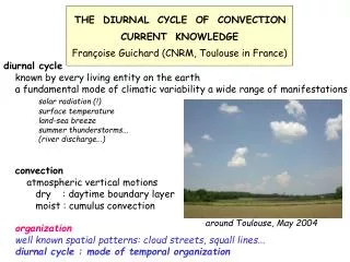
Summary and Conclusions (cont) • Surge on 13 July led to increased TPW and rainfall over southwestern US • Diurnal cycle of PBL winds varies from south to north; prominent nocturnal LLJ in north, absent in south; prominent afternoon sea breezes at BK and LM; weak land breezes at BK and LM, coastal offshore convection near S-Pol • Results are preliminary; further analysis awaits additional surface, pibal, and sounding data
(Ralph et al. 2000) (Nuss et al. 2000)