Application Issues in Great Lakes Remote Sensing
180 likes | 341 Views
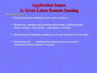
Application Issues in Great Lakes Remote Sensing. Application Areas Inventorying and monitoring fresh water resources Monitoring, modeling and predicting meteorology, hydrodynamics, climate changes, water quality, and aquatic ecosystems

Application Issues in Great Lakes Remote Sensing
E N D
Presentation Transcript
Application Issues in Great Lakes Remote Sensing Application Areas • Inventorying and monitoring fresh water resources • Monitoring, modeling and predicting meteorology, hydrodynamics, climate changes, water quality, and aquatic ecosystems • Monitoring and modeling coastal processes and wetlands of Great Lakes • Monitoring and modeling interactions between terrestrial watersheds and lake aquatic ecosystem.
Fresh Water Resources Inventorying and Monitoring Issues • Spatial extent and distributions of lakes & rivers • Seasonal and annual variability in lake water stage and volumes
Fresh Water Resources Inventorying and Monitoring Remote sensing measurements • Location, size, shape and boundaries of lake shorelines can be accurately mapped from high-resolution satellite optical & SAR imagery • SPOT (2.5-10m), IKONOS (1 m), GeoEYE (0.5 m), QuickBird (0.6 m), WorldView, etc • Radarsat, ERS, ENVISAT (25 m), etc • Nearshorelake bathymetry (water depth) from airborne bathymetric LiDAR systems and ship-board multi-beam echo sounding • SHOALS, CHARTS of JALBTCX (2-4 m) • EAARL of NASA and USGS (1-2 m) • MBES: multi-beam echosounders (2-10 m) • Lake water stage/level from radar and laser altimetry • ICESat laser altimeter • TOPEX/Poseidon, Jason-1, and ENVISAT radar altimeters
Fresh Water Resources Inventorying and Monitoring Supporting observations, models, and ideas • In situ tide gages for water stages • Automated shoreline extraction method • Water depth inversion model based on high-resolution multispectral imagery
Fresh Water Resources Inventorying and Monitoring Summary • Require better coverage of bathymetric data (5 yrs or after major storms) • Require more dense and frequent (daily) measurements on water stage/level • The Surface Water Ocean Topography (SWOT) mission will provide much better measurements on lake water stage/level.
Modeling and predicting meteorology, hydrodynamics, climate changes, water quality, and aquatic ecosystem Issues • Spatial and temporal variability in climate variables (temperature, precipitation, etc). • Lake water circulation and water physical properties (temperature , conductivity, pH, salinity, etc) • Spatial and temporal changes in lake ice extent and thickness • Spatial and temporal variations of chemical, optical and biological properties of lake water-water quality • Lake energy and water balance • Harmful Algae Blooms (HAB)
Modeling and predicting meteorology, hydrodynamics, climate changes, water quality, and aquatic ecosystem Remote sensing measurements • Precipitation data • NEXRAD, TRMM • Surface wind data • QuickSCAT • Water surface topography from radar altimeters • Lake ice thickness from time series SAR images with ice dynamic model • Radarsat, ERS, ENVISAT, etc. (30 m) • Water surface temperature from thermal infrared (TIR) channels of multi-spectral imagery • AVHRR, MODIS (1-4 km) • Landsat TM, ETM+, ASTER (60-120 m)
Modeling and predicting meteorology, hydrodynamics, climate changes, water quality, and aquatic ecosystem Remote sensing measurements • Chlorophyll/plankton/Macroalgae concentration from multispectral and hyperspectral remote sensing data, particularly from ocean color sensors • SeaWiFS, MODIS, MERIS, CZCS (1 km) • Hyperion (30 m), AVIRIS (4-20m), AISA (1-2 m), CASI, (1-2 m) etc • Landsat (30 m), ASTER (30 m), etc. • Water clarity (Secchi depth), suspended sediments, and color dissolved organic matters (CDOM) from multi-spectral and hyperspectral image data • SeaWiFS, MODIS, MERIS, CZCS • Hyperion, AVIRIS, AISA, CASI, etc • Landsat, ASTER, etc.
Modeling and predicting meteorology, hydrodynamics, climate changes, water quality, and aquatic ecosystem Supporting observations, models, and ideas • Field sampling & in situ sensor network • data buoys, NOAA meteorological and lake monitoring RECON stations; • submerged PAR sensors, thermistor chains for multi-level water temperature; • multi-parameter water quality sondes for oxidation reduction potential (ORP), total suspended solids (TSS), pH, nutrients (N, P) with ion selective electrodes (ISEs), dissolved organic matter; • fluorometer for chlorophyll concentration . • Empirical, semi-analytical, and analytical inversion models • Climate models, hydrodynamic models, water circulation models
Modeling and predicting meteorology, hydrodynamics, climate changes, water quality, and aquatic ecosystem Summary • Require higher resolution water surface temperature measurements (30-100 m) • Better spatial coverage and frequency of precipitation measurements • Better spatial coverage and frequency of ice thickness measurements • High resolution of water color sensors (30-100 m). • HyspIRI with hyperspectral infrared imager and thermal sensor and airborne hyperspectral and thermal sensors would be critical for monitoring HABs and acquiring key limnological variables and water quality parameters • Global Precipitation Measurement (GPM) missions would provide better precipitation data
Monitoring coastal processes and wetlands of Great Lakes Issues • Coastal erosion and shoreline retreat • Wetland mapping and monitoring • Lake benthic habitat mapping and monitoring • Exotic invasive species mapping and monitoring
Monitoring and modeling coastal processes and wetlands of Great Lakes Remote sensing measurements • Coastal morphological changes, and sediment redistribution from time series bathymetric and topographic LiDAR surveys • SHOALS, CHARTS of JALBTCX (2-4 m) • EAARL of NASA and USGS (1-2 m) • MBES: multi-beam echosounders (2-10 m) • Airborne terrestrial LiDAR (1-2 m) • Invasive species recognition, wetland and benthic classifications using multi-spectral and hyperspectral image data • Hyperion, AVIRIS, AISA, CASI, etc • Landsat, ASTER, SPOT, etc.
Monitoring and modeling coastal processes and wetlands of Great Lakes Supporting observations, models, and ideas • Field sampling and training data/endmember collection • Shoreline and volumetric change analysis • Image classification algorithms • Integration of hyperspectral and LiDAR data
Monitoring and modeling coastal processes and wetlands of Great Lakes Summary • Required better spatial coverage of bathymetric LiDAR measurements • Required repeat, regular bathymetric and topographical LIDAR surveys • The hyperspectral infrared data from the HyspIRI mission would provide important data sources for mapping invasive species, coastal wetlands and benthic habitats. The integration of LiDAR data and hyperspectral imagery will significantly improve the classification accuracy for wetland and benthic habitat mapping.
Modeling interactions between terrestrial watersheds and lake aquatic ecosystem. Issues • Simulate and predict the run-off, sediment, nutrient loads, point and non-point source pollutions in the watershed and their impacts on lake water quality and the health of aquatic eco-system. • Impacts of agricultural practices , industrial development, urbanization, land use changes, the construction of dams, and channelization within the watershed on the downstream lake aquatic ecosystem.
Modeling interactions between terrestrial watersheds and lake aquatic ecosystem. Remote sensing measurements • Land cover and vegetation types in the watershed from multi-spectral images • Evaporation and transpiration info derived from thermal remote sensing data • Digital terrain data from LiDAR, InSAR, and photogrammetry • Precipitation data from ground-based NEXRAD radar
Modeling interactions between terrestrial watersheds and lake aquatic ecosystem. Supporting observations, models, and ideas • Rain gage, stream gage data, NEXRAD, in situ sensors • Water samples from rivers and lakes • Watershed hydrologic model, water quality models • BASINS and HSPF, tec. • Coupling terrestrial watershed model and lake circulation models and aquatic ecosystem models
Modeling interactions between terrestrial watersheds and lake aquatic ecosystem. Summary • Require precipitation data (1 km) • Require soil moisture data (50-100 m) • Require evapotranspirationdata (50-100 m) • Require dense stream gage measurements • Require coupling watershed models with lake circulation and aqutic ecosystem models • Soil Moisture Active Passive (SMAP) and Global Precipitation Measurement (GPM) missions would provide essential soil moisture and precipitation data for modeling and predicting surface run-off and stream discharges .