Download
1 / 14
140 likes | 302 Views
Defining Airsheds for British Columbia. Prepared for EPPC Subgroup on Definition of Airsheds Draft – For Discussion Only. Airshed Management in BC. Support in BC dates back to early 1990’s

E N D
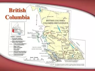
Defining Airsheds for British Columbia Prepared for EPPC Subgroup on Definition of Airsheds Draft – For Discussion Only
Airshed Management in BC • Support in BC dates back to early 1990’s • Based on realization that point sources not only major influence on local air quality, and that other agencies or stakeholders have role to play • Particularly relevant to BC given complex terrain and the large influence that local sources have on local air quality • Not used as way to manage certain source sectors but as process to manage range of point, area and mobile sources within particular geographic area • Local airsheds delineated based on location of sources, common meteorological influences and geography, local support and local authority to act
Airshed Management in BC [2] • Under Environmental Management Act: • Minister has authority to require area-based management plans (including airshed plans) • Greater Vancouver Regional District (GVRD) has delegated air management authority • Fraser Valley Regional District (FVRD) has delegated air planning authority through Order-in-Council • To-date, airshed planning in BC has been based voluntary, with plans developed for: • Metro Vancouver (GVRD) - FVRD • Whistler - Sea-to-Sky (draft) • Merritt - Okanagan (3 regional districts) • Williams Lake - Quesnel • Prince George - Bulkley Valley-Lakes District • PM management is primary focus (although ozone also concern in GVRD/FVRD, Sea-to-Sky and Okanagan)
British Columbia Emissions[Based on 2000 Emission Inventory]
British Columbia PM2.5 concentrations based on CWS metric (2004-2006)
British Columbia Ozone concentrations based on CWS metric (2004-2006)
British ColumbiaFactors influencing transport/dispersion • Trans-Pacific transport from Asia • Very complex terrain that influences local-to-regional scale dispersion of pollutants • Coastal sites: • Boundary layer meteorology • Seabreeze/landbreeze • Upslope/downslope • Summer stagnation/winter inversions • Interior sites: • Upslope/downslope • Valley effects • Capping inversions • Northeast sector: • Separated from rest of province by Rocky Mountains
British ColumbiaPreliminary Regional or Macro Airsheds • Based on consideration of source regions and influence of topography/meteorology, following regional or macro airsheds identified: • Georgia Basin • Coastal BC (excluding Georgia Basin) • Interior BC • Northeast BC
Potential Regional Airsheds NE Sector Interior BC Boundaries preliminary only Coastal BC Georgia Basin
British ColumbiaGeorgia Basin • Includes coastal areas of BC along Georgia Strait and Juan de Fuca Strait • Largest population area in province (incl. Vancouver, Victoria and Nanaimo) • Previously characterized as part of Border AQ Study • Home to several coastal pulp mills + cement plants • In Lower Fraser Valley (LFV), transportation sector (incl. marine) also large source of emissions • Includes following regional airsheds: • LFV (Metro Vancouver/FVRD) • Whistler/Sea-to-Sky Corridor
British ColumbiaCoastal BC outside of Georgia Basin • Includes west coast of Vancouver Island and north coast (including port of Prince Rupert) • Along with Georgia Basin, may comprise BC part of potential Sulfur Emission Control Area • Aluminum smelter in Kitimat also within this area
British ColumbiaInterior BC (excluding NE sector) • Area east of Coast Mtns and west of Rocky Mtns • Very complex terrain • Includes a number of local airshed management areas (e.g. Prince George, Quesnel, Williams Lake, Bulkley Valley-Lakes District and Okanagan) • Home to a number of pulp mills, OSB plants, plywood mills, a refinery, a Pb-Zn smelter and several mines • Any management approaches, including cap-and-trade programs, applied to this region will require further consideration of impacts on local airsheds
British ColumbiaNortheast BC • Comprised of area to the northeast of Rocky Mountains • Major O&G producing area of province • Major SOx emissions area • More in common with airshed containing NW Alberta than with rest of BC
Final Considerations • Need to be clear how definition of airsheds within federal regulatory framework complements or differs from existing airsheds such as identified in BC (they should be complementary) • In areas of complex terrain or with local airshed management approaches already in place, sub-regional scale implications of proposed federal approaches should be considered