Download
1 / 35
350 likes | 584 Views
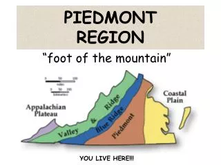
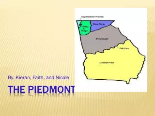
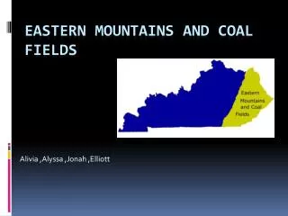
William Eric Sinclair Regulatory Specialist Western Regulatory Field Office 16 August 2012. EASTERN MOUNTAINS and PIEDMONT REGIONAL SUPPLEMENT. Both manuals provide technical guidance and procedures for identifying and delineating wetlands.

E N D
William Eric Sinclair Regulatory Specialist Western Regulatory Field Office 16 August 2012 EASTERN MOUNTAINS and PIEDMONT REGIONAL SUPPLEMENT
Both manuals provide technical guidance and procedures for identifying and delineating wetlands.
Where DIFFERENCES in the two manuals occur, the Regional Supplement takes precedence over the Corps Manual.
Wetland Definition:Those areas that are inundated or saturated by surface or ground water at a frequency and duration sufficient to support, and that under normal circumstances do support, a prevalence of vegetation typically adapted for life in saturated soil conditions. (Federal Register 1982)
Identification of wetlands is based on a three-factor approach involving indicators of: Hydrophytic Vegetation Hydric Soil Wetland Hydrology
Landform Examples of Landforms include: hillside, terrace, valley, sinkhole, depression, etc.
Are climatic/hydrologic conditions on the site TYPICAL for this time of year? Refer to: Online Corps Manual, page 73. EM&P, Chapter 5
Are Vegetation, Soil, or Hydrology Significantly Disturbed?Atypical Through Natural Events Or Through Human Activities
Are Vegetation, Soil, or Hydrology Naturally Problematic? Problem area wetlands are naturally occurring wetland types that lack indicators.
Problematic Wetlands • Cedar Glades • Red Parent Material Derived Soils • Seasonal Wetlands (Depressions) • FACU Dominant • Recently Developed
“Normal Circumstances”? Extent of any alterations? Relative permanence of physical alteration? If left “alone”, would current site conditions remain?
Hydrology 14 or more consecutive days of flooding or ponding, or a water table 12 in. or less below the soil surface, during the growing season at a minimum frequency of 5 years in 10. EM&P Manual, Pages 78 and 79
Growing Season Two indicators of biological activity that are readily observable in the field are: • Above-ground growth and development of vascular plants. • Soil temperature (41 degrees F at 12”). EM&P Manual, Pages 79-81
Plot Size? Recommended 30’, 15’, 5’ radius Adaptable to fit site conditions Plants rooted outside plot but growing in same soil and hydrologic conditions counted for percent cover estimates. EM&P Manual, Pages 20-23
National Wetland Plant List (http://wetland_plants.usace.army.mil/)
Hydrophytic Vegetation Procedures in Order • Rapid Test (All species FACW or OBL) • Dominance Test (Determine if more than 50% dominants are FAC, FACW or OBL) • Prevalence Index (At least 80% of the total vegetation cover identified) • Morphological Adaptations (For upland plants) EM&P Manual, Pages 25-33
Vegetation Data Mistakes • Absolute Cover = 100% exactly • Inclusion of non-vascular plants (moss) • Incorrect 50/20 calculations • Including + and - on indicator status • Prevalence Index (PI) unnecessarily completed • PI NOT calculated by cover estimates
Always Document These Four • Depths of soil layers (20” recommended) • Matrix colors and % • Redox colors if present and % • Soil texture (Sandy or other)
Soil Mistakes • Multiple soil pits recorded on one form • Only one soil layer recorded • % of Matrix or Redox not recorded • Texture not recorded • Inaccurate use of Red Parent Material Indicator (F21). EM&P Manual, page 72 • Incorrect Indicator selected
Corps Regulatory site for information and updates. http://www.usace.army.mil/Missions/CivilWorks/RegulatoryProgramandPermits.aspx