Download
1 / 28
280 likes | 507 Views
Vision for Aviation Services Digital Products. Jack May, Director Aviation Weather Center February 9, 2003. Outline. Products Today Why Aviation is Different (Difficult) In the mean time… (Interim Activities). Present Products. TAF Area Forecasts AIRMET/SIGMET

E N D
Vision for Aviation Services Digital Products Jack May, Director Aviation Weather Center February 9, 2003
Outline • Products Today • Why Aviation is Different (Difficult) • In the mean time… (Interim Activities)
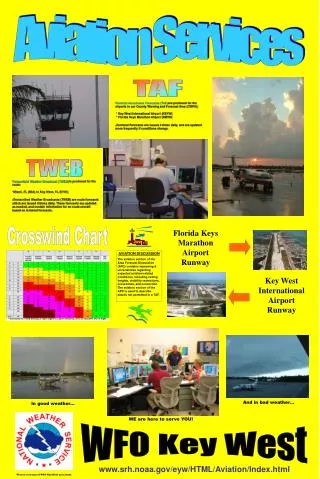
Present Products • TAF • Area Forecasts • AIRMET/SIGMET • Significant Weather Graphic • Transcribed Weather Enroute Forecast (TWEB) • Route Forecast (ROFOR)
Examples: Current Product Suite KATL 201730Z 201818 27015G24KT P6SM BKN035 TEMPO 2124 SCT035 FM0000 25010KT P6SM SCT035 FM0600 25008KT P6SM SCT030 TEMPO 0812 BKN030 FM1200 25010KT P6SM BKN020 TEMPO 1215 4SM BR FM1500 25012KT P6SM BKN020=
Examples: Current Product Suite SYNOPSIS...AT 18Z CDFNT 100 NW NRN ME-ERN LH-NRN WI. TROF SRN ME CSTLN-CAPE COD-FAR SERN VA. BY 12Z CDFNT ME-CSTLN-SRN VT-CNTRL LE-SRN WI. LOW OVR MD CSTL WTRS WITH STNR FNT TO ERN NC..ALSO XTNDG NEWD FROMLOW. ..HENDERSON.. ME NH VT NRN ME…BKN070 TOPS 090. 00Z SCT060. 05Z SKC. OTLK…VFR. NH VT SRN ME…SCT070. 23Z SKC OCNL SCT CI. OTLK…VFR BECMG MVFR VLYS 08Z. MA RI CT SCT050. 23Z SCT-BKN CI. OTLK…VFR NY LO LO WRN/CNTRL/NERN NY…SCT060. 23Z SCT CI. OTLK…VFR PA NJ SCT060. 00Z SCT-BKN CI. OTLK…MVFR BR MA DC DE VA MD DC DE NRN VA…SCT060 SCT-BKN100 TOPS TO 150. ISOL SHRA. OTLK…MVFR BR SWRN/S CNTRL/SERN VA…BKN-OVC030-040 LYRD TO 150. VIS OCNL 4-5SM SHRA. WDLY SCT TSRA SWRN VA…ISOL • Area Forecasts • Boston FA
Examples: Current Product Suite AIRMET SIERRA UPDT 4 FOR IFR AND MTN OBSN VALID UNTIL 262000 AIRMET MTN OBSCN…WV VA FROM EKN TO CSN TO 30N GSO TO HMV TO 40 WSW BKW TO EKN…MTNS OCNL OBSCD BY CLDS/PCPN BR. CONDS END 16-18Z. AIRMET IFR…VA FROM RIC TO ORF TO 40NE RDU TO HMV TO PSK TO RIC OCNL CIG BLW 010/VIS BLS 3SM BR. CONDS ENDG 15-16Z. ELSW… NO WDSPRD IFR EXP. AIRMET TANGO UPDT 2 FOR TURB VALID UNTIL 262000 AIRMET TURB…NH VT MA RI CT NY LE LO PA OH FROM MPV TO BOS TO ACK TO SAX TO JST TO HNN TO CVG TO FWA TO DXO…OCNL MOD TURB BTN FL280 AND FL350 DUE TO WIND SHEAR ASSOCD WITH JTST. CONDS ENDG 20Z. RMNDR…NO SGFNT TURB EXP EX INVOF CNVTV ACT. AIRMET ZULU UPDT 2 FOR ICE AND FRZLVL VALID UNTIL 262000. NO SGFNT ICE EXP OUTSIDE OF CNVTV ACT. FRZLVL…120-130 E OF YYZ-ERI-AIR-GSO LN..110-130 NRN ME..RMNDR 130-150. • AIRMETs • Sierra • Tango • Zulu
TWEB 357 TWEB 111402 KBLI-KPAE-KSEA. ALL HGTS MSL XCP CIGS. KBLI-KPAE...P6SM SKC...TIL 18Z KNUW-KFHR AREAS VIS BLO 3SM BR/FG CIGS BLO OVC010 TOPS 015. KPAE-KSEA...P6SM SKC...W PTN OF RTE 8SW KPAE-KPWT-KSHN-KTCM-KSEA-8SW KPAE WDSPRD VIS BLO 3SM BR/FG CIGS BLO OVC005 TOPS 015...18Z P6SM SKC....KSHN-KOLM LCL VIS BLO 3SM BR CIGS BLO OVC010 TOPS 015...20Z P6SM SKC.
ROFOR ROFOR VALID 16/23Z-17/01Z FOR ROUTE PHNL TO PJON FT 10000 30000 34000 39000 20.3N/ 2820P04 2965M31 3070M40 3170M51 160.9W 19.0N/ 3215P05 2850M31 3055M41 3250M52 164.3W SIG WX...NIL.
Digital Aviation Forecasts in NDFDWhy so slow? • FAA writes the rules. Following systems must be ready to accept new products: • AFSS Model I • AFSS OASIS • DUATs • WARP • ADDS • Traffic Situation Displays • Training Across the Board
Digital Aviation Forecasts in NDFDWhy so slow? • All of the players involved: • NWS • FAA • Flight Standards (Regulations, transmission, pilot training) • Air Traffic (ARTCC, ATCSCC, TRACON) • Flight Service Stations • DUATs • Aviation Organizations (AOPA, ALPA, ATA, SAMA, ADF) • International Conventions (ICAO, WAFS, MSC)
Digital, Gridded Data RequirementsWhy Aviation is Different • Time Resolution • Vertical Resolution • Weather Type • Cloud coverage or “cloud/no cloud” • Probability (in next 10 minutes?)
Digital Aviation Requirements • Ceiling and Visibility every 15 minutes • Graphic shows Airport Arrival plan which is adjusted based on forecast.
Digital Aviation Requirements • Wind direction and speed, every 5 minutes. • Graphic shows planes lined up to land at O’Hare and Midway based on current runway configuration. Jan.20, 2003: 1730 UTC ORD & MDW Arrivals
Digital Aviation Requirements • In convection, every 10 minutes for the first hour. Mitre Corporation Automation-assisted Weather Problem Resolution Tool
Time Resolution Hours 0-3: 15 minutes Hours 3-24: 1 hour Updates every 15 minutes. Vertical Resolution Surface-1,000 AGL: Every 100 feet 1,000-3,000 feet: Every 200 feet 3,000 feet to FL650: Every 1,000 feet Horizontal Resolution 2.5 km NWS Integrated Work Team looking at very short term aviation forecasts in a post IFPS/NDFD environment Future Domestic Requirements Gridded Data (Draft)
In the Meantime… What digital products exist or are being developed today?
GRIB File BUFR File National Convective Weather Forecast (NCWF) Every Five Minutes!!!
Ceiling and Visibility http://www.rap.ucar.edu/projects/cvis/
Graphical Area Forecast (GFA) • Replace current text Area Forecast as main product. • Text provided through product formatters • Using GAMET format • GFA replace hours 9-24 of non-international TAFs. • Assumes higher TAF refresh rate 0-9 hours. • Issued in BUFR format
Graphical Area Forecast (GFA) • BUFR • Earth referenced ‘objects’. Not gridded. • Meets WMO/ICAO standard for earth-referenced objects. • Allows display of individual features at user discretion. • Much lower traffic volume. • Requires user to ‘build’ product at destination. • Already being done in the World Area Forecast System (WAFS)
Graphical Area Forecast Experiment(GFAX) • Graphical Area Forecasts on experimental basis being prepared at AWC January 13-February 14. • Purpose • Identify the production tools required. • Allow users to provide input on presentation. • Produce products to help develop text formatters.
GFAX Website http://aviationweather.gov/gfax/