Download
1 / 72
720 likes | 845 Views
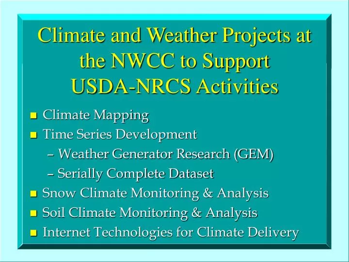
Climate and Weather Projects at the NWCC to Support USDA-NRCS Activities. Climate Mapping Time Series Development Weather Generator Research (GEM) Serially Complete Dataset Snow Climate Monitoring & Analysis Soil Climate Monitoring & Analysis Internet Technologies for Climate Delivery.

E N D
Climate and Weather Projects at the NWCC to Support USDA-NRCS Activities • Climate Mapping • Time Series Development • Weather Generator Research (GEM) • Serially Complete Dataset • Snow Climate Monitoring & Analysis • Soil Climate Monitoring & Analysis • Internet Technologies for Climate Delivery
Climate Mapping • Collaborative effort between NRCS National Water and Climate Center (NWCC) and the Spatial Climate Analysis Service (SCAS) at Oregon State University • Goal is to produce new maps and digital GIS layers of climate elements needed by the NRCS and others
A Spatial Climate Modeling System • PRISM (Parameter-elevation Regressions on Independent Slopes Model) • Statistical/Dynamical/Topographic approach • Uses point data, a DEM and a coordinated set of rules, decisions and calculations, designed to mimic an “expert” climatologist • For good reference see PRISM Guide Book under Technical Papers at the OSU PRISM web site
PRISM • Originally developed for precipitation only, now expanded to temperature, dewpoint, solar radiation and many derived variables such as HDD’s/CDD’s, GDD’s, frost dates, snowfall, snow water equivalent, etc. • Most commonly applied in monthly or annual time increments, but also applied to events
PRISM Model from OSU’sSpatial Climate Analysis Service • Funded primarily by the NRCS-NWCC since 1993 for development of spatial climate products for the U.S. • 4 km horizontal resolution raster data, and ARC polygon coverages both available • Most commonly applied in monthly or annual time increments, but also applied to events
PRISM • Any given grid cell value is determined by a linear regression of station values against elevation • Stations assigned weights • Combined weight of a station is a function of many factors
PRISM-derived Products • Mean Mon. and Ann. Precipitation • Mean Mon. and Ann. Temps (mx/mn) • Frost Dates and Freeze-free Season • Extreme Winter Min. Temps & Probs. • Growing, Heating, Cooling degree days • Snow-Water Equivalent & Snowfall • Rainfall Erosivity (‘R-factor’ for RUSLE), Intensity-Duration-Frequency
Other PRISM-derived Climate Map Products for the NRCS: • New Soil Climate Maps, including mean annual soil temperature, soil taxonomic regions • Precipitation Efficiency, Climatic Index, and other “older” Thornthwaite products • New Plant Hardiness Map of the U.S.
Cartographic-quality Map of Mean Annual Precipitation for Idaho Produced at the USDA-NRCS NCGC
Annual Precipitation Map of Elmore County, Idaho Produced by the NRCS NCGC “Cut-out” of State Map
July normal precipitation (top) vs. July 1993 precipitation (bottom)
100 Year, 24-hour NOAA Atlas 2 Values (inches) Northwest Colorado (1973)
PRISM Product Dissemination • Web Sites: OSU www.ocs.orst.edu/prism/prism_new.html (Raster and polygon coverages of practically everything produced to date (Arc, GRASS); documentation; metadata; DEM’s) NRCS www.ftw.nrcs.usda.gov/prism/prism.html (U.S., Regional and State mean annual precipitation cartographic products)
http://www.ftw.nrcs.usda.gov/prism/prism.html: • Cartographic state mean annual precipitation maps • Full repository of “official” NRCS PRISM layers
PRISM Product Dissemination • Compact Discs: All precipitation layers for all of the U.S. 3 CD’s (East, Central, West) of the lower 48 states. Includes Arc Explorer viewing software, and all documentation. Available from the NRCS-NCGC: 800-672-5559
PRISM Product Dissemination • Hardcopy maps: Cartographic-quality, walls-size maps of mean annual precipitation for each state Available from the NRCS Climate Data Liaison in each state
Wind Mapping to Support NRCS Air Quality Program • Need high resolution mean and event wind speeds and directions for whole U.S. • Atmospheric model needed for this: Sue Ferguson at USFS Research Seattle • Mean monthly winds of U.S. at 5 km resolution now nearly complete
Time Series Development:Weather Generator Researchand Integration
Ultimate Question:What is really needed?(for applications needing point-serial data) A continuous time series of weather data of sufficient length to make reasonable assessments for planning decisions, of sufficient temporal resolution to match the time step in process models, and of sufficient spatial resolution and accuracy to have confidence in its application in any location in the U.S.
What are our choices? Observed data -or- Model-generated data Observed data: Point, “truth”, missing values, limited record, one realization, only 1 or 2 elements at many stations Generated data: Point, only an approximation of the “true” climate, serially-complete, easy to generate
Why Stochastic Weather Generation Programs? • Easily accessible, serially-complete data sets are produced • Easily modified outputs to match other modeling requirements • Weather/Climate scenarios for locations with limited or no observed data • Ability to adjust model parameters for playing “What If ?” games; risk assessments
ARS-NRCS WeatherSimulation Team (WST) • Formed in response to need for updated, more dynamic weather simulation tool • Comprised of 5-10 ARS and NRCS scientists • Major focus areas include storm generation (generating sub-daily time steps), GEM as a predictive tool (linkage to large-scale forcings), generation of all needed weather elements, and spatial distribution of generator parameters
GEM: Generation of weather Elements for Multiple applications • Known as WGEN (Richardson, 1984) and USCLIMATE (Hanson et al., 1994) • Preservation of serial and cross correlations • Basic version is a point model, and delivers daily time series of precipitation, max/min temperature, solar radiation, average dewpoint and average wind speed
Distributing GEM Model Parameters Using the PRISM (Parameter-elevation Regressions on Independent Slopes Model) system at Oregon State UniversityGoal:To generate accurate climatic time series at any point in the U.S., regardless of the availability of historical climate information, for input to models, scenario development, and many other uses