Download
1 / 37
380 likes | 650 Views
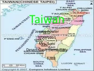
Ju -Jiang Hung Department of Civil Engineering, National Taiwan University, Taipei, Taiwan Chyi-Tyi Lee Ming-Lang Lin Institute of Applied Geology, National Central University, Chungli , Taiwan. Tsao -Ling rockslides, Taiwan. 報告者:邱奕勛 指導老師:李錫堤老師 報告 日期: 2011/01/06. OUTLINE. Introduction

E N D
Ju-Jiang Hung Department of Civil Engineering, National Taiwan University, Taipei, Taiwan Chyi-Tyi Lee Ming-Lang Lin Institute of Applied Geology, National Central University, Chungli, Taiwan Tsao-Ling rockslides, Taiwan 報告者:邱奕勛 指導老師:李錫堤老師 報告日期:2011/01/06
OUTLINE • Introduction • Method • Result and discussion • Conclusion
Introduction • Rockslide (Hung and Chen, 2001) • Many landslide disasters occur every year on the mountainous island of Taiwan. • The collision between the Philippine Sea plate and the Eurasian continental plate is active. • A dipslope in interbedded Pliocene sandstones, mudstones, and shales. Location map of site of Tsao-Ling rockslides, central Taiwan
Geology of the Tsao-Ling slopes Stratigraphy and lithology in the Tsao-Ling area
Tsao-Ling area before December 17, 1941 Topographic map of Tsao-Ling rockslide area before December 17, 1941 Reconstructed profiles of 1941 and 1942 slides
1941 Tsao-Ling rockslide event Intensity contour map of 1942 Chia-Yi earthquake
1941 Tsao-Ling rockslide event Simplified map of Tsao-Ling rockslide area after December 17, 1941, and before March 30, 1942 Reconstructed profiles of 1941 and 1942 slides
1942 Tsao-Ling rockslide event Reconstructed profiles of 1941 and 1942 slides
General view of head scarp and remaining slope, looking from landslide dam toward remaining slope and head scarp
Remote view of remaining part of landslide dam, looking from top of head scarp
1979 events at Tsao-Ling rockslide Reconstructed profiles of 1979 slide
Close-up view of small part of sliding surface,August 22, 1979, 1 week after sliding
View upstream of dammed lake and landslide dam, looking from toe of remaining slope
Aerial photograph of 1979 rockslide event on August 19, 1979, 4 days after slide and 4 days before overtopping
Topographic map of Tsao-Ling rockslide area in 1977 Reconstructed profiles of 1979 slide
Triggers for the Tsao-Ling events • Earthquake The peakground acceleration at the Tsao-Ling slope may be estimated by local attenuation equations: a : peak ground acceleration M : local magnitude R : the distance to hypocenter of the earthquake
Precipitation From 1949 to 1960, the annual mean rainfall in the Tsao-Ling area was 3000 mm, while that in the ALi-Shan station was 4000 mm.
Relationship of landslides to geology Orientation of joint sets in the Tsao-Ling rockslide area
Sliding plane a e f
Laboratory analysis • Boring and sampling
Tsao-Ling landslide induced by 1999 Chi-Chi Earthquake Topographic profiles based on the 40×40 m 1989 DEM and the2002 LIDAR mapping (Chen, 2006)
View up sliding surface of September 1999 rockslide on Tsao-Ling dip slope,triggered by Chi-Chi earthquake
Topographic changes of the Tsao-Ling landslide induced by the 1999 Chi-Chi earthquake(Chen, 2005)
Conclusion • The sliding plane of the 1941and 1942 slide is located at or near the Cho-Lan-Chin-Shui boundary ; the 1979 sliding plane located in the middle part of Chin-Shui shale formation. • They are nonplastic or low-plastic silty or c1ayey materials in nature. Quartz and c1ay minerals are the two most abundant minerals in these shaley formations. • X-ray diffractometer analyses show that the clay fraction of the shale contains very little or no montmorillonite. Expansion tests also show that the shale has very little (0.25%) expansion upon saturation. • When the residual frictioncoefficient of Tsao-Ling landslide is equal or less than 0.05 after a critical displacement due to the Chi-Chi earthquake, the landslide block can move across the Ching-shui River and deposit on Diagiaoshan.