Download
1 / 23
230 likes | 432 Views
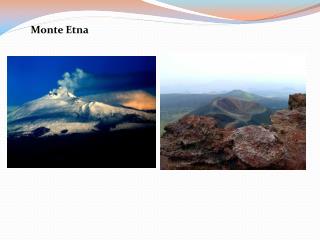
Mt. Etna Volcanic Plume from Aster and Hyperion data by Asi-Srv modules C. Spinetti, M.F. Buongiorno, M. Silvestri, S. Zoffoli. Istituto Nazionale di Geofisica e Vulcanologia, Italy Agenzia Spaziale Italiana, Italy. Picture by Italian Astronauts Nespoli from ISS, Etna 14-1-2011. Outline.

E N D
Mt. Etna Volcanic Plume from Aster and Hyperion data by Asi-Srv modules C. Spinetti, M.F. Buongiorno, M. Silvestri, S. Zoffoli Istituto Nazionale di Geofisica e Vulcanologia, Italy Agenzia Spaziale Italiana, Italy Picture by Italian Astronauts Nespoli from ISS, Etna 14-1-2011
Outline • Volcanicemissions in atmosphere • The Asi-SRV system • Volcanicplumemeasurementsmodules • Test site Mt. Etna • Results in test periods • Conclusions Spinetti et al, IGARSS 23-30 July 2011
Volcanicemissions in atmosphere Spinetti et al, IGARSS 23-30 July 2011
Volcanic Plumes components Water Vapour Ranges between70-90 % of plume component; Carbonic Gas Every year about 130 millions tons of CO2 are emitted by volcanoes; Sulfur Dioxide Every year about 1 million tons of SO2 are emitted by volcanoes; Solid and liquid Particles Solid particles can ranges in size from m to nm (aerosol). Liquid particles are formed by eterogeneous nucleationand condensation of H2SO4 into liquid particles of aerosol Spinetti et al, IGARSS 23-30 July 2011
ASI-SRV Volcanic Risk System Funded by the Italian Space Agency (ASI) with the aims to develop a system for near real time analysis of Earth Observations data for volcanic risk management. • The project philosophy is to implement specific modules which allow to process, store and visualize through Web GIS EO/non EO integrated products in the volcanic activity phases defined within Civil Protection operations: • Knowledge and prevention (K&P) • Crisis (C) • Post Crisis (PC) Spinetti et al, IGARSS 23-30 July 2011
Direct download Logical Architecture Processing chains Non-EOdata Sources Level EO Raw data DATA REPOSITORY Gis desktop Product Archive and validation Scientific Operators WMS Server Web browser User Level End user Products publication Spinetti et al, IGARSS 23-30 July 2011
TEST SITES Sites selection compatible with the spatial resolution of EO operative systems Vesuvio Etna Campi Flegrei Aster 3D Frequent monitoring with ground networks used to validate and integrate EO products. Picture courtesy of B. Benchke 14-6-2011 Studio di fattibilità - Rischio Vulcanico - PRR Spinetti et al, IGARSS 23-30 July 2011
EO Data used to S/S Surveillance and Early Warning of eruptions Volcanicplumemeasurements using EO data: the SRV modules Spinetti et al, IGARSS 23-30 July 2011
Processor Data level scheme MODULES Spinetti et al, IGARSS 23-30 July 2011
Module Logic workflow From raw data to plume parameter For each sensor a data series of remote sensed data have been processed By means of specific algorithm and using Auxiliary and Ancillary… Calibration Georeferentiation …the parameter is obtained Product Vectorfile Maps Before to post on the GIS each raster needs to be converted in a ESRI like vector.. Surface reflectance Vertical profile Plume altitude Optical particle parameters Convolution with sensor response function RTMSimulation Spinetti et al, IGARSS 23-30 July 2011
VAOT module is based on volcanic aerosol retrieval technique (Spinetti et 2003 and Spinetti and Buongiorno 2007) adapted to analyze Aster and Hyperion.The module output is a map of plume Aerosol Optical Thickness @ 550 nm with medium-high spatial resolution 15m and 30m • WV Module is based on CIBR technique (Carerre and Conel, 1994; Spinetti et al., 2004) using the H2O Hyperion absorption band @1125 nm in the atmospheric spectrum curve. The module output is a map of columnar content of plume water vapour. • Modules has been developed to be “user-driven” . A huge effort has been done to achive the semi-automatic way in order to produce results easly and in short time. Module VAOT (Aerosol optical thickness) and WV (Water Vapour) techniques Spinetti et al, IGARSS 23-30 July 2011
EO1-Hyperion VAOT 550nm@30m Module input AOT_Hy 24-9-2001 09:34GMTAOT mean 0.30+-0.09 AOTmin0.05+-0.02 AOTmax 1.10+-0.33 Plume area 2.25km2 Plume direction NE EO-1 - Hyperion 24 Sept 2001 Spinetti et al, IGARSS 23-30 July 2011
TERRA-ASTER VAOT 550nm@15m Module input Module output Classificated min0.1 0.2 0.3 0.4 0.50.6max min0.1 0.2 0.3 0.4 0.50.6max TERRA-ASTER 10 May 2010 Spinetti et al, IGARSS 23-30 July 2011
WV 9-7-2007 8-10-2009 EO1-Hyperion WV @30m The map on 25 October 2006 shows a plume structure divided in 3 dinstinct areas of high content in the summit corresponding to the 4 summit craters. The map on 9 July 2007 shows a dispersed plume over the summit area without any preferential direction. The map on 8 October 2009 shows a water vapour plume well South directed. WV 25-10-2006
Test periodEO-1 Hyperion Timeseries Out of scene Time series of total 142 data between acquisition period June 2001 to September 2010 GIS Productprovided 49 VAOT maps (90% ofselected 34% ofacquisition) 23 WV maps (46%) Swath width 7.5 km 17 Sept 2005 Spinetti et al, IGARSS 23-30 July 2011
TERRA – ASTER Time series Time series of total 262 data between acquisition period data from April 2000 to August 2010 GIS Productprovided: 32 VAOT maps (69% ofselected 12% ofacquisition) Swathwidth 60 km Spinetti et al, IGARSS 23-30 July 2011
2001-2010 Hyperion Timeseries VAOT Results 2001 eruption 2002 – 2003 eruption 2004 – 2005 eruption 2006 eruption 2008-2009 eruption
Aster and Hyperion Time series results VAOT 2000-2010 Impact index AOT max* area 2001 eruption 2002 – 2003 eruption 2004 – 2005 eruption 28 gen 06 2006 eruption 2008-2009 eruption 16 sett 02 16 Sept 07 13 July 01 13 July 01 4 May 00
EVEN EMIL EILI ENIC ECUR SO2 flux FLAME-DOAS ground network First SO2 measurements by COSPEC on 1970! From 2005 automatic UV-Doas ground network has been developed. station scans FLAME-Etna network Data analysis Spinetti et al, IGARSS 23-30 July 2011
Flame daily average flux SO2 2000-2010 WV_HyProduct 16-9-2007 09:32GMTWV mean 0.33+-0.01 (g/m2) WV min 0.03+-0.01 (g/m2) WV max 0.8+-0.01 (g/m2) Plume area 1.25km2 13 July 01 16 Sept 07 4 May 00 (Caltabiano et al., 2011; Salerno et al., 2007) Spinetti et al, IGARSS 23-30 July 2011
12-13 January 2011 Paroxysm Output: AOT@550nm 1km 11 -1-2011 9:16 UTC Input : Dati Modis Terra e Aqua 11 -1-2011 12:36 UTC
Conclusions • Modules of the SRV system has been developed in order to be used in near real time for monitoring purpose. • The VAOT and WV provide information on the degassing status of Etna in the early warning risk management phase. • Outup maps with 15 to 30 m of resolution give the AOT and vapour content and the plume structure indicating in some cases which crater is the most active. • The analysis of time series indicates high values of AOT correlated with large plume area during an eruption and before an explosive activity as 2000 2001 and 2007 paroxysm. The high values of Aot on a large area indicate aerosol formation that are correlate with high SO2 flux and water vapour . • The satellite revisiting time is critical to monitoring purpose to derive product maps. Spinetti et al, IGARSS 23-30 July 2011
Thank You Etna paroxysm 25-7-2011 Spinetti et al, IGARSS 23-30 July 2011