Download
1 / 24
250 likes | 543 Views
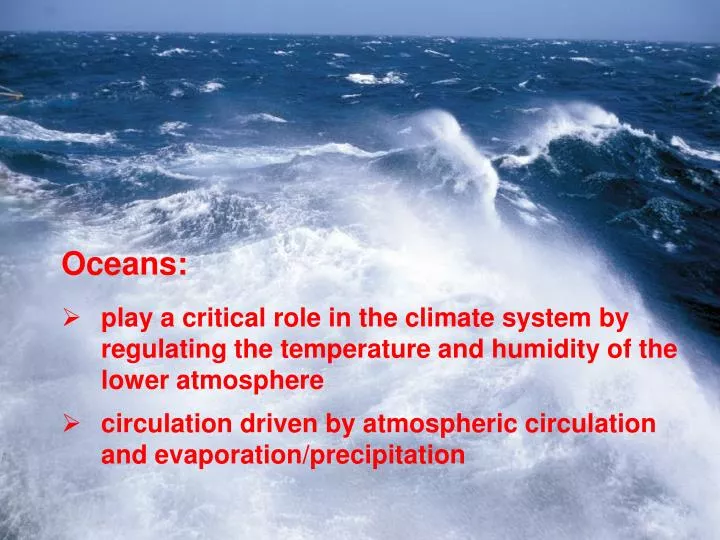
Oceans: play a critical role in the climate system by regulating the temperature and humidity of the lower atmosphere circulation driven by atmospheric circulation and evaporation/precipitation. Oceans cover 71% of the Earth ’ s surface, but distribution is uneven across the globe.

E N D
Oceans: • play a critical role in the climate system by regulating the temperature and humidity of the lower atmosphere • circulation driven by atmospheric circulation and evaporation/precipitation
Oceans cover 71% of the Earth’s surface, but distribution is uneven across the globe (From: Murck and Skinner, 1999)
Ocean Water Composition • Normal marine salinity, reflecting dissolved ions, is 3.5% (35 grams per liter; 35,000 parts per million). • Dissolved ions derive from chemical weathering of rocks. • These ions are mostly Cl-, Na+, SO42-, Mg2+, Ca2+ and K+.
Salinity (saltiness) of sea water varies within • narrow limits • evaporation: increases salinity • precipitation: decreases salinity • river discharge: decreases salinity • freezing of sea ice: increases salinity
Ocean Water Composition • Surface salinity can vary above and below 3.5%. • Higher salinity from evaporation and sea-ice formation. • Lower salinity from rainfall, glacial melt, and river input. • Salinity becomes more uniform with depth.
Ocean Water Temperature • Ocean surface T varies inversely with latitude. • Water buffers wide T shifts moderating climate. • Surface water approaches a uniform T with depth. • Ocean bottom water is near freezing < 4 °C (39 °F)
Vertical stratification of the oceans (From: Murck and Skinner, 1999)
The permanent thermocline (100 – 1000 m below the surface) separates cold deep water from shallower layers that are affected by changes in the Earth’s surface temperature and seasonal variations in radiation (From: Ruddiman, 2001)
Fig. 15.07 NASA
ECCO-2 MIT JPL ocean current model Estimating the Circulation and Climate of the Ocean Complexity of Oceans ECCO-2: Menemenus et al., EOS 2005 Oceans have complex patterns of water height changes and related flows. Height changes are significant whereas velocities are slow and do not necessarily reflect flow at depth. For example, sea surface height correlates with flow at depth via geostrophic relationship, i.e., flow along contours of constant pressure.
What drives the ocean circulation? • Surface winds surface currents (~10% of ocean volume) • Temperature and salinity differences thermohaline circulation (~90% of ocean volume) • warmer water is lighter • saltier water is heavier
Wind driven surface ocean circulation (From: Ruddiman, 2001)
Fig. 15.09a-e W. W. Norton
Surface ocean currents are primarily driven by wind patterns in the atmosphere (From: Murck and Skinner, 1999)
Upwelling Downwelling Vertical Oceanic Currents • Currents also transport ocean water vertically. • Downwelling – Surface waters are drawn downward. • Upwelling – Deep waters are pushed upward. • Wind perpendicular to shore drives vertical flow. • Onshore – Water piling up along coast drives downwelling. • Offshore – Upwelling replaces water moved away.
Vertical Oceanic Currents • Thermohaline contrast also drives vertical currents. • Temperature – Colder water is denser and sinks. • Salinity – More saline water is denser and sinks. • Polar water is both colder and saltier. • Deep ocean waters are replenished from the poles.
(From: Murck and Skinner, 1999) Thermohaline circulation: North Atlantic Deep Water forms when the warm and salty water of the Gulf Stream and North Atlantic Current cools and becomes increasingly saline due to evaporation, thus increasing its density
Sinking of surface water in the North Atlantic drives the thermohaline ocean circulation (From: Ruddiman, 2001)
Transect view of the deep Atlantic circulation • NADW forms in the North Atlantic as northward-flowing surface waters cool and become increasingly saline (density increases) • ABW forms around Antarctica when sea ice forms (increasing salinity and density) • AIW originates as cold sub-Antarctic surface water that sinks and spreads northward • (From: Ruddiman, 2001)
The thermohaline circulation (“conveyor belt”) involves all major oceans; it takes ~1000 years for water to complete the circuit (From: Murck and Skinner, 1999)
Thermohaline circulation driven by surface waters sinking in the North Atlantic • Sinking caused by increased density • Increased precipitation or sudden input of fresh water would lower density • Thermohaline circulation can shut down • This may have happened during the last deglaciation, causing Europe to plunge back to an ice-age climate for a short period
Coastal Variability • Eustatic sea-level changes effect coasts worldwide. • Inflation/deflation of mid-ocean ridge volumes. • Glaciation/deglaciation traps or releases water. • Pleistocene glaciations exposed all continental shelves.
Fig. 15.34 W. W. Norton. Adapted from Kraft, 1973