Intergraph 地理信息系统方案
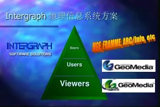
Doers. Users. Viewers. SOFTWARE SOLUTIONS. Intergraph 地理信息系统方案. 数据集成 Data Integration. 空间数据管理 Spatial Data Management. 全面开放 Open Standards. Windows Productivity. Intergraph GIS 解决方案. 网络化 Internet & Intranets. Intergraph GIS Products. Asset Modeling. MGE FRAMME.

Intergraph 地理信息系统方案
E N D
Presentation Transcript
Doers Users Viewers SOFTWARE SOLUTIONS Intergraph 地理信息系统方案
数据集成 Data Integration 空间数据管理 Spatial Data Management 全面开放Open Standards Windows Productivity Intergraph GIS 解决方案 网络化 Internet & Intranets
Intergraph GIS Products Asset Modeling MGE FRAMME Asset Mapping GeoMedia Analysis GeoMedia Web Map Distribution
SOFTWARE SOLUTIONS 全面开放的新一代地理信息系统Communicating Geographically
GeoMedia 是什么? • 第一个基于Intergraph Jupiter技术的GIS产品 • 数据存去和分析的强有力工具 • 开放的 GIS 数据集成器 • 可用户化的和可编程的 GIS 工具包 Jupiter是一个开放的创建纯Windows应用的标准,它不需传统的CAD内核 它充分发挥了Windows操作系统上的图形,对象和集成能力。 同时增加了 特别的GIS功能。
Oracle SDC/SDO MGE ARC/INFO& ArcView GeoMedia Universal Server FRAMME CAD MapInfo GeoMedia 能做什么? • 同时访问多种空间和属性数据库。
GeoMedia 能做什么? Arc/Info CAD Mapinfo • 无缝的集成多种空间和属性数据库。 在同一研究和工作区内使用多种 数据如MGE, Arc/Info, MapInfo等 进行空间查询和分析,就象使用 同一数据。 MGE
Intergraph MGE Transportation planning GIS Vendor 1 Land Info Systems GIS Vendor 2 Urban planning Word Processor Budget reporting Others... Open Systems
GeoMedia 能做什么? GeoMedia 能对所集成的数据进行专业的复杂的空间分析
GeoMedia能做什么? • 用属性数据制作专题地图
GeoMedia能做什么? • 多媒体的集成
GeoMedia能做什么? 可集成几乎 所有的 标准栅格格式
GeoMedia能做什么? • 能输出特制(WYSIWYG)的地图样式
Oracle Power Objects 简便的用户化 • 使用标准的程序开发语言进行方便的二次开发
Clients SQL*Net Server Oracle7SDO 创建S/C方式的用户应用 CustomApplication Choose commercial software or write custom applications
GeoMedia 的主要特性 • 多数据源访问-MGE,FRAMME,Arc/Info,ArcView, MapInfo, ORACLE SDO/SC, Access,MGSM 和CAD文件. • 集成操作环境 • 数据管理统一(图形和属性存于同一数据库中). • 多种数据的空间查询和分析 • 栅格矢量集成 • 标准语言用户化
GeoMedia 的主要优点 • 用户无须为多种数据格式的转换和信息的丢失而操心。 • 能及时操作和查询基于同一窗口的复合数据。 • 多GIS数据源的空间分析。 • 不用学习专门的开发语言。
GeoMedia Web Map - 功能 • 实时创建矢量CGM图形 • 自动地在你的图形上创超联接 • 多设计文件五缝工作 • 不需要 MGE, FRAMME 或 Arc/Info在运行 • 应用 NetScape or Internet Explorer即可工作 • 在 Intranet or Internet上运作 • 用户可以 zoom in/out, pan, and redline • 可显示预先定义的空间查寻结果
GeoMedia Web Map 结构 InterCap Inline InterCap ActiveX Free Free NetScape 2.0 MS IExplorer v3.0 Windows 95 / NT Windows 95 / NT 4.0 InterNet HTTPd (IIS) Custom Scripts MGE Project GMWebMap Tools ODBC Windows NT
GeoMedia Web Map - 益处 • 不需要提前转换数据 • Requires no interactive authoring • Delivers maps that looks and feels like FRAMME and MGE • Is customizable to tailor to your user needs • Allows viewing and query on your latest information • Easily links to other non-GIS information in your enterprise
GeoMedia Web Map • Is not a... • Spatial query engine • Product that requires GIS experience to use • Doer or User product • Data editing tool
GeoMedia Web Map • It is a... • Easy-to-use viewing/query tool • Easy way to distribute your 憇mart?information • Customizable product • Basically free viewing seat for the client • Open systems architecture • Product that is available today
Intergraph GIS Communicating Geographically... ...with Intergraph’s GIS Solutions The Internet MGE FRAMME
GeoMedia Web Map -主要优点 MGE FRAMME Others The Internet • 在企业内部有效和底成本的共享GIS信息。 • 使GIS和相关的图形在Web网上发布。 • 方便实用的地图浏览和查询工具。 Others
Thank you! SOFTWARE SOLUTIONS www.intergraph.com