Download

1 / 30
490 likes | 1.22k Views
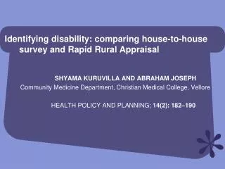
Rapid Rural Appraisal How to find out what’s going on!. Overview. What is Rapid Rural Appraisal (RRA)? Why do we need RRA? Planning for a RRA Some simple RRA techniques Semi-structured interviewing Mapping and modeling Seasonal and historical diagramming Preference ranking.

E N D
Overview • What is Rapid Rural Appraisal (RRA)? • Why do we need RRA? • Planning for a RRA • Some simple RRA techniques • Semi-structured interviewing • Mapping and modeling • Seasonal and historical diagramming • Preference ranking
Rapid Rural Appraisal • Series of techniques for "quick and dirty" research • Compared to quantitative survey techniques generate results: • Less apparent precision • Greater evidential value • More efficient and cost-effective • Particularly useful for learning about agricultural systems
Why Use It? • You may think you know the answers, but what is the question? • Learn about the agricultural production system • Identify constraints and opportunities in the local agricultural systems • Better identify issues in target population
The Process Explore the farming system Identify the target population Identify the problem Investigate the nature of the problem Explore possible solutions
Preparations • What are the objectives of the exercise(s) • Why is the work being done? • What type of information do you need? • Define the study area • Province • District • Community • Review “secondary” data: • Reports, maps, photos • UN, Govt., NGOs etc.
Preparations (cntd) • Direct observation • Learn about the area • Only a “starting point” • Do not assume you know! • Prepare check-lists
Check-Lists • General information • Agro-ecological zones • Climate • Main economic activities of local population • Socio-economic information • Distribution of assets • Gender roles • Land tenure system • Interest groups • Labor use patterns • Access to services and markets • Cultural attitudes towards farming • Farming system information
Check-Lists: Farming system information • Physical resource base: land, soil, water, vegetation, etc. • Land use patterns: agriculture, livestock, forestry activities • Cropping patterns: crops, varieties, patterns, rotations, varietal preferences • Assets available (e.g., major tools) • Yields per crop per unit of land • Quantities of physical, variable inputs used per crop per unit of land • Labor used per crop per unit of land • Prices for: inputs, outputs, labor, land, capital
Planning Community Meetings • Location of meeting • Mosque or other communal meeting place • Private compound • Seating is important • Time • Who can and cannot attend? • Who will facilitate exercises? • Group or individual meetings? • Culturally will everyone participate equally?
Know Your Audience! • Butawata, Uganda • Community meeting • Men dominated discussions • Split into two groups by gender • Asked to discuss and prioritize issues • Women ranked labor shortage #1 • Men did not even mention labor! • Bring two groups together • Share what was discussed • Discuss issues
Common RRA Techniques • Semi-structured interviewing • Mapping and diagramming • Seasonal and historical diagramming • Preference ranking
Semi-structured interviewing • Semi-structured interviewing is a form of guided interviewing • Some of the questions are predetermined • New questions are usually generated during the interview • Use a checklist of questions as a flexible guide rather than a formal questionnaire • Interviews take the form of discussions • Interviewer and interviewee learn from each other
During the Interview • Use checklist to stimulate discussion and a participatory dialogue • Ask questions around existing information on the community, or visual material such as diagrams, photographs, or maps • Use “open-ended” questions: who? why? what? when? where? how? • Listen!!! • Take some notes during the interview • Better to complete notes immediately after the discussion
After the Meeting • Finish the discussion politely • Have evening brain-storming sessions with the team to complete notes and to prepare for the following day • Establish report writing procedures with the team making sure enough time is allocated
Mapping and Diagramming • Simple schematic devices • Present information in a condensed and readily understandable visual form • A simplified “model of reality” • Draw in the presence of different categories of people (women and men, young and old, etc.), as their perceptions, viewpoints and information will often differ
Mapping and Diagramming (cntd) • Greatly simplify complex information • Facilitate communication • Stimulate discussion • Increase consensus among community members • Are an excellent way of involving community members
Information Collected with Mapping • Physical infrastructure • Social infrastructure • Cropping systems • Water sources • Woodlands • Major physical features • Land tenure systems • Grazing areas
Participants, Location and Equipment • Groups should generally not be too large (no more than 15) • Select a comfortable place, free from distractions • Equipment: Maps can be prepared with a variety of tools on a variety of surfaces. The most common combinations are: • sticks, stones, leaves, etc. on cleared smooth areas of ground • colored chalk on cement floors • colored pens on paper
Mapping • Explain the purpose of the exercise • Guidance should be kept to the minimum - give some assistance with the first features • The map is a tool: discussion can take place on its features and questions can be raised about items on the checklist • Copy the map when it is completed • A copy should be shown to the participants and a copy should be left with them
Transects • A diagram that is produced during a walking discussion with villagers • Shows the key features of different land use zones in a community • Gain a basic understanding of the agriculture in an area: constraints & opportunities • Check-lists are useful: soils, slopes, food crops, cash crops, land-tenure, livestock, water etc.
Seasonal and Daily Activity Calendars • Diagrams showing the timing and/or importance of events over a period of time (a year, a production season, a day) • Examples: • Food availability • Rainfall and temperature • Production and post-harvest activities • Prices • Marketing • Income • Labor or levels of work activity • Debt
Daily Activity Clocks: Zimbabwe Women - Winter Dry Season Women - Summer Wet Season
Daily Activity Clocks: Zimbabwe Men - Summer Wet Season Men - Winter Dry Season
Pair-wise Ranking • List set of priorities, compare each priority with all others