Download
1 / 18
190 likes | 318 Views
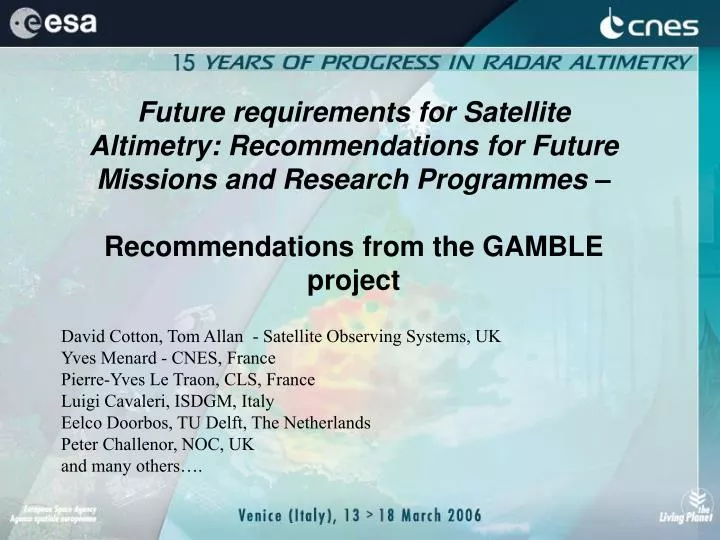
Future requirements for Satellite Altimetry: Recommendations for Future Missions and Research Programmes – Recommendations from the GAMBLE project. David Cotton, Tom Allan - Satellite Observing Systems, UK Yves Menard - CNES, France Pierre-Yves Le Traon, CLS, France

E N D
Future requirements for Satellite Altimetry: Recommendations for Future Missions and Research Programmes– Recommendations from the GAMBLE project David Cotton, Tom Allan - Satellite Observing Systems, UK Yves Menard - CNES, France Pierre-Yves Le Traon, CLS, France Luigi Cavaleri, ISDGM, Italy Eelco Doorbos, TU Delft, The Netherlands Peter Challenor, NOC, UK and many others….
Introduction • GAMBLE - was an EC FP5 funded “Thematic Network” to look at future developments in satellite altimetry (2002-2004). • Identify users' priorities for future improvements in information derived from satellite altimeters. • What new developments in altimeter systems will best suit these requirements?
GAMBLE “Themes” 1 - Sea Surface Height Features - CLS (Fr) 2 - Sea State Error Budgets and Feature Detectability –ISDGM (It) 3 - Precise Orbit Determination and Range Corrections _ TU Delft (NL) 4 - Requirements from Offshore Operators - SOS (UK) 5 - Framework for Future Research - SOC (UK) 6 – Recommendations for Future Missions -CNES (Fr)
GAMBLE Partners Work Package Leaders • Satellite Observing Systems (SOS), UK • Centre National d´Études Spatiales (CNES), France • Collecte Localisation Satellites (CLS), France • Istituto di Scienze Marine (ISMAR), Italy • Delft University of Technology, The Netherlands • Southampton Oceanography Centre (SOC), UK Other Partners • France: ALCATEL,CETP, SHOM, LEGI, LEGOS • UK: University of Newcastle, POL, SSTL, ESSC • Germany: MPI • Norway: NERSC • Web site http://www.altimetrie.net
Requirements - Sea Surface Height • Operational oceanography systems require accurate measurements of ocean eddies and associated currents - the ocean "mesoscale". • At least two satellites are required to monitor this mesoscale. • 3-4 satellite altimeters would provide much improved mapping of sea level and velocity. This would provide an improvement by a factor of 3 on a 2 satellite configuration. • For full resolution of eddies, measurements must resolve variability on the scale of the Rossby radius (~25 km). • Mapping of such variability would require constellations of micro-satellites and/or the application of wide swath techniques.
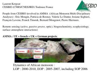
The Jason-1 – TOPEX/POSEIDON tandem mission ERS track (in black) used as a reference to compare Jason-1 and Jason-1+T/P
Priorities for Improving Measurements of Sea Surface Height Sea Surface Topography for Ocean Circulation Studies 2 (preferably 3) altimeters required for climate monitoring. Higher sampling required to monitor mesoscale ( < 100km, < 10 days). Improved geoid (GRACE/GOCE) will allow determination of absolute circulation patterns. Sea Surface Height for Assimilation in Operational Modelling Currents biggest source of uncertainty for offshore operators. Increased resolution of altimeter data would improve model accuracy Improved accuracy for Near Real Time Orbits. Tides Higher spatial resolution needed for internal tides, coastal tides, tides near topography. Coverage at higher latitudes ( > 66°). Coastal Issues MUCH higher resolution (< 10km, 1 hr) required. Smaller footprint, agile trackers to improve along track resolution near coast.
Users’ Requirements - Sea State • Research and operational applications require higher sampling to measure severe events. Models are not able to recreate the true variability in such storms. • Improved forecast accuracy can be expected if data from an increased number of satellite altimeters are assimilated into the wave models. • Accurate wave information is a major requirement for offshore operators. • Measurements of wave height, wave period, and full wave spectra are particularly important in new and challenging operating conditions. • "Rogue" waves are a topic of major current importance. A better understanding is required of conditions in which these types of waves are generated.
Priorities for Improvements of Measurements of Sea State • (Much) improved sampling in space and time required e.g. ~200km, 6 or 12 hourly. • Near real time availability of data ( < 3 hours, ideally < 1 hour). • Improved warning of storm surge events effecting vulnerable populations. • Rogue waves - when and where can they occur? • Improved performance at coasts. • Validation at high wave heights/wind speeds. • Wave direction and wave period.
How can we improve altimeters? • Increase Sampling Frequency • Swath Measurements. • Constellations of micro-satellites. • Use GPS reflections • Increase Along Track Resolution • Ka-band. • Use doppler spectrum. • Across track slope • Parallel altimeter tracks (e.g. Bi-static altimeters - “WITTEX” ) • Synthetic aperture altimeter • Swath altimeter • More wave information (direction/period) • Real aperture radar, SAR • Rotating asymmetric altimeter beam
Conclusions • The accuracy of altimeter measurements is adequate for all practical purposes but • Sampling by single satellites carrying narrow-swath altimeters is inadequate for: • (a) detection and tracking of mesoscale eddies that transport most of the heat within the ocean; • (b) delivery of real-time observations of sea-state at a frequency to match the rate of change of surface waves. How to satisfy these requirements? Two feasible approaches were identified: • 1. Fly new sensors that increase the swath width (e.g. Wide Swath Ocean Altimeter). • 2. Employ constellations of mini-satellites
Microsatellite Constellation GANDER - Real time global monitoring of sea state. 6 hours sampling from 10 GANDER microsats AlitKa - monitoring mesoscale variability Jason + 3 Altika on ENVISAT type orbit (35d), ~10 d coverage
Wide Swath / GPS reflections GPS reflection. 1d coverage from single receiver at 400km BUT to get ~cm accuracy need to average over ~10 days (25 km2 grid) Wide-Swath altimeter, Topex Orbit, fixed yaw coverage , 10 day coverage
Conclusions and recommendations for future missions Sampling by single satellites carrying narrow swath (~10km) altimeters is inadequate for: • Detection and tracking of mesoscale features in sea surface height (eddies, fronts, loop currents, etc) • Delivery of real-time observations of sea-state at a frequency to match the rate of change of surface waves. More, not fewer, altimeter observations are required to deliver operational oceanographic information to meet users’ needs. GAMBLE recommended an optimized convergent strategy for sea surface height and sea-state objectives, based on careful assessment of user requirements. Note since GAMBLE – Reports from ‘ ESA’s Innovative altimeter, and Operational Oceanography “Roadmap” studies – have lead to recommendations for altimeter configuration on board ESA Sentinel - 3 Mission
Recommendations for future missions Short Term (until 2007) • Maintain existing altimeter missions as long as they provide useful data. • Support continuation of laser tracking. The Mid Term (2008-2011) At the time of the GAMBLE Report - only one mission (Jason-2 / OSTM) was planned for this period - insufficient to maintain existing capabilities, never mind to achieve the important requirement of resolving mesoscale ocean features. Priority recommendation is for a satellite altimeter mission to be launched in 2007 to complement JASON-2/OSTM. • To make urgent plans, during early 2004, for at least one additional mission for launch by 2008. • Encourage operation of CRYOSAT to provide ocean data. • To encourage demonstration of new techniques, including altimeters for micro-satellites, wide swath altimeters, and new wave radars.
Recommendations for future missions (cont.) The long term situation (2011 and beyond) Maintain continuity of 20 day repeat TOPEX/Poseidon, Jason series, and 35 day repeat through altimeter(s) on ESA Sentinel Missions*. Develop and provide operational altimetric systems capable of providing operational monitoring on required time and space scales. This will require altimeter missions in addition to the two planned for this period. This is expected to be based on: • Constellation of altimeters, including low-cost microsatellite missions. • Operational wide swath altimeter mission Continue development of new techniques Satellite radar to measure wave spectra Use of reflected GPS signals. * ESA Operational Oceanography “Roadmap Study”, 2005
Last Words • The performance of satellite borne radar altimeters has probably contributed more to our understanding of global ocean process than any other single satellite sensor. • The last thing that any environmental change programme such as GMES should think of is cutting back on altimeter programmes. They need to be sustained and enhanced. • Europe is well placed to implement a system employing a constellation of comparatively inexpensive, dedicated small satellites to work in conjunction with the 'premium' research platforms. The benefits to the space industry would be matched by the socio-economic benefits to Europe providing a leading role in monitoring global climate change.