GEOG 3251: Mountain Geog, summer 2007 Adina Racoviteanu
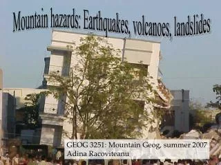
Mountain hazards: Earthquakes, volcanoes, landslides. GEOG 3251: Mountain Geog, summer 2007 Adina Racoviteanu. What is an earthquake?. Earthquake = Vibration of the Earth produced by the rapid release of energy Seismic waves = Energy moving outward from the focus of an earthquake .

GEOG 3251: Mountain Geog, summer 2007 Adina Racoviteanu
E N D
Presentation Transcript
Mountain hazards: Earthquakes, volcanoes, landslides GEOG 3251: Mountain Geog, summer 2007 Adina Racoviteanu
What is an earthquake? • Earthquake = Vibration of the Earth produced by the rapid release of energy • Seismic waves = Energy moving outward from the focus of an earthquake
Epicenter = spot on Earth’s surface directly abovethe focus Focus = location of initial slip on the fault; where the earthquake originates Why do earthquakes occur? • Fractures, faults • Energy released and propagates in all directions as seismic wavescausing earthquakes
Where do earthquakes occur? 1) Most earthquakes (90%) occur along the edge of oceanic and continental plates 2) Some along faults: normal, reverse, transform
Seismic waves: forms • P-waves: • compressional, or push-pull waves • Propagate parralel to the direction in which the wave is moving • Move through solids, liquids • S-waves: • Called shear waves • Propagate the movement perpendicular to the direction in which the wave is moving • Surface waves (L-waves or long waves). • Complex motion • Up-and-down and side-to-side • Slowest • Most damage to structures, buildings
Earthquake size: two ways to measure • Magnitude:Richter Scale • Intensity: Mercalli Scale
7 992 times more energy!! 31.5 times energy 6 1) Richter Scale • Measures the energy released by fault movement • related to the maximum amplitude of the S wave measured from the seismogram • Logarithmic-scale 5
2) Intensity:Mercalli Scale: • What did you feel? • Assigns an intensity or rating to measure an earthquake at a particular location (qualitative) • I (not felt) to XII (buildings nearly destroyed) • Measures the destructive effect • Intensity is a function of: • Energy released by fault • Geology of the location • Surface substrate: can magnify shock waves e.g. Mexico City (1985) and San Francisco (1989)
Largest earthquake in the world • More than 2,000 killed, 3,000 injured, 2,000,000 homeless, and $550 million damage in southern Chile • tsunami caused 61 deaths • $75 million damage in Hawaii; • 138 deaths and $50 million damage in Japan; • 32 dead and missing in the Philippines; and $500,000 damage to the west coast of the United States. Chile : May 22, 1960 Magnitude 9.5
Later that year… Arequipa. S.Peru June 2001
Earthquake damage • Ground Failure - constructions collapse • Fires - from broken gas and electrical lines • Landslides - EQ's triggered; occur in hilly/mountainous areas. • Liquefaction - water-saturated, unconsolidated materials flow • Tsunami (seismic sea waves; "tidal" waves) - can grow up to 65 m
Natural disasters in the Cordillera Blanca, Peru: Huascaran avalanche
Favoring conditions • Major tectonic faults that are active • Marked glacierization • Geologically young, steep mountains • Pro-glacial lakes • Immediate vicinity of human settlements
Mass wasting: types • Creep • Landslides: rock slides • Flows: avalanches, debris flow, mud flow • Falls
Landslide and Debris Flow (Mudslides): • masses of rock, earth, or debris saturated with water and moving down a slope • They are activated by: • storms, • earthquakes, • volcanic eruptions, • fires, • alternate freezing or thawing, • steepening of slopes by erosion or human modification.
Avalanche: • similar in mechanism to landslide • it involves a large amount of ice, snow and rock falling quickly down the side of a mountain • ice builds in cornices or forms over a weaker layer of snow, creating the danger of an avalanche.
ALPAMAYO Nev. Chacraraju
1962 HUASCARAN AVY • Large snow year • 50 degree F increase in temp over a few minutes • Caused avalanche • 4,000 fatalities
1970 Avalanche • Triggered by 7.7 magnitude earthquake • Rock face failure • Incorporated 30 meters of snow and ice! • Moraines confined flow initially • Accelerated over a distance of 2.4 km • Became airborne at change of slope
Landslides: May 30, 1970 Peru disaster Magnitude: 7.9 • A large mass of ice and rock slid from a vertical face on Nevado Huascaran, the highest peak in Peru • Debris reached a velocity of 280 km/hr • traveled 11 km horizontally in about 4 minutes at a mean velocity of 165 km/hr. • Buried the towns of Yungay and Ranrahirca, The death toll in both villages was 20,000.
1970 Earthquake that caused the Huascaran disaster killed about 40,000 people in Huaraz. Streets of Huaraz after the 1970 Earthquake. Adobe houses collapsed, killing people inside.
Church before 1970 avalanche. Note palm trees in foreground.
Yungay is now completely abandoned. Cemetery has a monument to the dead.