Download
1 / 14
140 likes | 155 Views
This project focuses on studying land use dynamics at the urban-rural fringe, particularly in Metro Detroit, and their ecological effects. The research aims to develop agent-based models of land use, compare them with historical changes, and use them to evaluate future scenarios. The project also explores complementary methodologies such as GIS, survey research, spatial analysis, and remote sensing.

E N D
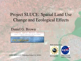
Land Cover and Land Use Change Project SLUCE: Spatial Land Use Change and Ecological Effects Daniel G. Brown With funding from Biocomplexity CSISS ABM-LUCC Workshop, Irvine CA, 10/4/01
The Team: Dan Brown, GIS, spatial analysis Scott Page, economics, complex sys Joan Nassauer, landscape architecture Rick Riolo, complex systems Bob Marans, survey research, urb. plan. Carl Simon, mathematics, complex sys Bobbi Low, behavioral evolution Kathleen Bergen, remote sensing David Allan, aquatic ecology Timing and People • Four-year project begins October 2001 • Involves faculty from: School of Natural Resources & Environment, Center for the Study of Complex System, Urban and Regional Planning, and the Institute for Social Research • In addition to research questions, objectives include extending models, data, model results, and insights into UM classes and through internet communities.
Agent-Based Models Spatial Analysis/ Remote Sensing Land Use Change Social Surveys and Scenarios Basic Goals • Focuses on land use dynamics at the urban-rural fringe (i.e., Metro Detroit) and their ecological effects. • Develops agent-based models of land use that will be compared with recent (~50 yrs) changes and used for evaluating future scenarios. • Explores and implements complementary methodologies (ABM, GIS, survey research, spatial analysis, remote sensing).
Research Questions • What are the dynamics that determine the ecological impacts of land development? • What feedbacks are most important in describing land pattern evolution? • Are there dominant tipping points/processes in the land development process? • What do system dynamics tell us about appropriate strategies for minimizing ecological impact? • What are the multi-scale patterns and dynamics of the land use and cover evolution (i.e., township, field, yard/subdivision) and appropriate scales of intervention?
Methodological Questions • How should we resolve the tension between the needs for model simplification on the one hand, to evaluate complexity and essential emergent properties, and model realism on the other, to facilitate scenario generation? • How can we generate agent rules that reflect responses from social surveys and their heterogeneity? • What land pattern descriptions best characterize emergent properties of system dynamics and ecological consequences?
Agent-Based Models Spatial Analysis/ Remote Sensing Land Use Social Surveys and Scenarios Model Building Approach • Begin using Swarm, adding tools as necessary. • Develop hypotheses and research questions through group discussion. • Include specific policy questions that can be addressed in the models. • Build several models over the course of the project. • Start with simple models to evaluate system dynamics, then build more complex models for scenario testing.
Initial System Description Ecological/ Habitat Impact Agents Landscape Structure Terrain Levers Land Cover Aesthetic Quality Mapped Attributes Landscape Decisions Water Development Density Land Use Distance from Services Subsidies Farmers Home Buyers/ Developers Land Use Change Profit Crop Price Zoning & Set-Asides Community Indicators Population Growth Climate Variability Yield Soil
Agent-Based Models Spatial Analysis/ Remote Sensing Land Use Social Surveys and Scenarios Selection of Townships for Collecting Spatial-Temporal Data • Typology based on 22 variables describing population (e.g., numbers and characteristics), housing units (incl. value), land cover, roads. • Provides a framework for selecting townships for study. Flint Detroit Ann Arbor
Land Use Data Sources • Parcel maps created at approx. 10 year intervals, showing ownership • Images of multiples scales (e.g., aerial photos, satellite images) • Interpretation of land use facilitated by overlaying parcels on images. Waterford Twp., Oakland Co.
Time Series Data for a Township Waterford Township, Oakland County Land Use Land Cover Plat Maps Photos Landsat Images 1997 1995/2000 1999/2000 1988 1987 1996 1977 1976 1992 1970 1970 1988 1956 1957 1984 1940 1940 source: Landsat 1872 source: USGS, SEMCOG, FSA Others available: 1920, 1908, 1857, 1836 source: Rockford Publishers, Map and Bentley Libraries
Land Use Legend Land Cover Legend F o r e s t Forest R e s i d e n t i a l O p e n W a t e r C o m m e r c i a l A g r i c u l t u r e W e t l a n d Not Forest T r a n s / U t i l i t y O p e n / G r a s s Water R e c r e a t i o n a l O l d F i e l d / Y n g F o r e s t Example Site (1 of 136) Land Cover Land Use
Agent-Based Models Spatial Analysis/ Remote Sensing Land Use Social Surveys and Scenarios Survey Research • Detroit Area Study (DAS) 2001: Interview and mail surveys of residents’ perception of quality of life on a number of social and environmental indicators. Includes information about residential location decisions (over 4000 respondents). • Landscape Architecture: Web-based and interview surveys of residents’ cultural acceptability of various, including innovative, landscape designs.
Landscape Survey Results: Yards • At the yard parcel scale: • Yards with some ecological benefits were the most attractive across all respondent groups.
Landscape Survey Results: Subdivisions • Subdivision scale designs with the most beneficial ecological function - less lawn area and more forest or prairie - were most attractive across all respondent groups.