Air Masses, Fronts, and Storms
190 likes | 394 Views
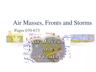
Air Masses, Fronts, and Storms. Prof. John Toohey-Morales, CCM St. Thomas University Miami Gardens, Florida. Air Mass Classification. Air mass is an extremely large body of air whose properties of temperature and humidity are fairly similar

Air Masses, Fronts, and Storms
E N D
Presentation Transcript
Air Masses, Fronts, and Storms Prof. John Toohey-Morales, CCM St. Thomas University Miami Gardens, Florida
Air Mass Classification • Air mass is an extremely large body of air whose properties of temperature and humidity are fairly similar • Classified according to their temperature and humidity
Air Mass Classification • Polar (P) masses originate in polar latitudes • Tropical (T) masses originate in warm tropical regions • Continental (c) masses originate over land • Maritime (m) air masses form over water
Air Mass Behavior • Continental Polar (cP)
Air Mass Behavior • Maritime Polar (mP)
Air Mass Behavior • Maritime Tropical (mT)
Air Mass Behavior • Maritime Tropical (mT)
Air Mass Behavior • Continental Tropical (cT)
Fronts • A transition zone between air masses with different densities, usually separating air masses with contrasting temperatures • Stationary fronts have almost no movement
Finding Fronts • Sharp temperature changes over a relatively short distance • Changes in air moisture content • Shifting winds • Pressure changes • Cloud and precipitation patterns
Go to Visualization Cold Fronts • Has cold, dry polar air replacing warm, moist air • Most move towards the south, southeast or east
Go to Visualization Warm Fronts • Warm, moist air replacing retreating cold air
Go to Visualization Occluded Fronts • Cold front catches up and overtakes the warm front • Most prevalent type of front that moves into the west coast of the U.S.
Go to Visualization Cyclogenesis • Mid latitude cyclones form outside the tropics at mid and high latitudes • In Polar Front Theory, storms form along the polar front • Frontal Wave • Open Wave • Occlusion
Upper Level Support • Upper level divergence must be greater than the surface convergence for lows to develop and strengthen (need an upper level trough to the west of the surface low) • This leads to a drop in surface pressure and intensification
Upper Level Support (contd.) • Upper level convergence leads to filling of surface lows or building highs (upper trough to the east) • Upper level winds steer the storms
Go to Visualization Upper Level Support (visual)
Go to Visualization Upper Level Support (visual)