Download
1 / 19
190 likes | 224 Views
Learn about the evolution of section corner identification in Madison County, from the challenges faced in the past to the current SCID Program, which allows local surveyors to submit accurate GPS coordinates of section corners. Discover how this program has improved accuracy, reduced disputes, and streamlined the process for legal descriptions and mapping projects.

E N D
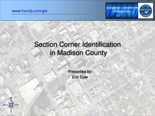
Section Corner Identification in Madison County Presented by: Erin Dyer
Elusive Section Corners • 20 years ago, plats and legal descriptions based on estimated section corners resulted in bad data • Projects were hampered by the inability to acquire accurate coordinates
Base Map Standardization • In 1985, the City’s base maps were standardized and output to large scale maps using corners from Quadrangles • Subdivision plats entered using PLSS had frequent errors because the corners in the field did not match those scaled off on the base maps
Road to Accuracy • In 1987, GPS coordinates were used to georeference base maps and for ground control of mapping projects • Positional accuracy for base maps leaped forward • GPS technology was new and costly; locating and documenting section corners was impractical at the time
Subdivision Regulation • In 1994, subdivision regulations were implemented requiring state plane coordinates for all points defining a subdivision boundary • These coordinates were based on the City’s GPS monuments • The input of subdivisions based on section corners problem was solved
Legals and LOMARs • Legal descriptions entered weekly all begin at a section corner thus requiring significant manipulation • In 2005, a LOMAR dispute ensued between a developer and the City because of an 80 ft difference between the referenced section corner and the mapped section corner • The solution involved additional work and untimely delays
Enough is Enough • Gone are the days when GPS was expensive and sparsely available • Local surveyors are already collecting section corner data • Tim Barnes approached the Tennessee Valley Professional Land Surveyors Society and proposed the SCID Program
SCID Rules • Corner Information must be submitted only by surveyors licensed in the State of Alabama. No blind Submittals will be accepted. • GPS occupation of the corner is preferred although in some cases traditional surveys combined with GPS occupation will be accepted • GPS occupations and traditional surveys should be performed in compliance with The Standards of Practice for Surveying in the State of Alabama • All submittals are voluntary and subject to publication. • Data may be submitted online or in hard copy to The City of Huntsville GIS Division. • Data submitted will not be a direct entry into the database. It will be reviewed and published by the GIS staff. • Submittals for the same corner will be published on a first come, first published basis. • Only section corners, quarter section corners and meaningful ancillary points will be accepted. • Disputes over corner coordinates shall be submitted to the City of Huntsville GIS division for review. • To avoid duplication of database records, all coordinates will be published as the Northwest corner.
SCID Pitch • Local surveyors would occupy purported section corners or quarter section corners with GPS units during their normal business routines • They would voluntarily submit the coordinates to the City’s GIS Division • The GIS Division would publish the coordinates on an Internet site • The GIS Division would also agree to move the base map corners to the GPS’d coordinates
Fields: Key Township Range Section Corner Meridian State Plane Zone Easting Northing NAVD 1929 Latitude Longitude NAD 1988 Determination Method Location Date Description License Number Submitted By SCID Database
SCID Submission • Created website www.hsvcity.com /gis/SCID/SCID_index.htm where the rules are posted along with a data submission form that can be submitted via FAX, USPS or email
Data Entry • Data is keyed in to a ArcSDE database table • An XY Event theme is created from the XY data in the database table so that each new record automatically displays as a point on the map
QA / QC • We decided to publish corners as the Northwest corner to prevent duplicate entries • The Key field is summarized for unique record counts to prevent duplicates • Utilizing the XY event theme curtails typos in the XY fields
ArcIMS & SCID • ESRI’s ArcGIS was used to create the .mxd • ESRI’s ArcIMS software was used to create the interactive map service / website • The XY Event and other layers displayed are pulled directly from the ArcSDE server • The XY Event allows the tabular data to display immediately in ArcIMS as point features
Interactive SCID http://gismaps.hsvcity.com/website/scid/viewer.htm
SCID Search • Search spatially by Zoom and Pan tools
SCID Search • Search records by Find or Query tools
SCID Statistics • Located Corners Statistics • NW Section Corners: 162 • NW Corner of the NE ¼ : 59 • NW Corner of the SW ¼ : 57 • NW Corner of the SE ¼ : 33 • Ancillary Points: 9 Total Points Collected: 320
SCID Results • Legal descriptions for easements, minor subdivision plats, rights of way, zoning lines, annexations and other land parcels are an easier fit to base map data • The pincushion effect (where many pins are driven into the ground around a purported section corner because one surveyor refuses to hold the existing monument because he believes his 1/100 ft difference is more correct) is lessened • Technical problems are being solved and the cooperation between the public and private sectors benefits all