Download
1 / 35
350 likes | 554 Views
Mapping South Asian dry dipterocarp forest using dual-season satellite imagery. Hugh Stimson, Melissa Songer & Peter Leimgruber 2nd Smithsonian Geographic Information Systems Conference February 11, 2005 National Zoological Park

E N D
Mapping South Asian dry dipterocarp forest using dual-season satellite imagery. Hugh Stimson, Melissa Songer & Peter Leimgruber 2nd Smithsonian Geographic Information Systems Conference February 11, 2005 National Zoological Park Conservation & Research Center Conservation GIS Lab
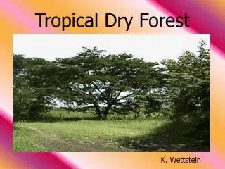
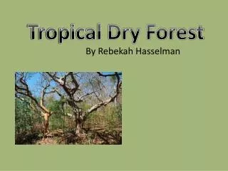
Dry Dipterocarp Forest “Indaing” High Indaing Low Indaing • South East and South Asia • Highly seasonal • Regular burning • Occurs near humans
Dry Dipterocarp Forest “Indaing” Eld’s Deer Cervus eldi thamin Leopard Panthera pardus Bateng Bos javanicus • also Asian Hare, Barking Deer, others
Dry Dipterocarp Forest “Indaing” • Cervus eldi thamin • Dry Dipterocarp Forest preferred habitat • Gone from most of former range • Habitat loss most significant threat • Resident of CRC
Dry Dipterocarp Forest “Indaing” • Agricultural replacement • Timber and non-timber extraction
Sensing and Mapping Chatthin National Park December 2000 ASTER image Chatthin National Park March 2000 ASTER image
Sensing and Mapping November 2001 Landsat image March 2000 Landsat image
Sensing and Mapping -- Protected Areas Systems Review of the Indo-Malayan Realm Asian Bureau for Conservation
Dual-Season Sensing November 2001 image – wet season March 2000 image – dry season
November 1 2003 MODIS image – wet season April 7 2003 MODIS image – dry season Dual-Season Sensing • Moderate-Resolution Imaging Spectroradiometer (MODIS) • NASA operated • 1-2 day temporal resolution • 36 discrete bands • 250, 500, or 1000m pixels • 2300km swath • several pre-processed products • freely available
880-660 880+660 NDVI Dual-Season Sensing Normalized Differential Vegetation Index (NDVI)
November 1 2003 MODIS image – wet season April 7 2003 MODIS image – dry season Dual-Season Sensing • Moderate-Resolution Imaging Spectroradiometer (MODIS) • NASA operated • 1-2 day temporal resolution • 36 discrete bands • 250, 500, or 1000m pixels • 2300km swath • several pre-processed products • freely available
November 1 2003 MODIS image – wet season Raw data for classification. April 7 2003 MODIS image – dry season Dual-Season Sensing • Moderate-Resolution Imaging Spectroradiometer (MODIS) • NASA operated • 1-2 day temporal resolution • 36 discrete bands • 250, 500, or 1000m pixels • 2300km swath • several pre-processed products • freely available
Dual-Season Sensing March 7 2002 ASTER image – dry season • Advanced Spaceborne Thermal and Emmission and Reflection Radiometer (ASTER) • NASA and Japanese Ministry of Economy Trade and Industry operated • 14 discrete bands • 15, 30, or 90m pixels • 60km swath November 24 2001 ASTER image – wet season
Dual-Season Sensing March 7 2002 ASTER image – dry season • Advanced Spaceborne Thermal and Emmission and Reflection Radiometer (ASTER) • NASA and Japanese Ministry of Economy Trade and Industry operated • 14 discrete bands • 15, 30, or 90m pixels • 60km swath Imagery for training classifactation. November 24 2001 ASTER image – wet season
November 1 2003 MODIS image – wet season April 7 2003 MODIS image – dry season Dual-Season Analysis
dry season NDVI wet season NDVI Dual-Season Analysis
Dual-Season Analysis dry season NDVI wet season NDVI
Dual-Season Analysis dry season NDVI wet season NDVI
Dual-Season Analysis dry season NDVI wet season NDVI
dry season NDVI wet season NDVI Dual-Season Analysis
Results Results of supervised classification.
Results Results of supervised classification.
Results • Remaining to do: • Develop a landscape-level accuracy assessment approach. • Try including a digital elevation layer in the classification model.
Thanks: Thomas Mueller, Dan Kelly, Jamie Robertson, Kevin Koy National Zoological Park Conservation & Research Center Conservation GIS Lab