Download
1 / 28
280 likes | 317 Views
Learn about the PRF Vegetation Index Insurance Program that protects against losses of forage production on grazing and hayland. The program uses satellite data and temperature measurements to determine vegetation index values, offering insurance coverage based on actual plant growth. Producers can select acres to insure and may receive indemnity payments if vegetation growth falls below normal values.

E N D
Pasture Range Forage Vegetation Index Insurance James B. Johnson Vince Smith MSU Department of Agricultural Economics and Economics Collaborating Partners: Billings RMA Regional Office Fort Peck Community College Riverton, Wyoming February 23, 2009
Pasture, Rangeland, Forage Vegetation Index (PRFVI) Pilot Program • A pilot insurance program that provides protection against losses of forage on grazingland and/or or hayland. • PFRVI insurance is available in all Wyoming counties.
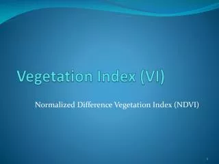
PRF Vegetation Index Insurance Program • A vegetation index is used to indicate the amount of forage production on grazing land and hayland. • The vegetation index is called the Normalized Difference Vegetation Index (NDVI). • The NDVI index is a “temperature constrained” index calculated from: • (a) Satellite vegetation data provided by the U.S. Geological Survey Earth Resource Observation and Science data center • and • (b) “Gridded” average daily temperature data produced by the National Oceanic and Atmospheric Administration (NOAA).
PRF Vegetation Index Insurance Program • The raw NDVI Index takes on values from 0.0 to 1.0. • It is based on reflection measurements that indicate the amount of vegetation on the ground. • Visible light values are sensitive to the amount of green chlorophyll in a plant which can absorb light, while infrared light is sensitive to the amount a plant cells inside a leaf which reflect back to a satellite. • The more chlorophyll, the higher the NDVI value recorded by a satellite's sensor.
PRF Vegetation Index Insurance Program • Vegetation can remain green in very cold or very hot weather and yet not grow. • So, the raw satellite vegetation index data are corrected using “on the ground” measures of temperatures provided by NOAA to more closely reflect actual plant growth • Optimum plant growth temperatures are also adjusted for the elevation of the area to which each NDVI applies.
Pasture, Rangeland, Forage Vegetation Index (PRFVI) Pilot Program • The PRFVI is: • A Group Risk Program that provides insurance against reductions in the NDVI below its average value for each insurance or “grid” area. • The product is used by producers with forage production on grazingland or hayland (feed for livestock comprised of plants grown for haying or grazing). • Producers need to recognize that it is possible for them to have low forage production on the acreage they insure and still not receive a payment under this group risk plan. • The actuarially fair Insurance premiums are subsidized by the federal government
PRF Vegetation Index Insurance Program: Concepts • Most GRP insurance programs are based on county level information • The PRFVI program is based on geographic grids. • A grid includes all land within is 4.8 mile by 4.8 mile area and is identified by longitude and latitude. • A unique NDVI exists for each grid in each insurance time period.
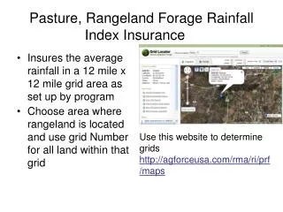
PRF Vegetation Index Insurance Program: Concepts • Grid Identification Number (GRID ID): A specific code associated with each grid contained in the actuarial documents for the PRFVI program. • The grid ID is determined by a geographic “point of reference” selected by the forage producer that identifies the location of the area the producer wants to insure. A part (but not all) of the area to be insured must be in the selected GRID • The RMA website provides producers and insurance agents with information about the NDVI for each grid and the PRFVI product for that grid.
PRF Vegetation Index Insurance Program: Concepts • The insured crop is defined as pasture, rangeland, or forage. • There are two crop types: grazinglandand hayland. • Grazingland has an established stand of forage suitable and intended for grazing by livestock. • Hayland has an established stand of forage suitable and intended for haying.
PRF Vegetation Index Insurance Program: Acres to be Insured • A producer does not have to insure all of the insurable acreage of grazingland or hayland in a grid. • The producer chooses the acres to be insured. • Some grazingland may not be insurable (for example, the area may be too steeply sloped, or too far from water for livestock to graze it). • Some land in a hayland area may also be uninsurable (because it is not suitable for mechanical harvesting).
PRF Vegetation Index Insurance Program: General Principles • Each grid’s NDVI index is normalized so that the value of 100 represents average vegetation growth. (Historical values for each grid’s NDVI are available on RMA’s PRF website). • A producer will receive an indemnity payment when the NDVI value for the grid falls sufficiently far below its normal value in the vegetation production period in which the producer’s has chosen to insure against poor forage growth.
PRF Vegetation Index Insurance Program: Implementation • The crop year for the PRFVI product begins on April 1 of the current year and ends on March 31 the following crop year. • The crop year is divided into four periods referred to as the “index intervals.” These intervals are: • Interval I: April 1 through June 30 • Interval II: July 1 through September 30 • Interval III: October 1 through December 31 • Interval IV: July 1 through March 31 • A producer must select the interval(s) for insuring forage production on the hayland and/or grazingland to be covered in each grid.
PRF Vegetation Index Insurance Program: Interval Selection Each producer must decide on which intervals they want to select to insure against losses in forage production. For example: A producer may be concerned that a lack of Fall or Winter precipitation could result in lack of forage in Interval II. So the producer may choose to insure against low levels of vegetation production in a grid in that interval A producer’s forage stand of 1280 acres may have a mixture of plant species maturing at different times of the year. For instance, there may be the early season grasses and late season grasses within an insurable grazingland parcel. So the producer may want to insure 480 acres in interval I and 800 acres in interval III.
PRF Vegetation Index Insurance Program: Amount of Insurance • County Base Value: The production value of grazingland or hayland forage production in a county (determined by RMA for each county). • Coverage Level: The percentage of the county base value chosen by the producer for insurance coverage on forage production. • A producer may choose a coverage level of 70, 75, 80, 85 or 90 percent. • Producers must insure each grid in the same county at the same coverage level. • CAT coverage is not available for the PRFVI.
PRF Vegetation Index Insurance Program: Amount of Insurance Grazing land and hayland have different county base values. For example, in Fremont county: Country base value for grazingland = $8.72 per acre County base value for hayland = $197.65 per acre (and is the same for all Wyoming counties).
PRF Vegetation Index Insurance Program • Productivity Factor: A percentage between 60 and 150 percent chosen by the insured producer to reflect their individual operation’s forage productivity relative to the county base value. • Producer Share: The operator’s share of the forage production. • Producers may select coverage levels and productivity factors to reflect the forage production value of the acreage they are insuring. • For example, a producer may believe that the value of forage production on the insured area is similar to the county base value. • So the producer may select a coverage level (say 90%) and productivity factor (say 110%) to obtain coverage approximately equal to the county base value.
PRF VegetationIndex Insurance Program: Amount of Insurance • Dollar Amount of Protection per Acre=county base value per acre for the crop type x coverage level x productivity factor. • A producer can select only one dollar amount of protection for each crop type in a grid. • Policy Protection per Unit: The dollar amount of protection per acre x the number of insured acres x the producer’s share of the area insured in each unit. • A producer may have between one and four units in each grid, reflecting the number of index intervals in which the producer has purchased insurance. • Policy Protection: The sum of the policy protections chosen by the producer for each insured unit in a grid.
PRF VegetationIndex Insurance Program: Insurance Premiums For Each Unit: Total Premium = Dollar Protection Per Acre x Number of Insured Acres/Unit x Premium Rate per $100 of Insurance x Adjustment factor (=0.01) x Producer Share Premium Subsidy = Premium per Unit x Subsidy rate Producer Premium = Total Premium per unit − Premium subsidy per unit * The adjustment factor expresses the premium rate on a per dollar of insurance rate because the premium rate is quoted in terms of dollars per $100 of insurance.
PRF Vegetation Index Insurance Program: Indemnities • Indemnitiesare paid when the grid’s average NDVI index for a specific interval is sufficiently low. • The Expected GRID Indexfor each interval is established by the Risk Management Agency using historical data on the NDVI for that interval and always equals 100. • The Expected Grid Index is therefore known to a producer prior to the November 30 sales closing date. • A producer can examine a grid’s NDVI historical values for each interval for the period 1989 to the current year using the RMA website for the PRFVI.
PRF Vegetation Index Insurance Program: Indemnities • The Final Grid Index Value for a specific interval is determined by the Federal Crop Insurance Corporation using the average NDVI value observed for the grid during the interval. • An NDVI value of 100 represents the average value for the index in the interval of interest. • An NDVI value of less 100 represents a lower than average value for that interval (and lower than average plant growth in the grid in that interval). • The Final Grid Index Value for an interval can only be calculated after the end of the interval.
PRF Vegetation Index Insurance Program: Indemnities • The Trigger Grid Index = 100 x the coverage level (selected by the producer). • An indemnity payment is made if the Final Grid Index (determined by RMA) is less than the Trigger Grid Index. • Indemnity payment = Policy Protection per Unit x Payment Calculation Factor (PCF). • where • PCF = [Trigger Grid Index – Final Grid Index]/ Trigger Grid Index. • Insurance payments are relatively timely as final grid indexes can be computed immediately after each index interval has ended and no information about forage yields has to be provided by producers.
PRFVI Insurance Program: A hayland example in a Fremont county grid
PRFVI Insurance Program: A hayland example in a Fremont county *Producers also must pay an additional $30 administration fee
PRF Vegetation Index Insurance Program • Indemnity Per Unit = Policy Protection per Unit x Payment Calculation Factor • = $62,614 x [(90 – 65) / (65)] • = $62,614 x 0.2777 - $17,388
PRF Vegetation Index Insurance Program • PRF is not available at the catastrophic coverage level (CAT level). • The Farm Service Agency policy applicable to the 2009 production year is therefore that NAP (Noninsured Crop Disaster Program) may be used for: • Rangeland production in all Wyoming counties • Hay production for all types except: • Alfalfa • Alfalfa/grass • Grass/alfalfa
PRF Vegetation Index Insurance Program • Producers should remember that NAP is available on a fee per crop basis (not acre), and covers only losses in excess of 50% of the established yield (per SSA) at 55% of the average marketing price for FSA.
PRF Vegetation Index Insurance Program Program Summary • The PRFVI is a pilot group risk insurance program in Wyoming • Sales closing date is November 30. • The program covers grazingland and hayland production in all Wyoming counties. • This program is based on a vegetation index calculated for four periods during the crop year (index intervals) that indicate the relative amount of greenness on the ground (as a substitute or proxy variable for forage production). • In Wyoming, even though PRF is available, producers who do not use the PRFVI may NAP for rangeland production and some types of hay production.