Download
1 / 49
500 likes | 678 Views
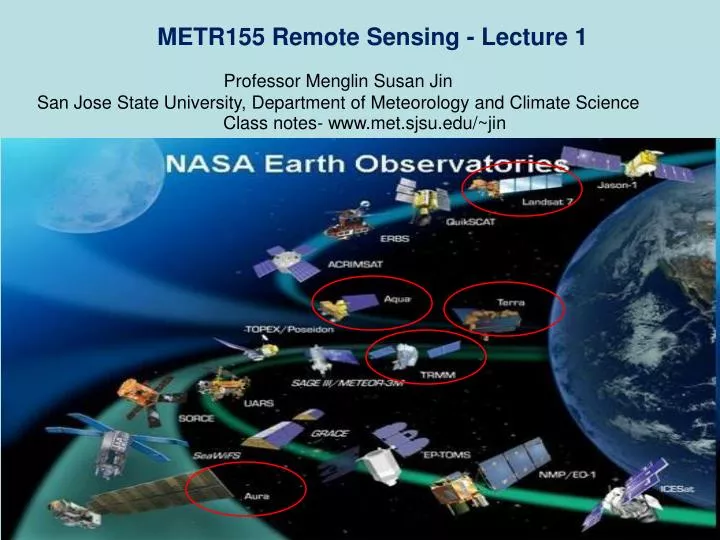
METR155 Remote Sensing - Lecture 1. Professor Menglin Susan Jin San Jose State University, Department of Meteorology and Climate Science. Class notes- www.met.sjsu.edu/~jin. Outline of today’s lecture Introduction and Welcome Discussion on the “Greensheet” – overview of this class

E N D
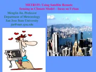
METR155 Remote Sensing - Lecture 1 Professor Menglin Susan Jin San Jose State University, Department of Meteorology and Climate Science Class notes- www.met.sjsu.edu/~jin
Outline of today’s lecture • Introduction and Welcome • Discussion on the “Greensheet” – overview of this class • Learning Contract • First Glance on the Power of Remote Sensing from Space • Get-to-know each other exam
For greensheet, class ppt notes http://www.met.sjsu.edu/~jin/METR155fall2011.htm
About Professor A very good scholar www.met.sjsu.edu/~jin 1. Research projects: funded by NASA, NSF, Department of Defense On land surface climate change, urbanization, remote sensing 20 leading author papers on top journals 2. to be an effective teacher • approachable, • respectful
Goal METR155 will help you to know the Fundamentals of Remote Sensing, Satellite Observations for Climate Change Research, and gain appreciation of the complexities involved with climate change issues
Fore METR155 Students Homework: 30% (12-15 homework) Midterm Exam(I and II): 40% Class Participation 5% Final Exam: 25% Scale: 90+ A, 80’s B, 70’s C, 60’s D, <60 F Homework will be assigned in class collected in discussions on 1.5 weeks later.
Fore METR280 Students (graduate students) Homework: 30% (12-15 homework) Midterm Exam(I and II): 40% Class Participation 5% Research Project 20% Final Exam: 25% Scale: 105+ A, 90’s B, 78’s C, 65’s D, <65 F Homework will be assigned in class collected in discussions on 1.5 weeks later.
Content The structure of the course include: Part 1: Basic theory –radiation, sensor design, orbit Part 2: Image Processing and Retrieval Skin Temperature, Vegetation Index Cloud Effective radius Part 3. Application in Climate Research. Mid-term1 Research project Mid-term2 Research Report Final Exam See the greensheet for details
Why Remote Sensing Strictly speaking, this course is designed to give an introduction to the topic of remote sensing on earth system and climatology • Remote sensing systems are • Instructors area of research • Wide area of interest with availability of sensor data (Google Earth) • Examples in this course concentrate on terrestrial and atmosphere remote sensing • The goal is not to teach remote sensing, but to familiarize with • Jargon/terminology from remote sensing • underlying physics • Methods introduced here are used in a variety of other fields • Biomedical imaging • Astronomical studies • Industry and manufacturing • Each field has its own idiosyncrasies that will drive the
Lecture Hour: 1:00 – 2:15 PM, Tuesday and Thursday Place: DH615 Office Hour: Wednesday 1:30 -2:30 PM Tuesday 2:15-3:15 PM Place: MSJ’s Office (DH613) TA: Henry @DH619 • I will meet with you for extra office hour whenever you need. • send email for appointment.
References: Close-to-be Textbook King, M. D. et al. 2007: Our Changing Planet: The View From Space. Cambridge; New York : Cambridge University Press,, 2007 Schowengerdt, Robert A.: Remote Sensing Models and Methods for Image Processing (2nd edition). Academic Press. Reference Book Schott, J. R. 1997: Remote Sensing: The Image Chain Approach. Oxford University Press. • Useful materials will be assigned on webpage/homework/class
Learning Contract • Instructor • On time and prepared. • Answers questions. • Approachable and friendly. • Fair with assignments and grades. • Genuinely concerned about your learning and intellectual development.
Learning Contract • Students • Make every effort to arrive on time; and if late, enter class quietly. • Preserve a good classroom learning environment by a) refraining from talking when other people are talking b) turning off cell phones. • Be courteous to other students and the instructor. • Aware that learning is primarily their responsibility. • Aware of universities policy on academic integrity and pledge to abide by them at all times. • Have read and understand what plagiarism is and know how to cite sources properly.
Academic Integrity • Integrity of university, its courses and degrees relies on academic standards. • Cheating: • Copying from another’s test, cheatsheet etc. • Sitting an exam by, or as, a surrogate. • Submitting work for another • Plagiarism: • Representing the work of another as one’s own (without giving appropriate credit)
Plagiarism • Judicial Affairs http://sa.sjsu.edu/judicial_affairs/index.html • Look at the Student Code of Conduct • Read through SJSU library site on Plagiarism http://www.sjlibrary.org/services/literacy/info_comp/plagiarism.htm • http://turnitin.com/
“Getting Acquainted" QuizClass Participation • Write three sentence about Quantum Physics • What is Electromagnetic Spectrum? • What are Transmittance, Absorptance, and Reflectance? • Why do we need remote sensing from space? • What are the advantages of remote sensing technique, you feel? • What are the disadvantages of remote sensing, you feel?
More on Quiz • To ensure the good communication between professor and students, how would you feel that the professor is approachable? • After each class, how many hours do you to spend to go over class material?
Let’s see Remote Sensing: Needs and Examples . • Why do we need remote sensing from space? • What are the advantages of remote sensing technique? • What are the disadvantages of remote sensing? .
MODIS Snow Observations See this video at http://www.met.sjsu.edu/~jin/video/GlobalSnow.mpg
Advantages of MODIS snow (pervious video) • High resolution (1km) • High Coverage (global) • Can assess remote regions including mountains and polar regions • Continuous observations (2-per-day, 10 years)
Fire Observation on Mountain Etna In July 2001 Mt Etna on the island of Sicily exploded dramatically into life. See this video at http://www.met.sjsu.edu/~jin/video/MtEtna.mpg
Himalayas Land cover, Elevation Surface roughness Snow coverage Surface temperature Vegetation albedo See this video at http://www.met.sjsu.edu/~jin/video/Himalayas.mov
Katrina See this video at http://www.met.sjsu.edu/~jin/video/katrina-visir_sm.mov
Clouds and Aerosol video: Aerosol-GRECE_1 See this video at http://www.met.sjsu.edu/~jin/video/aerosol-GRECE_1.mov
Concept of Remote Sensing “Remote sensing” is something we do all the time! Several of the human senses gather their awareness of the external world almost entirely by perceiving a variety of signals, either emitted or reflected, actively or passively, from objects that transmit this information in waves or pulses.
A formal and comprehensive definition of applied remote sensing • Remote Sensing in the most generally accepted meaning refers to instrument-based techniques employed in the acquisition and measurement of spatially organized (most commonly, geographically distributed) data/information on some property(ies) (spectral; spatial; physical) of an array of target points (pixels) within the sensed scene that correspond to features, objects, and materials, doing this by applying one or more recording devices not in physical, intimate contact with the item(s) under surveillance (thus at a finite distance from the observed target, in which the spatial arrangement is preserved); techniques involve amassing knowledge pertinent to the sensed scene (target) by utilizing electromagnetic radiation, force fields, or acoustic energy sensed by recording cameras, radiometers and scanners, lasers, radio frequency receivers, radar systems, sonar, thermal devices, sound detectors, seismographs, magnetometers, gravimeters, scintillometers, and other instruments. This is a rather lengthy and all-inclusive definition
make a list of key words in it • Acquisition/measurement; • data/information; • properties; • phenomenon,... • material; • recording device; • not in contact; • measuring field; • radiation; • instruments.
two more simplified definitions • First: Remote Sensing involves gathering data and information about the physical "world" by detecting and measuring signals composed of radiation, particles, and fields emanating from objects located beyond the immediate vicinity of the sensor device(s) • Second:
two more simplified definitions • Second: (more related to this course) Remote Sensing is a technology for sampling electromagnetic radiation to acquire and interpretnon-contiguousgeospatial data from which to extract information about features, objects, and classes on the Earth's land surface, oceans, and atmosphere (and, where applicable, on the exteriors of other bodies in the solar system, or, in the broadest framework, celestial bodies such as stars and galaxies).
Key components of Remote Sensing • Sensor • Object (not contiguous to sensor) • Radiation (shortwave, infrsred, microwave etc) • Things emits energy (sun, earth surface etc)
emitted or reflected, actively or passively, • Senor senses radiance either emitted (from earth surface, atmosphere) or reflected solar radiation • Sensor can either passively receive radiance from the object or emit radiance to the object first and then receive its reflected signal
Example of passive and active remote sensing In this figure, find out passive and active remote sensing environment
Passive and Active Remote Sensors • Remote sensing systems which measure energy that is naturally available are called Passive Sensors. (Sun, surface emission, etc) • Active sensors, on the other hand, transmit short bursts or 'pulses' of electromagnetic energy in the direction of interest and record the origin and strength of the backscatter received from objects within the system's field of view. Passive systems sense low level microwave radiation given off by all objects in the natural environment.
Temperature is measured by therometer
World Meteorological Organization (WMO) http://www.wmo.int/pages/index_en.html Weather station http://www.nationmaster.com/encyclopedia/Image:Translational-motion.gif
Earth’s Hydrological Cycle - Schematic • Evaporation, transpiration (plants) • Atmospheric transport (vapor) • Condensation (liquid water, ice) • Precipitation • Surface transport (continental rivers, aquifers and ocean currents) PHYS 622 - Clouds, spring ‘04, lect. 1, Platnick
Importance of remote sensing Remote Sensing allows data in locations that may be inaccessible or too large for in situ approaches • Interplanetary studies are an excellent example of where remote sensing is useful • Sample and return missions are expensive and difficult • Apollo missions were last fully successful sample and return missions (Genesis was partially successful) • Still, remote sensing was critical even in those missions to determine where best to sample Meteorological applications • Probably the clearest example with the widest audience and daily impact • Meteorological satellites cover large areas that are inaccessible • Can cover these areas repeatedly to look for changes over time • National Defense • Resource Mapping
About Research Project • Paper review on sensor/variable you choose: MODIS clouds MODIS aerosol MODIS land skin temperature MODIS albedo MODIS water vapor TRMM rainfall OMI Ozone . Analyze the data using online visualization tool For example.
http://gdata1.sci.gsfc.nasa.gov/daac-bin/G3/gui.cgi?instance_id=neespihttp://gdata1.sci.gsfc.nasa.gov/daac-bin/G3/gui.cgi?instance_id=neespi • http://disc2.nascom.nasa.gov/Giovanni/tovas/