Announcements
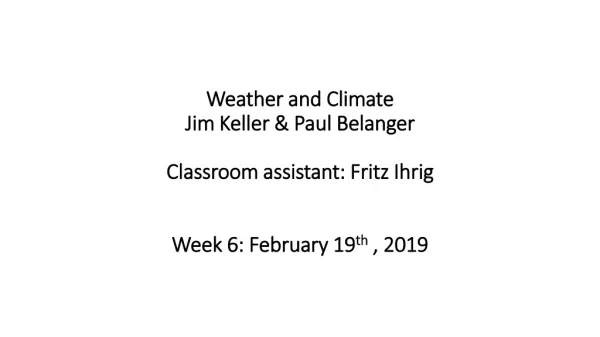
Weather and Climate Jim Keller & Paul Belanger Classroom assistant: Fritz Ihrig Week 6: February 19 th , 2019. Announcements. Fritz Ihrig ; classroom assistant, liaison to OLLI: fgihrig@msn.com ; h. 303-526-1750 Announcements: Paul Belanger: PEBelanger@glassdesignresources.com

Announcements
E N D
Presentation Transcript
Weather and ClimateJim Keller & Paul BelangerClassroom assistant: Fritz IhrigWeek 6: February 19th , 2019
Announcements • Fritz Ihrig; classroom assistant, liaison to OLLI: • fgihrig@msn.com ; h. 303-526-1750 • Announcements: • Paul Belanger: • PEBelanger@glassdesignresources.com • c. 303-249-7966; h 303-526-7996 • Jim Keller: • kellerjb10@aol.com • H 303-526-0867 c 303-503-9711
This lecture is about the influence mountains have on the weather
Review earlier • Hemispheric circulation with a complex 3 cells system complicated by land, oceans, irregular land surface: • ascent at 60 degrees and at the equator, • descent 30 degrees latitude and the poles; • Hadley, Ferrel and polar • Prevailing Winds • Westerlies mid-latitudes • Easterlies at the poles • And NE or SE at the equator/tropics • Air Masses • Maritime/Oceanic or continental in type • Polar or tropical in Origin • 4 Air Mass types: • cP = continental Polar • cT = continental Tropical • mP = maritime Polar • mT = maritime Tropical • Fronts – where air masses of different densities meet
Discuss • Surface gravity waves • Mountains are internal gravity waves • Stationary • Dynamic • Horizontally stable, but not vertically stable • ELR – Environmental lapse rate ~6.5 C/km • DALR – Dry adiabatic lapse rate of 10C/km • Stratosphere more stable than Troposphere
Atmospheric Stability • Isentropes: lines of constant entropy • Lines indicate degree of stability; the closer the more stable – thus the stratosphere (above the tropopause) is more stable than the troposphere below it • Mountains and associated waves disrupt that https://en.wikipedia.org/wiki/Isentropic_process https://en.wikipedia.org/wiki/Isentropic_process
Air parcels want to come back to the level it started • Mountain waves – stationary to the round but disrupt the vertical
Temperature inversions • reasons: • Cool below-higher density, warmer above-lower density • Cool, dry owing to lack of water vapor in clouds • Vertical wind shear etc. • Denver’s Brown Cloud • Can prevent disturbances higher up
Clouds can form 2 places • Very Strong Winds Downslope & Hydraulic Jump farther downwind
Flow Regimes Supercritical flow
Mountains make troughs; and can make extratropical cyclones • HORIZONTAL WIND PLUS EARTH’S SPIN CAN CAUSE VERTICAL AXIS SPIN (VORTICITY) IN HORIZONTAL PLANE & FORMATION OF CYCLONES
Earth’s spin causes horizontal wind spin which creates low pressure - i.e. a cyclone
Mountains have a huge role in weather • Cause air disturbances • Cause instability • Propagate up to higher altitudes • Cause downwind waves, hydraulic jumps and cyclones
The squall line Thunderstorm • Often near coastline • Sources providing forecasts: • NWS • NCAR • Acting weather and other companies providing forecasts • Some of the URLS we will explore: • http://weather.gov/bouThen below that: • https://www.weather.gov/bou/weatherstory • https://www.weather.gov/ • and put in Genesee, co • detail goes here https://forecast.weather.gov/MapClick.php?textField1=39.69&textField2=-105.27#.XGRIHvZFx3g • this site http://weather.rap.ucar.edu/ is very good – many many sub-maps and links/options: • NAM model • Satellite image • MLSP/WINDS • http://weather.rap.ucar.edu/model/displayMod.php?var=eta_sfc_mslp&loop=loopall&hours= • Preciphttp://weather.rap.ucar.edu/model/displayMod.php?var=eta_sfc_prcp&loop=loopall&hours=
National Weather Service (NWS) - Doppler Radar sites: • Real time weather monitoring
Radar https://en.wikipedia.org/wiki/Radar • Doppler = pulse; listens back • Different sizes, dependent of frequency, etc. • 10cm focus in lecture • Decibels dBZ – units of decibels • Underestimates ice and snow • Hail stones the “brightess” • Butterflies, bats seen; ground clutter, etc.
Example: Lincoln, NE July 8, 2003 • Videos of radar showing progression and how the data was collected
Wind Shear & Vorticity • Shear makes spin – horizontal vorticity = creates low pressure • Upper winds moving east faster than counterflow winds as in lower atmosphere
The part visible to 10 cm (2.54 cm/in) radar • Squalls, their structure and lives
The Thunderstorm Project:crash that killed senator put it “on congress’ radar” • Provided an understanding of the thunderstorm life cycle ONE CELL CYCLE
Cold pool circulation and circulation that has virga that cools and moistens the air – when combined get a bigger storm
Squall Line Echo • Bow echo: https://en.wikipedia.org/wiki/Bow_echo • Derecho: https://en.wikipedia.org/wiki/Derecho
Squall Lines & Fronts Squall line
C-P DIAGRAM • CAPE = Convective Available Potential Energy • Environmental Lapse Rate & Convective Lapse Rate showing available energy for convection of an air parcel CAPE: https://en.wikipedia.org/wiki/Convective_available_potential_energy
REVIEW CHAPTER 18 • HOW SQUALL LINE WORKS • AND HOW IT SHOWS ON RADAR • CONVECTIVE CELLS DESTROY THEMSELVES BUT OTHERS FORM. • 30-40 MINUTES LIFE OF A CELL • SQUALL LINE – WIDENS from cool front at it progresses
Mesoscale Convective System (MCS) Last Lecture: • Weather radar • Squall lines – a TYPE OF MCS, Mesoscale Convective System: https://en.wikipedia.org/wiki/Mesoscale_convective_system This Lecture: • SUPERCELL thunderstorms - another type Mesoscale Convective System – organized convection • Dry lines: https://en.wikipedia.org/wiki/Dry_line - trigger storms
Vortex Tube – Starts with vertical rotation, horizontal axis IF TILTED: Tube gets tilted and there’s rotation opposite with spin in Horizontal plane
Several supercells CAPE: air parcel with temperature greater than atmospheric lapse rate https://en.wikipedia.org/wiki/Convective_available_potential_energy