Urbanization by Watersheds
1984 – 2009 Twin Cities Metropolitan Area. Urbanization by Watersheds. Tobias Fimpel & Alex Steele. Objective. Identify land cover changes within the 8 primary watersheds in the Twin Cities metro area from 1984 – 2009. Study Area. Data. Landsat images 8-15-1984 7-25-2009

Urbanization by Watersheds
E N D
Presentation Transcript
1984 – 2009 Twin Cities Metropolitan Area Urbanization by Watersheds Tobias Fimpel & Alex Steele
Objective • Identify land cover changes within the 8 primary watersheds in the Twin Cities metro area from 1984 – 2009
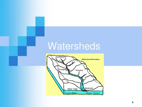
Data • Landsat images • 8-15-1984 • 7-25-2009 • Watersheds in the Twin Cities Metropolitan Area • Shapefile,DNR Level 08 Catchments from the Metropolitan Council.
Procedures – Training Areas • Classification Scheme: • Water • Urban • Undeveloped • Agriculture
Procedures – Accuracy Assessments • Stratified Random Samples • Reference Data: Landsat • Overall accuracies of 72% and 84%
Results Mississippi River – Rush – Vermillion North Fork – Crow River