Download
1 / 41
440 likes | 752 Views
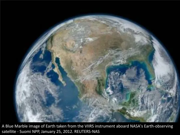
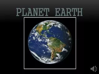
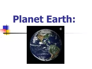
OUR HOME PLANET, EARTH. Our Earth is about average among the planets in the Solar System, in many respects: Earth is the largest and most massive of the four terrestrial planets, but smaller and less massive than the four giant, or Jovian, planets.

E N D
OUR HOME PLANET, EARTH • Our Earth is about average among the planets in the Solar System, in many respects: • Earth is the largest and most massive of the four terrestrial planets, but smaller and less massive than the four giant, or Jovian, planets. • Earth is third in distance from the Sun among the four terrestrial planets. • Earth has a moderately dense atmosphere; 90 times less dense than that of Venus but 100 times denser than that of Mars. • Earth is also unique in many respects: • Earth is the only planet with liquid water on its surface. • Earth’s atmosphere is the only one having a significant (21%) proportion of molecular oxygen. • Earth is, to our best current knowledge, the only planet in the solar system having living organisms. • Earth is the only terrestrial planet having a moderately strong magnetic field. • Earth is the only terrestrial planet having a large satellite.
THE SOLID EARTH • The field of geology is concerned with the study of the structure, history, and activity of the solid Earth, including its interactions with the atmosphere, hydrosphere, cryosphere, and biosphere. • The structure of the body of the solid Earth contains four major zones: the core (which is divided into inner and outer zones), the (upper and lower) mantle, the asthenosphere, and the lithosphere. • The structure of the outer zones is not uniform and fixed over the surface of the Earth, but shows much variability with position and time. • The field of plate tectonics deals with this spatial and temporal variability. • Geological phenomena such as earthquakes, volcanoes, and continental drift are accounted for by plate tectonics.
PLATE TECTONICS IN EARTH SCIENCE • The theory of Plate Tectonics, which was not generally accepted until the mid-20th Century, explains a great many features of Earth’s current activity and past history which were previously seemingly unrelated. • Several lines of evidence indicate that the continents as they now exist have moved large distances over the last few hundred million years, both relative to each other and relative to the north and south poles of Earth’s rotation axis. • According to Plate Tectonics, Earth’s lithosphere is made up of individual plates which “float” on a semi-molten asthenosphere.
PLATE TECTONICS IN EARTH SCIENCE • The motions of the lithospheric plates are driven by convection currents in the asthenosphere. • The mid-Atlantic “rift zone”, which includes the volcanic island of Iceland, is a region of upwelling of molten rock from the asthenosphere, which also results in a widening separation of the Americas from Europe and Africa. • When tectonic plates collide with each other, one may be “subducted” beneath the other, or the two may merge. • Plate tectonics also explains other Earth activity, such as volcanoes, earthquakes, and orogenisis (mountain building).
VOLCANIC ACTIVITY • Volcanic activity, the production of molten rock (lava) and its eruption to Earth’s surface (on land or in the oceans) is one manifestation of tectonic activity. • Molten rock is produced as a result of the following two major types of plate motion: • Separation (moving apart) of two crustal plates, which allows molten rock to rise to the surface between them. • Collision of two crustal plates, with one moving beneath the other (subduction), resulting in the creation of molten rock from surface materials on the subducted plate. • Volcanic activity in Iceland and elsewhere in the mid-Atlantic is due to crustal spreading (the mid-Atlantic rift). • Volcanic activity near the west coasts of North and South America is due to subduction of Pacific Ocean plates beneath the west edges of the continents. • Some volcanic activity, such as in the Hawaiian Islands, is not directly the result of plate motions.
Eruption of Mt. St. Helens Volcano, May 1980 Post-Eruption View from LandSat
View of the Volcano Anak Krakatau, in the Sunda Strait, Indian Ocean, Indonesia; Taken by the Ikonos Satellite, June 11, 2005
EARTHQUAKES • Earthquakes are due to sudden motions of crustal plates, as a result of fracture or slipping of one plate relative to another. • Zones of high probability of earthquakes (seismic activity) are, like volcanic activity, usually near plate boundaries or subduction zones. • The shaking motion of earthquakes is due to the propagation of two types of seismic waves: longitudinal waves, and transverse waves. • Longitudinal waves, like sound waves, can propagate through solids and liquids. • Transverse waves can propagate only through solids. • Monitoring of seismic waves at large distances from earthquake centers have revealed details of Earth’s inner structure, including the fact that the outer core is molten (does not transmit transverse seismic waves).
Epicenter Focus Fault
December 26, 2004 Earthquake-Generated Tsunami (Red = Wave Heights Measured by Jason 1 Satellite)
Longitudinal Waves Transverse Waves
Propagation of Seismic Waves Through Earth’s Interior Longitudinal waves travel through both solids and liquids. Transverse waves travel through solids only.
CONTINENTAL DRIFT • Another aspect of the theory of plate tectonics, is that it indicates that the continents of Earth’s crust move (relative to the main body of Earth) and change shape with time. • This explains the similarity of extinct animal and plant fossils on adjacent continents (such as South America and Africa) which are now separated by large bodies of water. • Magnetized minerals and their orientations relative to Earth’s magnetic poles also provide evidence for continental drift. • Some continental areas now close to the equator give evidence of at one time being covered with glaciers (which would have required them to be closer to the poles). • This “continental drift” is also consistent with the currently observed plate motions which give rise to volcanic and seismic activity.
Fossils of now-extinct animal species in land areas now separated by oceans provide evidence of continental drift.
Earth’s Land and Oceans 200 Million Years Ago Pangaea Tethys Sea
200 Million Years Ago 50 Million Years Ago 150 Million Years Ago 100 Million Years Ago Present
Zones on Present-Day Continents with Evidence of Glaciation from Pangaean Times 300 M years ago Present
Mountain Building Processes Press & Siever 1984, p. 498
Space-Based Remote Sensing of the Solid Earth • Observing the solid Earth from space has many unique advantages in comparison to ground- and aircraft-based measurements. • In particular, satellites in appropriate orbits can make observations of the entire Earth, at repeated intervals and/or over long periods of time, using a variety of instrumentation and observing techniques. • The first major satellite program dedicated to solid Earth observations was the LandSat series, beginning in the mid-1960’s. • The most recent, and most capable, mission of this type is the currently operational Terra satellite, launched in February, 2000. • Terra is the first of three major Earth science satellites, constituting NASA’s Earth Observing System (EOS). • More recently launched sister satellites, in this three-satellite series, are the Aqua satellite (for studies of Earth’s oceans and other water bodies) and the Aura satellite (for studies of Earth’s atmosphere from above).
The Terra Earth Observing Satellite Mission • The Terra mission (EOS-1) was launched February 24, 2000. • The primary scientific objectives of the Terra mission include studies of the following: • What are Aerosols? • Changing Global Cloudiness • Why Isn’t Earth Hot as an Oven? • Changing Global Land Surface • The Scientific Instruments on Terra are the following: • - Advanced Spaceborne Thermal Emission and Reflection Radiometer (ASTER) • - Clouds and Earth’s Radiant Energy System (CERES) • - Multi-angle Imaging Spectroradiometer (MISR) • - Moderate-resolution Imaging Spectroradiometer (MODIS) • - Measurements of Pollution in the Troposphere (MOPITT)