SABOT
130 likes | 280 Views
SABOT. Standardized Auxiliary Boat Operations Training Ninth District - Eastern Region COMO. Lew Wargo, Sr. DSO-OP/CQEC 15 April 2014 PILOTING & NAVIGATION. SABOT. PILOTING & NAVIGATION. PILOTING.

SABOT
E N D
Presentation Transcript
SABOT Standardized Auxiliary Boat Operations Training Ninth District - Eastern Region COMO. Lew Wargo, Sr. DSO-OP/CQEC 15 April 2014 PILOTING & NAVIGATION
SABOT PILOTING & NAVIGATION
PILOTING • This exercise may easily be combined with the exercise for plotting and running search patterns.
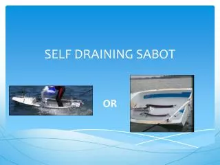
PILOTING • This is an exercise for the member’s skill in the use of their GPS-Chart Plotters. With NOAA discontinuing the distribution of charts for sale it would benefit our members to sharpen their electronic navigation skills. NOAA small boat charts are available on-line. This breaks a standard size chart into approximately 16 (8 ½ X 11) pages.
PILOTING • The NOAA WEB site for these free (in-color) chart-lets is: • http://www.nauticalcharts.noaa.gov/staff/BookletChart.html
TERMINAL PERFORMANCE OBJECTIVE Given a predetermined navigation exercise, enter a course on your GPS ashore and then pilot a vessel to the destination the using the following: Seaman’s Eye GPS/DGPS Chart Plotter RADAR Dead Reckoning (DR)
REFERENCES • Boat Crew Seamanship Manual • Auxiliary Boat Crew Qualification Guide • SABOT Job Aid (Section “E”) • GPS/Chat Plotter Instruction Manual for the unit being used.
STANDARDS • Ashore all course WPTS are entered into GPS and ETA to each WPT is accurately computed within 1 minute. • All turns made within 100 yards of WPTS • Leg runs accurate within 60 seconds. • Destination arrival within 5 minutes of ETA • Arrival accurate within 100 yards
ENABLING OBJECTIVES A. Compute ETA for each (WPT) and (CSP). B. Identify all landmarks used to steer. • Energize all available electronic navigation equipment onboard.
ENABLING OBJECTIVES D. Demonstrate tuning and setting appropriate range scale on RADAR if equipped. E. Demonstrate entering all WPTs into GPS. F. Demonstrate setting appropriate range scale on GPS chart plotter.
PILOTING G. Demonstrate getting vessel away from the pier and starting on the proper course. H. Pilot vessel to first WPT using all available equipment and techniques. I. Turn vessel to correct course upon reaching first WPT.
ENABLING OBJECTIVES J. Predict ETA to next WPT with course and correct speed to make good to second position. K. Pilot vessel to subsequent WPTS and make good on ETA.
ENABLING OBJECTIVES L. Demonstrate ability to arrive and station keep at the final destination (CSP) and verify position using all available equipment and within established parameters. M. Conduct “Debrief” on the mission.