Download
1 / 29
290 likes | 319 Views
This project aims to enhance the COMCI database by improving user accessibility, developing an online interface for spatialization schemes, and connecting the visualizations back to the database. The goal is to provide efficient access to valuable marine and coastal information for coastal resource managers, policymakers, researchers, and the public.

E N D
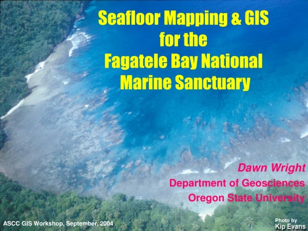
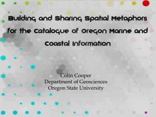
Colin Cooper Department of Geosciences Oregon State University
Objectives • To stream-line the COMCI database to increase user accessibility, for both searching and adding new records. • To build an online interface for disseminating spatialization schemes, allowing users to search the COMCI database
Benefits of Spatialization • Allows users to see the entire database as they explore it • Exploration can lead to knowledge construction, information retrieval, and database summarizing (Fabrikant and Buttenfield, 2001) • Reduces high dimensional datasets into a representation streamlined for user interpretation
Spreading Knowledge • As database visualizations become more popular, demand for user access will increase • Connecting the visualization back to the database bridges the gap of transferring newly gained knowledge back into information through record retrieval
Catalogue of Oregon Marine and Coastal Information (COMCI) • Database of references pertaining to information on Oregon’s marine environment • Makes this information available to the public
COMCI was initiated as part of a graduate course at Oregon State University (OSU) on the science and management of marine reserves Further developed by a broader collaboration among the Partnership for Interdisciplinary Studies of the Coastal Oceans (PISCO), Oregon Sea Grant, the OSU Departments of Zoology and Geosciences, the Northwest Alliance for Computational Science and Engineering (NACSE), and the Oregon Coastal Atlas project COMCI: In the beginning
http://www.coastalatlas.net Collaborators Oregon Ocean- Coastal Management Program OSU Ecotrust
COMCI: The Future • Incorporate COMCI into the Oregon Coastal Atlas web portal • Grow within an updatable atmosphere relying on user-support • Provide efficient access to pertinent information for coastal resource managers, policy makers, researchers, and interested members of the public
Building an ArcIMS site for COMCI • ArcIMS is a web mapping service that uses dynamic maps to deliver data to a wide range of clients and users • Users only need an Internet browser • Provides GIS functionality and allows the user to interactively search study areas
Building an ArcIMS site for COMCI • Adding geographic scope to the database and creating shapefiles • Uses Oregon Coastal Atlas location sites plus larger scale regions • ArcXML is used to create a map file that determines the display of the map service • A JavaScript parameters file will determine the extent of functionality of the map service and control the display of the surrounding frames
Sharing COMCI via the ArcIMS site • Active Server Pages (ASP) were created to access the COMCI database and return results through the web server • A Find References Tool was created using built-in hyper-linking functions of ArcIMS to retrieve COMCI records from the map
Using the Find References Tool Lower Columbia R
Self-Organizing Map (SOM) • SOMs (Kohonen networks) use learned vector quantization to populate space with data clusters, using competitive learning • Organize data sets into a predefined output space, preserving topological relationships between input patterns and their display in the output space • It groups similar records from the database places them close to each other on a map
The basic SOM learning algorithm • Each SOM node is associated with a codebook • vector that represents the position of the • node in the input attribute space • An algorithm is used to calculate distance • between an input pattern and every unit in the • network, selecting the unit that is closest to • the best matching unit • Two Types of Hexagons • Node Hexagons: A node from the input space that is populated with similar data items (represented as a circle) • Distance Hexagons: Empty codebook vectors that are shaded to represent dissimilarity between neighboring node hexagons
Creating a SOM visualization in GeoVista Studio • Needed to visualize all COMCI records • Convert string attributes to numbers • Number range developed for increasing generality in geographic scope • Create a shapefile with a polygon for each COMCI record
Creating a SOM Visualization in GeoVista • Load the shapefile and associated COMCI csv file in GeoVista Studio’s data mining design • Subspace theme, subject, and scope attributes and assign weights • Begin SOM training • Use Parallel Coordinate Plot (PCP) in conjunction with the shapefile to interpret SOM visualization
Using Flash • Highly interactive environment can be created • Easy to implement graphical elements • Cartographic principles can be utilized • Aesthetically pleasing display combined with high interactivity can result in more acceptable and usable products (Cartwright et al, 2001)
Results • Using interactive map interfaces allows the user to focus in on his/her interest area while at the same time being able to see what areas are in the proximity and the scope of the area itself • Using ASP for connecting the web applications to the COMCI database is an efficient method of querying and retrieval • No need to update ArcIMS
Discussion • Traditional map services can be used to disseminate map metaphors and directly link to databases using ASP • Interpreting a SOM representation still requires intensive manual interaction • SOM map was not easy to read and only slightly enhanced knowledge about COMCI’s structure • As innate geographic sense is important, users must be aware of the map layout’s dependency on the spatialization routine used
Conclusion • The COMCI ArcIMS mapping service was successful in creating a geographic search interface for bibliographic references • Using the map metaphor allows the user to see the entire database • Serving spatial visualizations over the World Wide Web by way of map services increases access to advanced exploratory techniques like Self Organizing Maps • Ultimately, the goal of COMCI is to provide policymakers, resource managers, with information needed to evaluate and reassess coastal and ocean management strategies
Acknowledgements Many thanks to Tanya Haddad of the state of Oregon Ocean-Coastal Management Program for excellent technical assistance during various stages of this project. We are indebted also to the original coordination of Jane Lubchenco and Jim Good in offering the original Marine Resource Management course at OSU that gave rise to COMCI. Heather Leslie, Brooke Simler, Renee-Davis Born, Anne Guerry, and Laura Opsommer of PISCO, and Joe Hanus and Sherry Pittam of the Northwest Alliance for Computational Science and Engineering. Thanks also to Danielle Pattison and Chris Zanger of OSU. Works Cited Cartwright, W., Crampton, J., Gartner, G., Miller, S., Mitchell, K., Siekierska, E., and Wood, J. (2001). Geospatial Information Visualization User Interface Issues. Cartography and Geographic Information Science, vol. 28, no. 1: 45-60. Fabrikant, S.I. and Buttenfield, B.P. (2001). Formalizing Semantic Spaces for Information Access. Annals of the Association of American Geographers, vol. 91, no. 2: 263-280.