Download
1 / 23
230 likes | 410 Views
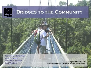
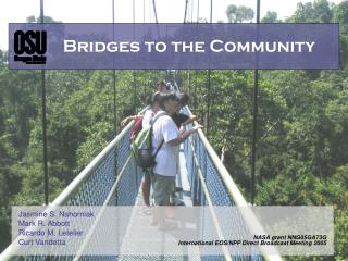
Bridges to the Community. Jasmine S. Nahorniak Mark R. Abbott Ricardo M. Letelier Curt Vandetta. NASA grant NNG05GA73G International EOS/NPP Direct Broadcast Meeting 2005. Direct broadcast stations act as a bridge between real-time satellite data and the user community.

E N D
Bridges to the Community Jasmine S. Nahorniak Mark R. Abbott Ricardo M. Letelier Curt Vandetta NASA grant NNG05GA73G International EOS/NPP Direct Broadcast Meeting 2005
Direct broadcast stations act as a bridge between real-time satellite data and the user community. We have a responsibility to provide accurate documentation, instruction, and support. The stations are ideal candidates to act as regional learning centers.
Roadmap A case study: • The OSU direct broadcast station • Major software transition • User impact Bridging the gap • Educating the community • Regional Learning Centers
The Oregon State UniversityDirect Broadcast Station • located in Corvallis, Oregonon the west coast of the United States • operational since February 2001 • satellite data are collected from MODIS (TERRA and AQUA)
Station objectives: • collect, process, and disseminate real-time MODIS oceans data • all data (real-time and archived) freely available online, by ftp, and by subscription • user-friendly data access • http://picasso.coas.oregonstate.edu/ORSOO/MODIS/DB/
main scripts, RT-STPS, GBAD SUN SUN ERSDEM2 passcollection L1b L2 oceansreal-time reprocessing GSC & browser Linux Linux SGI SGI PC PC 1 oceans met data oceans SST data orbit data outsideusers 2 12:00 4 14:00 camera web server data base ftp server 3 12:30 Key: SUN SGI PC Linux
Early 2004: MODIS science team restructured TERRA MODIS processing suspended oceans code responsibility transferred from the University of Miami to the Ocean Color team (NASA) Implications for direct broadcast: TERRA MODIS processing not fully supported major software change
main scripts, RT-STPS, GBAD SUN SUN ERSDEM2 passcollection L1b L2 oceansreal-time reprocessing GSC & browser Linux Linux SGI SGI PC PC 1 oceans met data oceans SST data orbit data outsideusers 2 12:00 4 14:00 camera web server data base ftp server 3 12:30 Key: SUN SGI PC Linux
Processing Level Level 0 Raw data converted into a time-ordered set of packets (PDS) Level 1b Calibrated radiances at 36 wavebands Level 2 Ocean products at 1 km resolution (not mapped) Level 3 Daily equal-area maps of ocean products Images Thumbnails and larger images representing the data
Processing Level raw 0 0 1b 1b 2 2 3 images Software (platform) RT-STPS - NASA (SUN)and GBAD – NASA (SGI) MODIS Level 1 Processing Software for Direct Broadcast Data - NASA (SGI) MODIS ocean data processing code – University of Miami (SGI) MS2GT, SIMAP, IDL,ENVI, Matlab (SUN) Original configuration
Processing Level raw 0 0 1b 1b 2 2 3 images Software (platform) RT-STPS - NASA (Linux)and GBAD - NASA (Linux) SeaDAS - NASA (Linux) New configuration
Processing Level raw 0 0 1b 1b 2 2 3 images Software (platform) RT-STPS - NASA (SUN)and GBAD - NASA (SGI) MODIS Level 1 Processing Software for Direct Broadcast Data - NASA (SGI) MODIS ocean data processing code – University of Miami (SGI) MS2GT, SIMAP, IDL, ENVI, Matlab (SUN) Software (platform) RT-STPS - NASA (Linux)and GBAD - NASA (Linux) SeaDAS - NASA (Linux) Original configuration New configuration
The Transition Pros: Compatible with NASA Simple installation and updates Easier to implement Runs on Linux PCs (less expensive than SUN/SGI) No software licenses required Simplifies processing Cons: Requires complete overhaul ofthe processing system TERRA MODIS oceans processing supported but not validated Output filenames, formats, and contents are different than before Data users will be affected
Original files New files
Impact on our data users: Filename change File contents change File sizes and spatial coverage change New algorithms TERRA MODIS not validated How do we ease transitions like this?
The Bridge Users need access to: Accurate, online documentation Technical support Software tools Training classes
What have we learned from our users? • large data files • excessive documentation • software tools provided • consistency (data files, software, different satellites) • online instruction (documentation, teaching modules) • online discussion groups with prompt replieshttp://ocforum.gsfc.nasa.gov • different users have different needs
This 2-day workshop attracted 40 participants from across the United States as well as Canada, Peru, Chile, and the United Kingdom. A combination of talks and hands-on-tutorials covering a variety of software tools. The itinerary focused on the file formats, contents, and software for viewing and manipulating the data. The information presented in the 2003 workshop is now largely obsolete – a repeat workshop should be organized, focusing on the new file formats.
What did we learn from the workshop? • Many attendees wanted to know: • “Which software should I use?” • a wide variety of software is available for data processing • users were confused and intimidated by the variety of choice • Different users have different needs: • some want to create pretty pictures • others want in-depth knowledge of the data and software • it is difficult to cater to both types of user at a single workshop
Suggestions for future workshops Cater workshops to different types of users (basic vs. advanced) Hold workshops at / near direct broadcast stations Customize the workshops to topics of regional interest Yearly or biennial workshops
EOS direct broadcast stations are currently located at 101 locations in 28 countries. • The stations at these disperse locations are ideal for acting as regional learning centers.
Regional Learning Centers Pros: Globally distributed Main data users usually local Station technicians know more about their data than anyone Incorporate regional environmental issues Outreach to the community Attract more researchers, better research, and funding Cons: Each workshop must be custom-made Someone has to organize it!
Conclusion A major software transition in progress at the Oregon State University direct broadcast station, brought issues of user impact to the forefront. The utilization of existing direct broadcast stations as regional learning centers would both serve the needs of the users as well as provide a forum for public outreach. Acting as bridges between satellite data and the scientific community, direct broadcast stations should play a larger role in educating the public.