Download
1 / 30
300 likes | 481 Views
Seafloor Mapping in Massachusetts CZM – USGS Seafloor Mapping Cooperative & Gulf of Maine Mapping Initiative. Anthony R. Wilbur Massachusetts Office of Coastal Zone Management Boston, Massachusetts. OCM Strategic Action Plan Workshop February 26 – 28, 2008 Dania Beach, Florida. Outline.

E N D
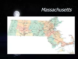
Seafloor Mapping in MassachusettsCZM – USGS Seafloor Mapping Cooperative& Gulf of Maine Mapping Initiative Anthony R. Wilbur Massachusetts Office of Coastal Zone Management Boston, Massachusetts OCM Strategic Action Plan Workshop February 26 – 28, 2008 Dania Beach, Florida
Outline • History of CZM’s Role in Seafloor Mapping • CZM-USGS Seafloor Mapping Cooperative • Gulf of Maine Mapping Initiative (GoMMI) • Challenges
1994 2003 2004 2006 2008+ 2007 1994-1998 Mapping Begins & Continues 2001 2002-2004 • Seafloor Mapping of Stellwagen Bank & Massachusetts Bay • completed by scientists at USGS, Woods Hole
1994 2003 2004 2006 2008+ 2007 1994-1998 2001 Mapping Begins & Continues 2002-2004 ‘Marine Habitat Characterization and Mapping Workshop’ in Sebasco, ME Gulf of Maine Mapping Initiative (GOMMI)
1994 2003 2004 2006 2008+ 2007 1994-1998 Mapping Begins & Continues 2001 2002-2004 NOAA’s CSC Fellowship Drafted ‘Strategic Plan for Mapping Massachusetts’ Benthic Marine Habitats’ and Published guide on types and functions of marine habitats in Massachusetts
2003 1994 2004 2006 2008+ 2007 1994-1998 Mapping Begins & Continues 2001 2002-2004 Delay in gas pipeline construction resulted in monetary mitigation – $1.5 million. Fines used to create the Massachusetts Seafloor Mapping Trust
2003 1994 2004 2006 2008+ 2007 1994-1998 Mapping Begins & Continues 2001 2002-2004 CZM-USGS Seafloor Mapping Cooperative Mapping begins in northern Massachusetts Bay in 2004
2004 1994 2003 2006 2008+ 2007 1994-1998 Mapping Begins & Continues 2001 2002-2004 Massachusetts Ocean Management Initiative ‘In support of comprehensive management and monitoring of ocean resources, the Commonwealth should acquire high-resolution seafloor habitat maps.’
2006 1994 2003 2004 2008+ 2007 1994-1998 Mapping Begins & Continues 2001 2002-2004 Massachusetts invests $1 million to mapping cooperative 1st two seafloor mapping reports published Boston Harbor North Shore – Gloucester to Nahant
2007 1994 2003 2004 2006 2008+ 1994-1998 Mapping Begins & Continues 2001 2002-2004 $$$ Massachusetts Seafloor Mapping Trust receives additional $3 million in mitigation funding
Massachusetts Coastal Zone Management & US Geological Survey Seafloor Mapping Cooperative
CZM-USGS Seafloor Mapping Cooperative • Established Partnership • Identified Goal Produce high-resolution maps and geospatial data of seafloor geology and topography • Determined Effective Methods • Prioritized Mapping Needs • Implement Mapping • Publish Results and Advertise Availability
3 1 existing mapping data of Stellwagen Bank and Massachusetts Bay 2 4 5 6 Buzzards Bay Vineyard Sound Seafloor Mapping Priorities Completed – Ongoing Mapping • Nahant to Gloucester • Boston Harbor • Cape Ann to Salisbury • Hull to Duxbury • Northern Cape Cod Bay • Eastern Cape Cod Next Mapping Areas Buzzards Bay and Vineyard Sound
Area 1 Nahant to Gloucester • Area mapped 134 km2 • Water depths 5-40 m • Data collected • bathymetry • backscatter • subbottom profiles • grabs and photography http://pubs.usgs.gov/of/2005/1293/
Area 2 Boston Harbor • Area mapped 173 km2 • Water depths 0-32 m • NOAA data re-processed -multibeam/single-beam bathymetry -backscatter • New data collection -bottom samples / photography http://woodshole.er.usgs.gov/pubs/of2006-1008/
Area 3 - Cape Ann to Salisbury Beach • Area mapped 340 km2 • Water depths 5-90 m • Data collected • bathymetry • backscatter • subbottom profiles • samples, photography Cape Ann Publication imminent
Area 4 - Hull to Duxbury • Area mapped 190 km2 • Data collected • bathymetry (preliminary) • backscatter • subbottom profiles • samples, photography Data collection complete (2006-2007) Publication due in 2009
Area 5 - Northern Cape Cod Bay • Area mapped 460 km2 • Data collected • bathymetry (preliminary) • backscatter • subbottom profiles • samples, photography Data collection completed in Spring 2008 Publication by 2009
Area 6 Eastern Cape Cod Bay • Area mapped 153 km2 • Data collected • bathymetry • samples, photography http://woodshole.er.usgs.gov/pubs/of2005-1048/
CZM-USGS Seafloor Mapping CooperativeSummary • Strategic plan was valuable education publication, along with organizational exercise • Funding was key to start, maintain and expand the cooperative • Partnership with USGS – including a 1:1 cost-share – critical for all aspects of cooperative • Objectives identified and schedule maintained • Early decision to collect geospatial data of seafloor topography and geology in waters ≥10m using established acoustic technologies • Strong agency leadership
CZM-USGS Seafloor Mapping CooperativeSummary • To date, ~560 square miles of the ocean bottom from the New Hampshire border to northern Cape Cod Bay are mapped • Currently developing 5+ year plan to continue cooperative • Communicating and sharing results key to maintaining support and initiating new partnerships • Mapping results are stimulating new research and management strategies, while improving the understanding of the ocean environment in Massachusetts http://woodshole.er.usgs.gov/project-pages/coastal_mass/
Subcommittee of the Gulf of Maine Council on the Marine Environment - a US and Canadian partnership • Volunteer Steering Committee & Coordinator • U.S. Federal • NOAA’s National Marine Fisheries Service • NOAA's Office of Coast Survey U.S. Geological Survey • Canada Federal • Geological Survey of Canada • State • ME Department of Marine Resources • NH Department of Environmental Services • MA Office of Coastal Zone Management • Academia • Center for Coastal and Ocean Mapping & NOAA/UNH Joint Hydrographic Center
Mission: To promote mapping of the entire Gulf of Maine basin http://www.gulfofmaine.org/gommi/
Objectives: • Facilitate communication and collaboration within the mapping community • Build logistical and financial support • Make maps and data widely available
2005 Also Surveyed In 2005 Accomplishments • Published a number of outreach and planning documents: - Overview of mapping technologies - User needs assessment - Strategic plan for mapping - Website • Hired a GOMMI coordinator • Coordinated a 2005 geophysical survey • Groundwork established for GOMMI coordinator at UNH-NOAA CCOM
Challenges & Priorities Funding • Long-term, secured funding required for full-time staffing and to complete mapping Coordination Who is responsible for coordinating mapping? Recommendations 8 & 9 • Coordination among federal agencies, especially for mapping in state waters (e.g., NOAA, ACOE and USGS) • Coordination, communication and data sharing between federal and state agencies • Increasing partnership for furthering the applicability of mapping data
Challenges & Priorities Data Understanding and Availability • Providing resource managers with knowledge and tools for appropriate application of seafloor mapping data Recommendations 6 & 7 Technology and Standards • Develop and test shallow water mapping techniques Recommendation 11 • Standards/tools for combining datasets (e.g., Geocoder) • Establish protocols for seafloor mapping, groundtruthing and benthic habitat mapping (CMECS, Greene et al., etc.) Recommendations 4 & 6 Academic-government partnership (possible private)