Download
1 / 2
20 likes | 87 Views
Explore advancements in network and station performance analysis through data quality control, bias analysis, and signal evaluation at various geodetic sites worldwide. Learn about calibration techniques, data simulation, and future modeling updates. Stay updated on high satellite tracking, laser power upgrades, and precision enhancements for SLR systems. Join experts in discussing the latest trends and proposals in geodetic analysis standards.

E N D
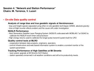
Session 4: "Network and Station Performance" • Chairs: M. Torrence, V. Luceri • On-site Data quality control • Analysis of range bias and true geodetic signals at Herstmonceux • - bias and height signals separated using other on-site geodetic techniques (GNSS, absolute gravity) • - time-of-flight counter effects evident and the cause still under investigation • NGSLR Performance • - Next Generation Satellite Laser Ranging System (NGSLR) collocated with MOBLAS-7 at GGAO to calibrate the NGSLR event timer and processor • - High energy returns used to calibrate the longer-pulse transmit system built for LRO • Quality control tools at MLRO • - cooperation between data analysts, engineers, operators • - control infrastructure and web based information system to enable a constant monitor of the system parameters • Tracking Performance of High Satellites at Mt Stromlo • laser power upgrade at Mt Stromlo SLR Station • station operated unmanned in all weather conditions and still at its productivity levels.
Data quality control at Analysis Centers • Multi-Satellite Daily Bias at HIT-U • routine quality control system for the ILRS global network provided by the Hitotsubashi University and numerical tables are available via web, ftp and email. • Stations directly contacted when a bias is evident and encouraged to reply. • LAGEOS data analysis at Changchun • Data analysis at the Changchun site: a bridge between theoretical research and observational work • LAGEOS 1/2 RB and TB evaluation • Network and models • Sub-centimeter SLR precision with SLRF2005/LPOD2005 • Analysis of Jason1, Lageos1/2, and TOPEX SLR data • Individual SLR station performance and systematic signals evaluated • Several stations updated in SLRF2005 to obtain LPOD2005 • TRF datum and ILRS network geometry • - SLR network geometry considered as a candidate to explain the discontinuity in the SLR scale • Further investigation will be done using data simulation • TerraSAR-X/TanDEM-X scenario • In September 2009 TanDEM-X launched to fly with TerraSAR-X in a very close formation • Difficulties in the tracking shown • Improved Modeling in the SLR analysis standards • Model update under discussion • In the near future, a proposal will be done by ILRS to IERS for modification of the analysis standards related to the products contributing to the establishment of the future ITRFxx.