Understanding Geographic Information Systems (GIS): Definition, Components, and Data Types
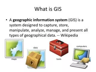
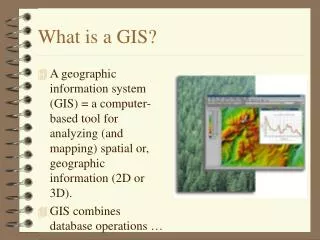
Geographic Information Systems (GIS) are powerful tools that store, retrieve, analyze, and display geo-coded spatial and attribute data. Geo-coded data consists of position, shape types (point, line, polygon), topology, and thematic content. A GIS comprises three essential components: computer hardware, software applications, and an organizational context. Proper integration of these components is crucial for effective GIS functionality. Additionally, it involves the use of vector and raster data structures for spatial analysis. This overview highlights the foundational aspects of GIS and its applications.


Understanding Geographic Information Systems (GIS): Definition, Components, and Data Types
E N D
Presentation Transcript
WHAT IS GIS? By Okan Fistikoglu
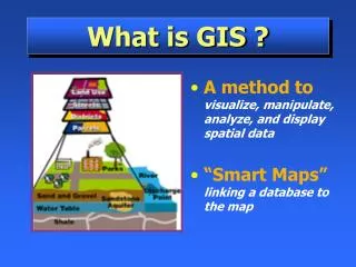
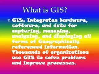
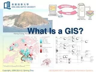
DEFINITION Geographical Information Systems (GIS) are the systems that store, retrieve, analyze, transform and display geo-coded spatial and attribute data. What is geo-coded data?
GEOCODED DATA=Geodata • Position (x,y,z) • Shape Type (Point, Line, Polygon) • Relation to others (Topology) • Thematic Content (Indicated Info) SPATIAL DATA ATTRIBUTE DATA
GEOCODED DATA=Geodata more examples?
COMPONENTS OF A GIS Geographical Information Systems have three important components, • computer- hardware • sets of application software modules • a proper organizational context. These three components must be in balance if the system is to function satisfactorily.
COMPONENT-1 computer- hardware DISC DRIVER DIGITIZER SCANNER C.P.U. TAPE DRIVER SCREEN PLOTTER
Data Input Query Input Geo Database Display and Reporting Transformations COMPONENT-2 application software The software package for geographical information system consists of five basic technical modules.
Data Input Sensors Existing maps Observations Scanners Query Input Geo Database Magnetic media Interactive terminal Digitizers Text files Display and Reporting Transformations DATA INPUT COMPONENT-2 application software
Input Data Input GEOGRAPHIC DATABASE Position Topology Attributes Management System Transinformation Retrieval Query Input Query Input Geo Database Display and Reporting Transformations COMPONENT-2 application software
Data Input DISPLAY AND REPORTING Query Input Geo Database Visual Display terminal Magnetic media Plotter Printer Display and Reporting Transformations MAPS TABLES FIGURES COMPONENT-2 application software
Data Input TRANSFORMATION Maintenance Query Input Geo Database Utilization and Analysis Display and Reporting Transformations COMPONENT-2 application software
Management Aims and Queries from management Information for Management Geographical Information System Data Gathering COMPONENT-3 organizational contex
TYPE OF GEODATA REMEMBER!!! • Position (x,y,z) • Shape Type (Point, Line, Polygon) • Relation to others (Topology) • Thematic Content (Indicated Info) SPATIAL DATA ATTRIBUTE DATA
ATTRIBUTE DATA(Thematic Content) Type Permisible Operations Examples • Alfanumeric Value • (String) = “Okan Fistikoglu” “1. Kordon Street” “Forest” • Numeric Value ≤ ≥ Birth “1971” No. “256” Percent “35”
SPATIAL DATA Position Shape Topology Types X, Y, Z coordinates of the data Point, Line, Polygon Positional relation of the data to the others NEW Vector, Raster
STRUCTURE OF SPATIAL DATA • Analysis of attributes and their interactions within the region investigated can be performed using two different approaches. These two approaches determine the process of data collection, data manipulation, and consequently, determine the Structure of Spatial Data. Accordingly, there are two types of structures: • vector structure • raster or grid structure. VECTOR RASTER
VECTOR STRUCTURE POINT Y X
VECTOR STRUCTURE 3 1 4 2
VECTOR STRUCTURE 0 3 1 2 4 1 2
0 0 0 0 0 0 0 0 4 0 0 0 0 0 0 0 0 0 0 0 0 0 0 0 0 0 0 0 4 0 3 4 0 4 0 4 0 0 0 5 0 0 0 0 0 0 0 0 0 0 4 0 4 0 4 0 0 0 4 0 4 5 0 5 4 0 4 5 0 0 0 4 0 0 4 4 0 0 0 4 0 0 0 0 0 5 0 0 0 5 0 0 0 0 0 0 POINT LINE POLYGON RASTER STRUCTURE 4=FOREST 5=URBAN 3=WELL 4=ROAD WIDTH
VECTOR vs RASTER Some major strengths and limits of vector and raster structures.