Download
1 / 53
530 likes | 655 Views
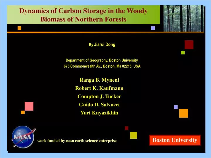
Dynamics of Carbon Storage in the Woody Biomass of Northern Forests. Title. By Jiarui Dong Department of Geography, Boston University, 675 Commonwealth Av., Boston, Ma 02215, USA. Ranga B. Myneni Robert K. Kaufmann Compton J. Tucker Guido D. Salvucci Yuri Knyazikhin. Boston University.

E N D
Dynamics of Carbon Storage in the Woody Biomass of Northern Forests Title By Jiarui Dong Department of Geography, Boston University, 675 Commonwealth Av., Boston, Ma 02215, USA Ranga B. Myneni Robert K. Kaufmann Compton J. Tucker Guido D. Salvucci Yuri Knyazikhin Boston University work funded by nasa earth science enterprise
works at BU workload • Improving the precision of simulated hydrologic fluxes in land surface model. • Dong, J., Salvucci, G.D., and Myneni, R.B. (2001), JGR., 106(D13):14357. • 2. Development and analysis of vegetation data sets from NOAA global data. • 3. Three field campaigns for the validation of the MODIS LAI/FPAR algorithm. • Buermann, W., Dong, J., Zeng, X., Myneni, R.B., and Dickinson, R.E. (2001), J. Climate, 14(17):3536. • Buermann, W., Wang, Y., Dong, J., Zhou, L., Zeng, X., Dickinson, R.E., Potter, C.S., and Myneni, R.B., JGR (accepted Dec. 2001) • Shabanov, N.V., Wang, Y., Buermann, W., Dong, J., Hoffman, S., Smith, G.R., Knyazikhin, Y., Gower, S.T., and Myneni, R.B., Validation of the radiative transfer principles of the MODIS LAI/FPAR algorithm with data from the Harvard Forest, RSE, (in review) works at BU JGR: Journal of Geophysics Research; PNAS: Proceedings of the National Academy of Sciences; RSE: Remote Sensing of Environment. 1a of 45
works at BU workload • Remote sensing estimates of northern boreal and temperate forest woody biomass: carbon pools, sources, and sinks. • Myneni, R.B., Dong, J., Tucker, C.J., Kaufmann, R.K., et al. (2001), PNAS, 98(26):14784. • Dong, J., Kaufmann, R.B., Myneni, R.B., Tucker, C.J., et al., RSE, (accepted Feb. 2002). works at BU JGR: Journal of Geophysics Research; PNAS: Proceedings of the National Academy of Sciences; RSE: Remote Sensing of Environment. 1b of 45
abstract Abstract • The relation between forest woody biomass and satellite greenness was estimated with data from 167 provinces in six countries and 19 years of remote sensing data. • Regression analyses indicated that the regression model can be used to represent the relation between forest woody biomass and NDVI across the spatial, temporal, and ecological scales. • For about 1.5 billion ha of the northern boreal and temperate forests, the estimates of carbon pools, sources, and sinks are provided at a relatively high spatial resolution. • This research may contribute to a monitoring program for the industrialized nations to meet their greenhouse gas reduction commitments under Kyoto Protocol. abstract 2 of 45
contents • Motivation • Introduction • Definitions • Data • Methods • Results • Discussion • Concluding Remarks contents 3 of 45
motivation Motivation • About 1 to 2 giga (109) tons of carbon (Gt C) a year are suggested to be sequestered in pools on northern land.1 • Debate is currently underway regarding which of the forest biomass sinks can be used by the industrialized nations to meet their commitments under the Kyoto Protocol. • Thus, characterizing the location and mechanism of carbon sinks is of scientific and political importance. motivation 1. Bousquet, P., Peylin, P., Ciais, P., Qu\'er\'e, C.L., Friedlingstein, P. & Tans, P.P. (2000) Science290, 1342-1346. 4 of 45
introduction (1 of 3) Global carbon estimates Global Carbon Budget for the 1980s and 1990s1 global carbon budget A recent IPCC assessment updated the global carbon budgets. 1. Schimel et al. (2001), Nature, 414:169-172. 5 of 45
introduction (2 of 3) Heimann estimates global carbon budget This figure, quoted in IPCC 2001, represents our current understanding, that is, about 1-2 billion tons of carbon are sequestered in sinks on northern land. Elsewhere, land is neutral. Heimann, M. (2001), Max-Plank Institute for Biogeochemie, Technical Report 2. The results, for the 1980s (plain bars) and for 1990-96 (hatched bars), were deduced from eight inverse models. Positive numbers are fluxes to the atmosphere. 6 of 45
introduction (3 of 3) Land carbon pool • Carbon on land is contained in various pools such as,1 land carbon pools - vegetation - detritus - black carbon residue from fires - soil - harvested products, etc. • This study is limited to analysis of the carbon pool in the woody biomass of northern temperate and boreal forests, which cover an area of about 1.4 to 1.5 billion hectares.2 1. Schulze, E.-D., Wirth, C. and Heimann, M. (2000), Science, 289:2058-2059. 2. Liski, J. and Kauppi, P. (2000), in Forest Resources of Europe, CIS, North America, Australia, Japan and New Zealand (industrialized temperate/boreal countries), UN-ECE/FAO contributions to the Global Forest Resources Assessment 2000, (United Nations, New York), pp. 155-171. 7 of 45
definitions (1 of 2) Forest • We define forests as the following remote sensing land covers • - broad leaf forests - mixed forests • - needle leaf forests - woody savannas this land cover definition is broadly consistent with land use definitions of a forest but not of forest and other wooded land used by the FAO. forests -7.5 -2.5 0 5 10 15 20 25 Forest Fraction (% of pixel area) defined as the fraction of each quarter degree pixel occupied by these land covers, according to Hansen et al., 1 km satellite based land cover map. Hansen, M.C., DeFries, R.S., Townshend, J.R.G. and Sohlberg, R.(2000), Int. J. Remote Sens., 21, 1331-1364. 8 of 45
definitions (2 of 2) Woody biomass • Woody biomassconsists of- wood - twigs • - bark - stumps • - branches - roots • of live trees, shrubs and bushes. • The vegetation pool • gains carbon from photosynthetic investment in these organs. • loses carbon due to woody biomass - aging - mortality - disease - harvest - insect attacks - fire - windthrow 9 of 45
data (1 of 4) Data remote sensing of biomass • Forest biomass cannot be directly measured from space yet. • Year-to-year changes in biomass are quite small, about two orders of magnitude smaller than the biomass pool. At decadal and longer time scales, the biomass changes can be considerable due to accrual of the differences between gains and losses. • Potentially, these can be observed as low frequency variations in climatological greenness. 10 of 45
data: satellite (2 of 4) Satellite data • normalized difference vegetation index (NDVI) • global • 15-day maximum value composites • 8 km resolution • July 1981 to December 1999 satellite data • The key processing features included: • cloud screening • calibration • El Chichon & Mt. Pinatubo corrections • data quality assessed1,2 1. Kaufmann et al. (2000), IEEE Trans. Geosci. Remote Sens., 38:2584-2597. 2. Zhou et al. (2001), J. Geophys. Res., 106(D17): 20069-20083. 11 of 45
data: satellite (3 of 4) Satellite data • Growing season NDVI total, the area under seasonal NDVI curve and above a threshold, can capture both the average seasonal level of greenness and growing season duration, and therefore is an ideal measure of seasonal vegetation greenness. satellite data -7.5 -2.5 0 5 10 15 20 25 Change in NDVI Total per year (80s &90s) 12 of 45
data: inventory (4 of 4) Inventory data • The inventory data, in the form of stem wood volume, are from 167 provinces in six countries (can, fin, nor, rus, swe and usa). • The stem wood volume were converted to above-stump and total biomass, using country specific coefficients.1 • These data represent a wide variety of inventory practices, provincial forest area, ecosystem types, age structures, and time periods. forest inventory data 1. Liski, J. & Kauppi, P. (2000) in Forest Resources of Europe, CIS, North America, Australia, Japan and New Zealand (industrialized temperate/boreal countries), UN-ECE/FAO contributions to the Global Forest Resources Assessment 2000, (United Nations, New York), pp. 155-171. 13 of 45
methods: GIS (1 of 5) GIS-1 • The methodology of matching pixel level NDVI data and provincial inventory data is illustrated here, using Sweden as an example. matching inventory and ndvi data • Sweden spans a latitude range from 55oN to 70oN; • The inventory data are available for 24 provinces; • The reported data are stem wood volume (106 m3) and forest area (103 ha). Administrative map of Sweden 14 of 45
methods: GIS (2 of 5) GIS-2 • A remote sensing land cover map is required to match the provincial inventory estimates to pixel satellite data. matching inventory and ndvi data • This map is at a spatial resolution of 1x1 km.1 • Forests are defined as the 6 remote sensing land covers. evergreen needle forests evergreen broadleaf forests deciduous needle forests deciduous broadleaf forests mixed forests woody savannas savannas closed shrub lands open shrub lands grasslands croplands barren 1. Hansen, M.C., DeFries, R.S., Townshend, J.R.G. and Sohlberg, R.(2000), Int. J. Remote Sens., 21, 1331-1364. 15 of 45
methods: GIS (3 of 5) GIS-3 matching inventory and ndvi data • For each province, the cumulative growing season greenness is estimated from NDVI data layers, by averaging over forest pixels, as identified from the land cover map. • This assures that the growing season greenness is assembled from the forested regions only. 16 of 45
Estimates of forest and land area Remote sensing estimates Inventory report (1982-86) Inventory report (1993-97) 0 1 2 3 4 5 Area (million ha) Forest Area (million ha) 0 2 4 6 8 10 Land Nbtn Vbtn Jmtl Vnrl Gavl Kopp Vrml Oreb Vstm Upps Sthm Sadm Ostg Skbg Alvs Jkpg Kron Kalm Gotl Gtbg Hall Blek Skan methods: GIS (4 of 5) GIS-4 matching inventory and ndvi data Both inventory and remote sensing estimates match well. These provide some confidence in both data sets. 17 of 45
methods: GIS (5 of 5) GIS-5 • The inventory stem wood volume data are converted to total biomass, and plotted against the growing season NDVI total for each province. matching inventory and ndvi data 1. British Columbia; 2. Washington, Oregon, and (north) California. 18a of 45
GIS-5 large 18b of 45
methods: regression model (1 of 3) Regression model • The relation between woody biomass and seasonal greenness is estimated with the following specification, • 1/Biomass = a + [(1/NDVI)/Latitude2] + g Latitude ndvi biomass relation Biomass: inventory estimate (tons/ha) NDVI: cumulative growing season NDVI averaged over five years prior to inventory date Latitude: average of latitudes over forest pixels in each province , and : regression coefficients (a = -0.0377; = 3809.65; g = 0.0006) 19 of 45
methods: regression model (2 of 3) Regression tests • There is a statistically meaningful relation between biomass and NDVI in nearly every nation and sample period. statistical tests * Results for U.S. when one outlier is removed. ** DF: Degree of Freedom. 20 of 45
methods: regression model (3 of 3) Regression tests • Regression analyses indicate that there is a statistically meaningful relation between biomass and NDVI, regardless of latitude. • The spatial relation between biomass and NDVI is not statistically different from the temporal relation. statistical tests 21 of 45
results: spatial patterns (1 of 4) estimates spatial pattern of pools • Biomass estimates from satellite data can provide spatial detail of the carbon pool and pool changes at relatively high resolution. • To document these regional features, the forest woody biomass carbon pools were evaluated for two periods, the early 1980s (1982-86) and late 1990s (1995-99). • Pool changes were then evaluated as the difference between these two pool estimates, pixel-by-pixel, and quoted on a per year basis. 22 of 45
0 10 20 30 40 50 60 Carbon Pool (tons C/ha) 1995 to 1999 results: spatial patterns (2 of 4) Pool pattern • Spatial patterns of pool size in the northern temperate and boreal forests during late 1990s. • The biomass map indicates larger average pools in North America compared to Eurasia (51 vs. 39 tons C/ha). spatial pattern of pools 23a of 45
0 10 20 30 40 50 60 Carbon Pool (tons C/ha) 1995 to 1999 Pool pattern 23b of 45
results: spatial patterns (3 of 4) Pool pattern • The average pool size in Europe and the USA is larger than in Canada and Russia (54-58 vs. 38-44). • Among the European countries, Austria, France and Germany have notably large average pools (60, 67 and 73, respectively). • The estimates for Finland, Norway and Sweden are comparable to Russia (35-40 vs. 38). spatial pattern of pools Scandinavia: Sweden, Finland and Norway; A.F.G.: Austria, France and Germany. 24 of 45
-0.3 0 0.3 0.6 0.9 Sources Sinks Changes in Carbon Pool (tons C/ha/yr) 1980s & 90s results: spatial patterns (4 of 4) Sink pattern • Carbon sinks are seen in Eurasian boreal and North American temperate forests. spatial pattern of pool changes 25 of 45
results: uncertainties (1 of 3) Uncertainty uncertainties in remote sensing estimates • The inventory estimates were derived from wood volume increment and loss data. • Remote sensing estimates are from biomass differences between two time periods. • Thus, the comparison of the two estimates is valuable. 26 of 45
results: uncertainties (2 of 3) Uncertainty A comparison of remote sensing and inventory estimates of (a) the biomass carbon pool, and (b) the pool changes. uncertainties in remote sensing estimates 27a of 45
Uncertainty 27b of 45
Uncertainty 27c of 45
results: uncertainties (3 of 3) Uncertainty • Regression analysis shows that there is no bias in the estimation of biomass pools and pool changes . • The relative difference between remote sensing (x1) and inventory (x2) estimates is 27% for above-stump biomass (10.4 tons C/ha) • 33% for total biomass (16.1 tons C/ha) • 50% for changes in pool size (0.33 tons C/ha/yr) uncertainties in remote sensing estimates Inventory = + Remote Sensing + 28 of 45
results: estimates (1 of 1) Countrywise • The carbon pool in the woody biomass of northern forests (1.5 billion ha) is estimated to be 61 20 Gt C during the late 1990s. • This is comparable to the TBFRA-2000 reports (80 Gt C), but on 2.5 billion ha of forests and other wooded land. • Our sink estimate for the woody biomass during the 1980s and 90s is 0.680.34 Gt C/yr. • This is in the mid-range of estimates by Sedjo1 for mid-1980s (0.36 Gt C/yr) and TBFRA-20002 for early and mid-1990s (0.81 Gt C/yr). NH estimate 1. Sedjo, R.A., 1992, Ambio, 21: 274-277. 2. Liski, J. & Kauppi, P., 2000, in Forest Resources of Europe, CIS, North America, Australia, Japan and New Zealand (industrialized temperate/boreal countries), UN-ECE/FAO contributions to the Global Forest Resources Assessment 2000, United Nations, New York, pp. 155-171. 29 of 45
results: country estimates (1 of 6) Canadian estimates • The estimates of the three large countries, Canada, Russia and the USA, are crucial because they account for 78% of the pool, 73% of the sink and 77% of the forest area. • For Canada, we estimate a sink of about 73 Mt C/yr, which is comparable to an inventory estimate by the Canadian Forest Service,1 about 85 Mt C/yr. canadian estimates 1. Canadian Forest Service, The State of Canada's Forests 1993, Nat. Resour. Can., Ottawa, Ontario, Canada. 30a of 45
Canadian estimates 30b of 45
USA estimates 31 of 45
results: country estimates (3a of 6) Russia estmates • Estimates for Russia differ, because of differences in definitions of forest cover types. russian estimates 32a of 45
results: country estimates (3b of 6) Russia estmates • When expressed on per ha forest area basis, russian estimates • The various pool estimates are comparable(38-43 tons C/ha). • The difference in sink estimates between remote sensing and TBFRA-2000 is smaller (0.44 vs. 0.53; in tons C/ha/yr). 32b of 45
results: country estimates (4 of 6) sinks (Mt C/yr) 0 50 100 150 200 250 300 Russia USA Canada Sweden Germany Japan Italy France Romania Spain Poland Turkey Finland UK Bulgaria Austria Belarus Czech Norway Greece Portugal Latvia Ukraine Switzerland Lithuania Estonia Hungary Belgium Netherlands Denmark annex 1 countries: sinks annex 1 countries# #Australia, Iceland, Ireland, Luxembourg, New Zealand are not included. 0 2 4 6 8 10 12 14 16 33 of 45
results: country estimates (5 of 6) sinks to emissions 0 0.2 0.4 0.6 0.8 1 annex 1 countries: sinks to emissions ratio Sweden Latvia* Russia* Canada Finland Norway Lithuania* Austria Portugal Estonia* Bulgaria Romania Turkey Belarus* Greece Spain Switzerland USA Italy Czech* France Poland Hungary Germany Japan UK Ukraine* Denmark Belgium Netherlands Emissions indicate the degree of industrialization, efficiency of the industries and the population. Sinks are a function of forest area. annex 1 countries# *Annual mean emissions are from 1992 to 1998. The others are from 1982 to 1998. #Australia, Iceland, Ireland, Luxembourg, New Zealand are not included. 34 of 45
results: country estimates (6 of 6) sinks to emissions per capita (10-8 ) 0 5 10 15 20 25 30 35 40 Latvia* Estonia* Sweden Norway Finland Lithuania* Austria Bulgaria Portugal Canada Belarus* Switzerland Greece Czech* Romania Hungary Russia* Spain Turkey Italy Poland Denmark France Belgium Germany UK USA Japan Netherlands Ukraine* annex 1 countries: sinks to emissions per capita annex 1 countries# *Annual mean emissions are from 1992 to 1998. The others are from 1982 to 1998. #Australia, Iceland, Ireland, Luxembourg, New Zealand are not included. 0 0.5 1 1.5 2 2.5 3 3.5 35 of 45
discussion: reasons (1 of 6) Reasons • The reasons for the observed changes in the forest woody biomass pool are not known. • This implies uncertainty regarding the future of biomass sinks and therefore the need for monitoring. • The spatial patterns, however, offer some clues. reasons • Woody encroachment and longer growing seasons from warming in the northern latitudes possibly explain some of the changes, and 36 of 45
-0.3 0 0.3 0.6 0.9 Sources Sinks Changes in Carbon Pool (tons C/ha/yr) 1980s & 90s discussion: reasons (2 of 6) Canada (sink) • Increased incidence of fires and infestations in Canada. pool changes in canada 37 of 45
-0.3 0 0.3 0.6 0.9 Sources Sinks Changes in Carbon Pool (tons C/ha/yr) 1980s & 90s discussion: reasons (3 of 6) USA (sink) • Fire suppression and forest regrowth in the USA. pool changes in usa 38 of 45
-0.3 0 0.3 0.6 0.9 Sources Sinks Changes in Carbon Pool (tons C/ha/yr) 1980s & 90s discussion: reasons (4 of 6) Russia (sink) • Declining harvests in Russia. pool changes in russia 39 of 45
-0.3 0 0.3 0.6 0.9 Sources Sinks Changes in Carbon Pool (tons C/ha/yr) 1980s & 90s discussion: reasons (5 of 6) Europe (sink) • Improved silviculture in the Nordic countries. pool changes in europe 40 of 45
-0.3 0 0.3 0.6 0.9 Sources Sinks Changes in Carbon Pool (tons C/ha/yr) 1980s & 90s discussion: reasons (6 of 6) • Forest expansion (afforestation and reforestation) and regrowth in China.1 pool changes in china japan 1. Fang, J., Chen, A., Peng, C., Zhao, S., and Ci, L. (2001), Changes in forest biomass carbon storage in China between 1949 and 1998, Science, 292:2320-2322. 41 of 45
discussion: limitations (1 of 1) Limitations • How robust are these results? • Residual atmospheric effects and calibration errors in satellite data cannot be ruled out. • Uncertainties in inventory data are country-specific and difficult to quantify. • Simple models are used to convert wood volume and greenness data to biomass. • The differences in forest area estimates between remote sensing and inventories are not easy to coordinate because of definition issues. limitations • All of this suggests a cautionary reading of the results and need for further research. 42 of 45