Download
1 / 39
390 likes | 403 Views
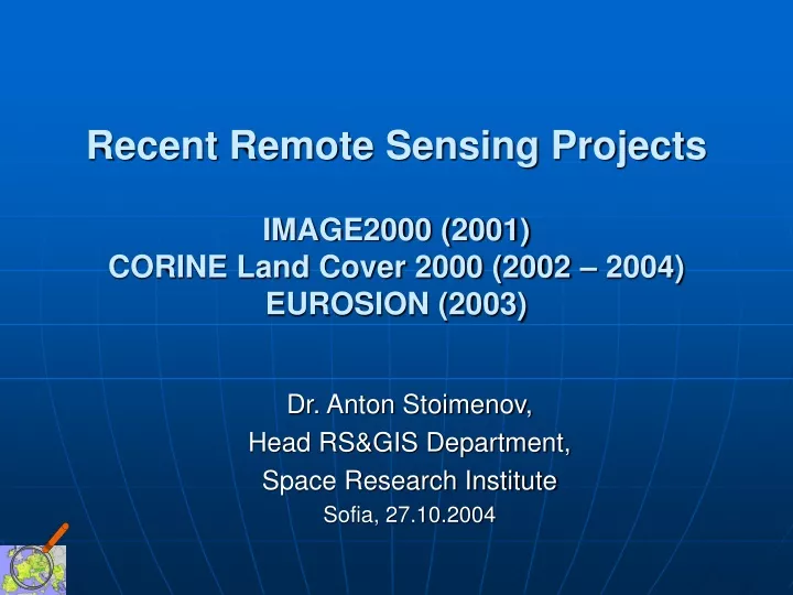
Recent Remote Sensing Projects IMAGE2000 (2001) CORINE Land Cover 2000 (2002 – 2004) EUROSION (2003). Dr. Anton Stoimenov, Head RS&GIS Department, Space Research Institute Sofia, 27.10.2004. IMAGE 2000 Orthorectification of 13 Landsat 7 ETM+ scenes over Bulgaria.

E N D
Recent Remote Sensing Projects IMAGE2000 (2001)CORINE Land Cover 2000 (2002 – 2004)EUROSION (2003) Dr. Anton Stoimenov, Head RS&GIS Department, Space Research Institute Sofia, 27.10.2004
IMAGE 2000Orthorectification of 13 Landsat 7 ETM+ scenes over Bulgaria Anton Stoimenov, Ventseslav Dimitrov, Nikolina Pelova,– Space Research Institute, Remote Sensing & GIS Department Rumiana Vatseva – Institute of Geography
ИЗБОР НА ЗЕМНИ КОНТРОЛНИ ТОЧКИ ВПАНХРОМАТИЧНИ ИЗОБРАЖЕНИЯ НАLandsat 7 ЕТМ+ Входни данни: • 13 стандартни Landsat 7 ETM+ сцени (12 са заснети през 2000 г. и една през 2001 г.) – ниво 1G, носител CD-R,панхроматичен каналс размер на пиксела 15 m; • Топографски карти М 1: 25 000 и 1:100 000; Използван специализиран софтуер и хардуер: • Софтуер за обработка на аеро- и спътникови изображения и ГИС на канадската фирма PCI Geomatics8.2- продуктите OrthoEngine и FOСUS; • Стандартна периферия,дигитайзер А0 oce 6815 искенер НР Scanjet 2200c.
Увеличение на ЗКТ в изображението и картата
Резултати и изводи • В обработените 13 сцени са избрани общо 352 ЗКТ, като 102 от тях са общи за две или повече сцени. • Надморската височина на избраните точки е в интервала от 1 m (Мандренско езеро) до 2200 m (Долно Рибно езеро – Рила). • Само две ЗКТ са с естествен произход (оттокът от Долно Рибно езеро, водослив на реки в Източни Родопи). • Постигнатите точности (по модела) за повечето точки са подпикселни. Най-голямата средноквадратична грешка на ЗКТ е 2.58 пиксела, а най-малката 0.36 пиксела. Средната грешка за всички изображения е под 1 пиксел.
CORINE Land Cover 2000 Project Anton Stoimenov, Ventseslav Dimitrov, Nikolina Pelova, Nevena Borisova, Milena Danailova – Space Research Institute, Remote Sensing & GIS Section Rumiana Vatseva – Institute of Geography Youlin Tepeliev – University of Forestry
AIMS, PRODUCTS • National CLC2000 geometric accuracy: better than 100 meter thematic reliability: better than 85 % • National CLC changes between 1990 and 2000 • Revising national CLC90 • National metadata (per working unit)
CONSISTENCY To ensure consistency between the three databases, the following condition have to be fulfilled: CLC2000 = CLC90rev - CLC changes (where “-" means intersect)
USES OF THE RESULTS AT EUROPEAN LEVEL • Assessing impacts of policy against regional development perspectives, spatial planning (DG-REGIO, DG-ENL) • Assessing impacts of agriculture policies on the environment (DG-AGRI, DG-ENL) • New strategy on integrated coastal zone management (DG-ENV, DG-ENL) • Implementation of biodiversity conventions, habitatats and protected sites (DG-ENV, DG-ENL) • Integrated watershed analysis(DG-ENV, DG-ENL) • Assessment of air emission and air quality measures (DG-ENV, DG-ENL) • Strategic environmental assessment of trans-European transport networks TERM (DG-TREN, DG-ENV, DG-ENL)
Preprocessing Photointerpretation (interpreters) Internal QC/QA Field checking, self-verification (interpreters) External verification (EAA Technical Team) Data integration (Datecs Ltd.) GENERALISED WORKFLOW Validation (interpreters and central)
Изследване точността на база данни IMAGE 90(преди корекция на систематичните грешки)
Сравняване геометрията на ортотрансформираните изображения от 1990г. и 2000 г. Максималната стойност на несъвпадение е 12,85m (т.G0002) 9.26m, Средноквадратните стойности на несъвпаденията за всички точки са съответно: RMSo =9.26 m, RMSх = 7,10 m, RMSу = 7.09 m.
Отместване на вектори в БДCLC 90 спрямо ортотрансформирана БД Image 90
Изследване точността на векторна база данни CLC 90
Сравняване геометрията на векторната БД CLC90(след систематична корекция)и ортотрансформираните изображения от 1990г.
Computer aided satellite image interpretation Implemented by the team of interpreters Dual aims: • Revising / improving CLC90 (systematically corrected) • Interpretation of changes using IMAGE2000 and revised CLC90 Related tasks: • Internal QC/QA (by the leading photointerpreter) • Field checking, verification (by the photointerpreter) Nomenclature (44 classes), 25 ha/100 m limit, Definition of change: 5 ha/100 m
Input data Orthorectified satellite images: • Landsat 5 TM 1990/1992 (resampled pixel size 25 m) – 11 scenes • Landsat 7 ETM+ 2000/2001 (resampled pixel size 25 m) – 13 scenes CLC 1990 vector DB Ancillary data: • Georeferenced topomaps 1:100 000 & 1:25 000 • Thematic maps • Orthorectified Satellite images • Georeferenced aerial photographs • Field check
Software ArcView GIS 3.2- Inter Change 1.0
CLC Nomenclature Level 1 Level 2Level 3 5 categories 15 categories44 classes • Artificial surfaces (4 categories;11 classes) • Agricultural areas (4 categories;11 classes) • Forest and semi-natural areas (3 categories;12 classes) • Wetlands (2 categories;5 classes) • Water bodies (2 categories;5 classes)
CLC90 vector DB geometrical correction • Non-systematicgeometric errors (>100 m) • Un-correct boundary delineationand unrecognized objects
Semantic errors • Classes 221 & 222 - 211, 242 & 243
BULGARIAN COASTAL ZONE 1975 – 1990 LAND COVER CHANGE DETECTION BASED ON SATELLITE IMAGES Anton Stoimenov, Ventseslav Dimitrov, Nikolina Pelova, Nevena Borisova, Milena Danailova – Space Research Institute, Remote Sensing & GIS Section Rumiana Vatseva – Institute of Geography
EUROSION project • Maping land cover changes 1975 - 1990 for the European coastal zone • Coastal zone definition – 10+2 km strip along shore line • Modified CORINE Land Cover Methodology and Nomenclature used • Backward change detection based on CLC1990 Data Base
Input raster and vector data Orthorectified archive satellite imagery used: • Landsat 1 MSS images – August 1977, resampled pixel size – 50 m • Landsat 5 TM images – August 1991/1992, resampled pixel size – 25 m Ancillary data used: • Orthorectified Satellite and Georeferenced aerial images • Georeferenced topomaps 1:25 000 & 1:100 000 • Thematic and city maps • Field checks, inquiries, statistical data
METHODOLOGY STEPS(cont.) Changes and change statistics for the Northern part of Bulgarian Coastal zone
METHODOLOGY STEPS(cont.) Changes and change statistics for the Southern part of Bulgarian Coastal zone
METHODOLOGY STEPS(cont.) Changes in Southern part of Bulgarian Coastal zone - detail
Bulgarian CZ Changes 1975-1990 Total area of changes: 21 756 ha - 6.11% of the territory. Northern part: 4 882 ha – 2.11% Southern part – 16 874 ha – 8.88%
Quality Assurance and Quality Control Internal QA and QC: • Checking of IP&GIS work by Project leader. • Crosschecking executed by Photointerpreters. • Field checking of CZ selected areas. • Full checking of results by Project leader. External QC by JRC representative: • Full checking of Photointerpreters work • CLC75 and Change DB consistency checking.
ИЗВОДИ • Работата по Проектите и получените резултати за пореден път показват ефективността от използване на сателитни изображения при създаване и обновяване на средномащабни карти на земното покрите. • Натрупаният в световен мащаб огромен архив с непрекъсната серия изображения(около 30 години) от спътниците Landsat позволява да се изберат най-подходящите времеви интервали от кохерентни данни. • Получените на национално и европейско ниво данни могат да бъдат използвани от широк кръг институции и специалисти в областта на селското и горското стопанство, регионалното планиране и опазването на околната среда.